Budinci (border crossing) - Border stone A 115 (on marked path)
Starting point: Budinci (border crossing) (335 m)
| Lat/Lon: | 46,87243°N 16,25978°E |
| |
Name of path: on marked path
Time of walking: 37 min
Difficulty: easy marked way
Altitude difference: 18 m
Altitude difference po putu: 45 m
Map: Pomurje 1:40.000
Recommended equipment (summer):
Recommended equipment (winter):
Views: 104
 | 1 person likes this post |
Access to the starting point:
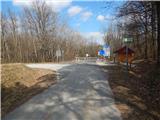
From the road Murska Sobota - Hodoš, in Šalovci, a little after the Ina petrol station, turn left in the direction of Budinci and Dolenciv. When you arrive in Dolenice, turn left at the crossroads and then right at the bus station onto a side road. There is a downhill, then after the transformers cross the Dolenski potok from the crossroads after the bridge and go left. Continue on the main road, passing the cross and the chapel, and then through the hamlet of Petešin Breg to the state border, where you park in a suitable place.
Path description:
From the border crossing, where you see the signs for the "Pout po dolaj pa bregaj" route, continue left to the west and initially walk along the asphalt road, which opens up to a beautiful view of part of Budinci - the northernmost village in Slovenia. When the asphalt road turns left, go straight on to cart track, along which there are numerous boundary stones. The road continues along the national border, leaving the national border at the A126 boundary stone, as the markings on the trees direct you slightly to the right to the Hungarian side of the border. We continue parallel to the national border, but we are walking entirely on Hungarian territory. A little further on, at two marked crossroads, continue straight ahead and continue in a direction slightly to the right of the national border. In front of one of the few hunting observatories that are visible along the way, the signs with cart track direct you to the left, where, after a few 10 steps of further walking, you reach the border stone A 115, at which the northernmost point of Slovenia is located.
The description refers to the situation in November 2022, the pictures are from March 2021 and November 2022.

Pictures:
 1
1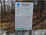 2
2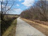 3
3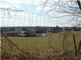 4
4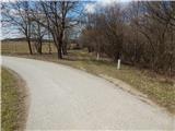 5
5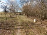 6
6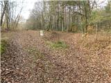 7
7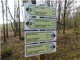 8
8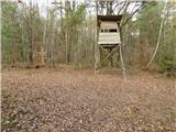 9
9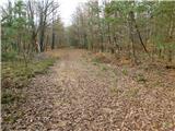 10
10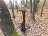 11
11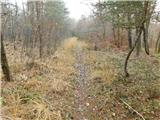 12
12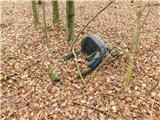 13
13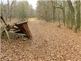 14
14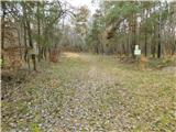 15
15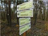 16
16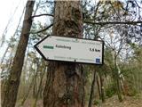 17
17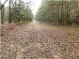 18
18 19
19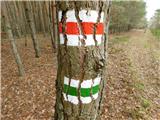 20
20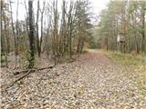 21
21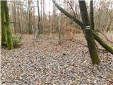 22
22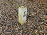 23
23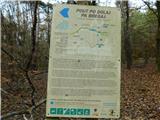 24
24
Discussion about the trail Budinci (border crossing) - Border stone A 115 (on marked path)