Breginj - Punta di Montemaggiore
Starting point: Breginj (550 m)
| Lat/Lon: | 46,262°N 13,4259°E |
| |
Time of walking: 5 h
Difficulty: partly demanding marked way
Altitude difference: 1063 m
Altitude difference po putu: 1300 m
Map: Julijske Alpe - zahodni del 1:50.000
Recommended equipment (summer):
Recommended equipment (winter): ice axe, crampons
Views: 10.092
 | 2 people like this post |
Access to the starting point:
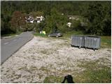
First, drive to the Kobarid centre, then continue to the Robič border crossing. Near the village of Staro selo, leave the main road leading to the Robič border crossing and turn right towards Breginj. Follow the main ascending road to Breginj, where you park in the parking lot near the church.
Path description:
From the parking lot, continue past the church (just go around it on the right) and continue up the asphalted road towards Stol and Muzco. The road first climbs through the village, and we follow it in the familiar direction at the junctions. Higher up, the road loses its asphalt coating and leads us past an old mill to a marked crossroads, where we continue slightly to the right (to the left, the Church of Our Lady of the Snows). The road, which continues to climb moderately, soon leads us to a marked crossroads, where a marked footpath to Muzec (Musc) branches off to the left.
Take the above-mentioned path, which continues to climb moderately through the forest. Next, the path leads us to a small spring (a spring with drinking water), then turns slightly to the left and starts to climb more steeply. Higher up, the path is laid and leads us to a small crossroads, where we continue to the right (straight Plazi). The way forward again begins to climb steeply through the forest, and then leads us to a sharp and crumbly ridge. Over this ridge leads an exposed path, which leads in a few minutes into the lane of a forest. Once out of the forest, the path leads to grassy slopes where, within a few minutes' further walking, you reach a marked crossroads.
Continue left (slightly right Klatnica - drinking water spring) along the increasingly steep mountain path. The path goes higher up to a very steep and scenic side ridge, which you then climb for some time. Higher up, you reach a small unmarked crossroads, where you continue along a less steep path on the left (the right extremely steep path leads directly to Muzec). The left path then ascends crosswise and leads us past a small pothole to the main ridge of Muzce. Here we continue to the left (right Muzec) and after some 10 steps of further walking we arrive at the bivouac under Muzec.
From the bivouac, continue westwards along the scenic ridge path, which gradually starts to climb steeper and steeper. This increasingly scenic route, which is also quite steep in the upper part, is then followed all the way to the top of Gabrovec, which is reached after 15 minutes of further walking.
From the top, continue along the ridge to the west and initially descend slightly. There are a few short climbs over a couple of undistinguished peaks. Later, a small grassy peak is reached on the right side of the ridge and then the slope below the summit is traversed through the forest. Once out of the forest, there is a short, slightly steeper slope, and then a steeper climb up the ridge. After a few more short climbs along the ridge, the path leads us to an undistinguished grassy peak Nad Ohojami
From the top, continue along the ridge and descend slightly again. The steeper part of the ridge is followed by a path that retreats to the forested north side and then crosses the slopes to the west. This route leads us past the indistinct peak Nizki vrh to a marked crossroads. Down to the left the path leads through the Plazi, and we continue straight along the ridge behind the markings "Br. Jalovec 1h". The path continues along the ridge and occasionally through the forest on the north side of the ridge. There is a short climb along the ridge, which leads us to the grassy peak Gnjilica
From the summit continue westwards and after descending the path leads back into the forest. After crossing the forest, you will reach the grassy ridge again, which is already on the Italian side of the border. From here it is a few steps to a marked crossroads.
At the crossroads, continue straight ahead along the ridge, with the path to the right leading to the Tanamea saddle / There at the border, and the path to the left leading down to the village Brezje
We continue straight ahead along the grassy ridge to the west. The ridge becomes slightly narrower in the last part and there is only a short, slightly steeper climb to the top of Breški Jalovec.

Pictures:
 1
1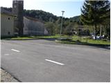 2
2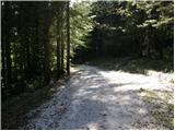 3
3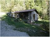 4
4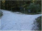 5
5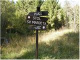 6
6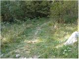 7
7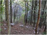 8
8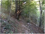 9
9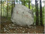 10
10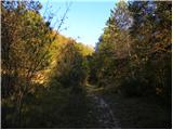 11
11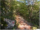 12
12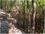 13
13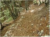 14
14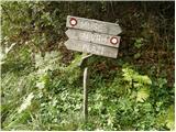 15
15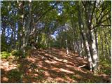 16
16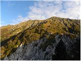 17
17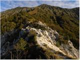 18
18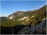 19
19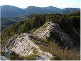 20
20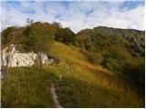 21
21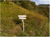 22
22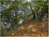 23
23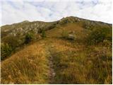 24
24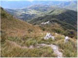 25
25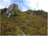 26
26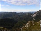 27
27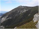 28
28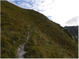 29
29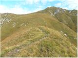 30
30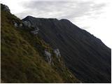 31
31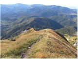 32
32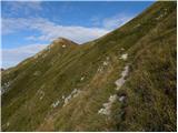 33
33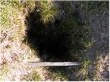 34
34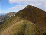 35
35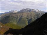 36
36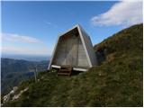 37
37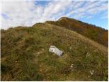 38
38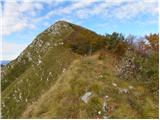 39
39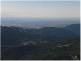 40
40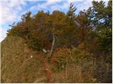 41
41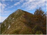 42
42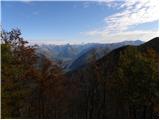 43
43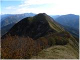 44
44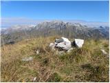 45
45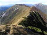 46
46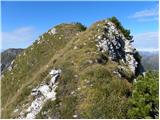 47
47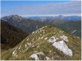 48
48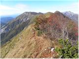 49
49 50
50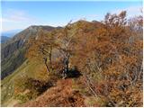 51
51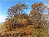 52
52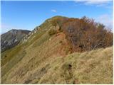 53
53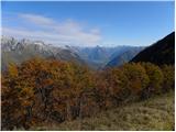 54
54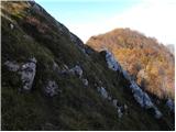 55
55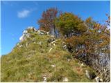 56
56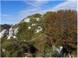 57
57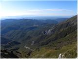 58
58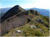 59
59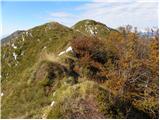 60
60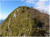 61
61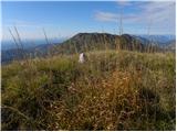 62
62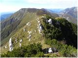 63
63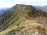 64
64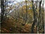 65
65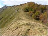 66
66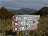 67
67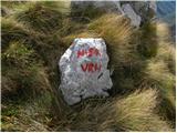 68
68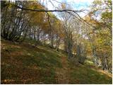 69
69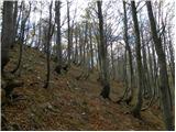 70
70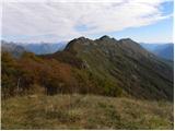 71
71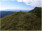 72
72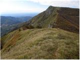 73
73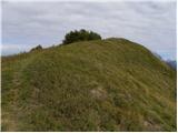 74
74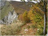 75
75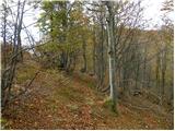 76
76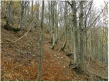 77
77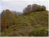 78
78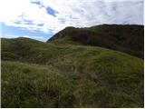 79
79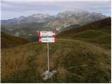 80
80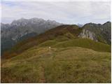 81
81 82
82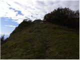 83
83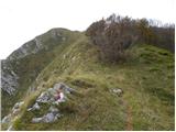 84
84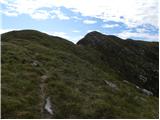 85
85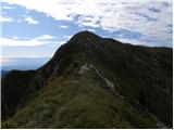 86
86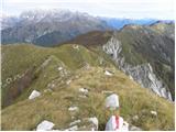 87
87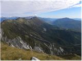 88
88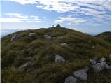 89
89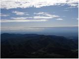 90
90 91
91
Discussion about the trail Breginj - Punta di Montemaggiore
|
| darinka45. 05. 2019 |
Je kdo hodil iz Breginja? Se da priti prej kot v petih urah? Je postavljen realni čas hoje?
|
|
|
|
| darinka421. 06. 2019 |
Včeraj amo prehodili to turo, le v obratnem vrstnem redu. Iz Breginja na Nizki vrh in potem na Breški Jalovec. Rabili smo 4 ure 35 min. Nadaljevali smo po grebenu do V. Muzca. Tu pa ure , ki so na tabli, se nikakor niso skladale z našo potjo, kajti ta grebenska je kar zahtevna in mislim, da smo porabili več kot dve uri do Muzca. Piše pa pol manj. Stezica je slabo vidna. Malokdo tu hodi.
|
|
|
|
| ločanka22. 06. 2019 |
Tudi jaz sem ugotavljala na ostalem grebenu Stola, da je predviden čas na tablah precej pretiran, bolj za tekače 
|
|
|
|
| turbo22. 06. 2019 |
Saj poznata tisto:"Koliko je še do vrha?" Odvisno, kako hitro boš stopila. 
|
|
|
|
| ločanka22. 06. 2019 |
Že, samo ni mišljeno, da dirkaš
|
|
|
|
| darinka422. 06. 2019 |
Pa še nekaj je zanimivo. Z Breškega Jalovca prehodiš kar nekaj vrhov. Preden prideš na V. Muzec. n vsi so mu podobni. Ko že misliš, da je pravi, ugotoviš, da je treba še kar nekaj poti tudi skozi ruševje. Tako je ko greš prvič.
|
|
|
|
| darinka47. 02. 2021 |
Upam res upam da nam rata poletna do Breškega Jalovca . Z Breginja. Ampak v lepšem vremenu kot smo ga imeli dve leti nazaj. Kajti na vrhu ni bilo razgledov. Greben smo prehodili v slabi vidljivosti in dežju od bivaka pod Muzcem do izhodišča.
|
|
|
|
| darinka421. 04. 2022 08:03:12 |
Včerajšnji vzpon iz Breginja na Nizki vrh in nadaljevanje na Breški Jalovec je bilo v vetru soncu in snegu. Na vrhu sta bila dva italianska pohodnika. Sicer nikjer nikogar na poti. Nadaljevali smo po grebenu do bivaka pod Muzcem in sestopili v Breginj.
|
|
|
|
| bo_zl1. 05. 2025 21:28:54 |
Tudi jaz danes po poti iz Breginja na Nizki vrh, od tam pa na Breški jalovec (4 ure), nato pa nazaj grede po grebenu vse do Malega Muzca (3 ure) in od bivaka sestop v Breginj (2 uri). Mir in samota zagotovljena, le na Breškem Jalovcu trije obiskovalci, sicer pa nikjer žive duše.
|
|
|
|
| darinka47. 10. 2025 18:34:49 |
Je kdo hodil na Breški Jalovec s Tamnameji? Zadnjič smo videli tablo tam ob cesti .
|
|
|
|
| darinka48. 10. 2025 20:12:48 |
Hvala Simonu in Bojanu.
|
|
|
|
| ločanka9. 10. 2025 07:38:52 |
Darinka, pred kakšnim tednom so tam reševali dva italijanska pohodnika, ki sta pri sestopu zašla nad en hudournik, in se nista mogla rešiti sama.
|
|
|
|
| darinka49. 10. 2025 08:14:20 |
Ja , marsikaj nepredvidljivega se zgodi, sploh ko ne poznaš terena. Ne bom pozabila sestopa z Ušja, ko smo obtičali ob 15najsti uri na brezpotju. Kamor smo poskušali priti , smo prišli do prepadnih sten. Potem nam je nekako uspelo najti lovsko pot . Smo prišli v temi na izhodišče. Dobro je imet svetilke s sabo , četudi si ne misliš, da boš iskal prehode.
|
|
|