Bohinjsko sedlo - Planina Za Črno goro
Starting point: Bohinjsko sedlo (1277 m)
| Lat/Lon: | 46,2409°N 14,0101°E |
| |
Time of walking: 3 h 20 min
Difficulty: easy marked way
Altitude difference: 63 m
Altitude difference po putu: 565 m
Map: Škofjeloško in Cerkljansko hribovje 1:50.000
Recommended equipment (summer):
Recommended equipment (winter): ice axe, crampons
Views: 2.694
 | 1 person likes this post |
Access to the starting point:
a) From the motorway Ljubljana - Jesenica take the exit Lesce and follow the road towards Bled and on to Bohinjska Bistrica. From Bohinjska Bistrica turn left towards Tolmin and Soriška mountain pasture. Follow this road to a large parking lot near the Soriška ski centre mountain pasture.
b) From Železniki, drive towards Podbrdo or vice versa, but only until you reach the point where the signs for Soriška planina direct you to the ascending road. Follow this road to the large parking lot at the foot of the Soriška ski slope mountain pasture.
Path description:
From the parking lot, continue westwards on the dirt road towards Litostrojska hut on Soriška mountain pasture. The road then climbs moderately and quickly leads to the hut.
From the hut, continue straight along the marked path in the direction of Lajnar, Možica and Šavnik. The path initially climbs parallel to the ski lift for some time, then splits into two parts. Continue along the right-hand path, along which you will see the sign Možic (straight ahead Lajnar), which gradually starts to climb steeper. At a higher level, cross the lane of low forest, and then gradually arrive in a small valley. From the valley, bear slightly right and follow the path as it crosses the grassy slope to reach the old Italian caravanserai in a few minutes.
From the caravelle, which is also the site of a small shepherd's hut, it takes a few steps to climb up to a grassy ridge where the path from Lajnar and Petrov Brdo joins. Here we continue first to the right, then after a few steps to the left down (sharp left peak Slatnik 3 minutes). A short descent follows and the path leads us to the next crossroads, where we again continue slightly to the left (straight Možic 10 minutes). The path continues in the direction of Šavnik and Črna prst, which quickly descends into the forest. There is a short, slightly steeper descent through the forest, and then the path lays down and leads to a grassy valley called Na Poljani. Here continue left (right down mountain pasture after Šavnik) and climb across the meadow to a small pass between Slatnik on the left and Šavnik on the right.
From the pass, from which the path to Šavnik branches off to the right, continue straight ahead and then immediately left into the forest through which you begin to descend. During the descent, you can see a converted old military bunker on the right-hand side, and we follow the path, which occasionally opens up some views towards Porezno and Baška grapa, to the Vrh Bače saddle.
From the saddle, continue first to the right and then, at a marked crossroads at the end of the road, to the left into the forest. A few minutes climb through the forest follows, then the path is laid and leads to the GRS hut. There is a short descent, and the path gradually moves from the slopes of Šanc to the less vegetated slopes of Koble. Here we first climb through a sparse forest, and then the path leads us to a slightly exposed ridge, which we begin to climb steeply (in the wet there is a danger of slipping in some places). Higher up, the ridge is laid, and the path turns to the right, which after a minute of further walking leads us to the undistinguished top of Koble. From Kobla there is a slight descent, and then the path continues along a less steep ridge towards the neighbouring Krevlo. Towards the top of Krevla, a marked path in the direction of "Kobla žig" branches off a little further to the left, and we continue straight ahead, passing the summit on the right, which is only a short 10-step walk away.
On the other side of Krevla, the path starts to descend again, this time to the nearby ski resort. When you reach the edge of the ski slope, you will see the signs for Črna prst pointing down to the left. There is some more downhill, and then you reach the small swamp Na Kalu, where there is also a less obvious crossroads. Continue on the right path (to the left, via a small saddle, the old shepherd's path leads, which crosses the southern slopes of the lower Bohinj Mountains, only this one joins the path from Podbrdo to Črna prst after a while), which continues to descend gently and leads us slightly lower to a marked crossroads. At the crossroads, continue on the lower right path (the upper left path leads to Črna prst), which descends through the forest for a short distance, then turns to the right and leads out of the forest to mountain pasture Za Črna gora.

Pictures:
 1
1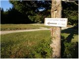 2
2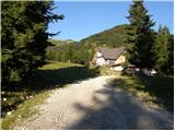 3
3 4
4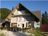 5
5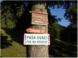 6
6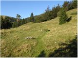 7
7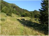 8
8 9
9 10
10 11
11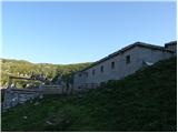 12
12 13
13 14
14 15
15 16
16 17
17 18
18 19
19 20
20 21
21 22
22 23
23 24
24 25
25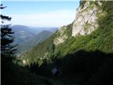 26
26 27
27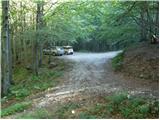 28
28 29
29 30
30 31
31 32
32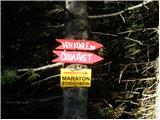 33
33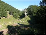 34
34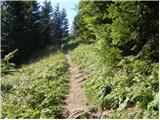 35
35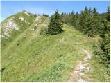 36
36 37
37 38
38 39
39 40
40 41
41 42
42 43
43 44
44 45
45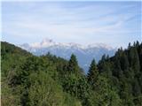 46
46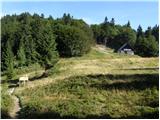 47
47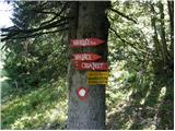 48
48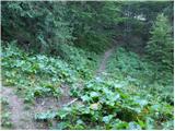 49
49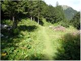 50
50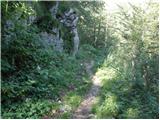 51
51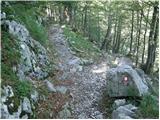 52
52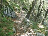 53
53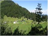 54
54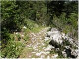 55
55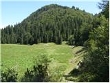 56
56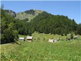 57
57
Discussion about the trail Bohinjsko sedlo - Planina Za Črno goro