Bohinjska Bistrica - Krevl (on ski track)
Starting point: Bohinjska Bistrica (520 m)
| Lat/Lon: | 46,2673°N 13,9586°E |
| |
Name of path: on ski track
Time of walking: 2 h 45 min
Difficulty: easy unmarked way
Altitude difference: 995 m
Altitude difference po putu: 1000 m
Map: TNP 1:50.000
Recommended equipment (summer):
Recommended equipment (winter): ice axe, crampons
Views: 7.037
 | 2 people like this post |
Access to the starting point:
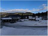
From the Ljubljana - Jesenice motorway, take the Lesce exit and then continue in the direction of Bled and Bohinj. When you reach Bohinjska Bistrica, turn left in the direction of Soriška planina, and then take the left turn straight onto the side road in the direction of the village of Ravne and the ski resort of Kobla. Continue for a further 10 m and then park in the large parking lot at the foot of the Kobla ski centre.
Path description:
From the starting point, first carefully cross the road, then walk past the lower station of the Goat's Back lift to the lower station of the Kobla 1 double chair lift, which is a short descent away. From the double chair, cross a small stream over a bridge and continue slightly to the left and then start climbing along the ski slope. After a few short steep climbs, the ski slope is lowered and you reach the bottom station of the double chair lift Kobla 2. Here, cross the road leading from Raven towards the former Dr. Janez Mencinger's hut and continue the climb slightly to the right on an increasingly scenic grassy slope. After a while, you will reach the bottom station of the Kobla 3 double chairlift, where you will also enter the next forest road. Follow the road to the left, and we walk along it for a good 10 minutes, to a small crossroads to the west of the Little Peak. Here the road continues straight ahead, and we continue to the right on a narrower ski slope (worse road), which climbs steeply a few times. The path we are following gradually turns more and more to the right and gradually changes from a minor road to a wide and sloping ski slope. Continue on the lesser road, which climbs moderately up the ski slope, and which, while loking at Šavnik, Možic, Slatnik and Lajnar, leads to a folded pass between Krevlo on the left and Kravja Črna gora on the right.
From the prevala, from where we have a beautiful view towards Črna prst, we continue to the left along the marked path in the direction of "Vrh Koble - žig". Here the path first climbs through the lane of a forest and then leads to a scenic ridge. The path continues along and along the scenic and, on the coastal side, precipitous ridge, which, with increasingly beautiful views, is followed to the top of Krevlo (the sign-in box reads Kobla), which is reached after a few minutes of further walking.

We can extend the trip to the following destinations: Črna prst
Pictures:
 1
1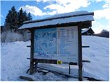 2
2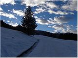 3
3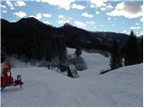 4
4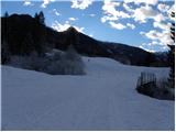 5
5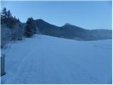 6
6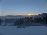 7
7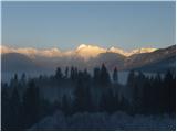 8
8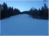 9
9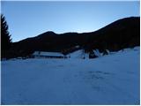 10
10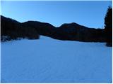 11
11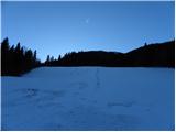 12
12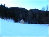 13
13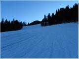 14
14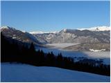 15
15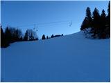 16
16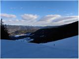 17
17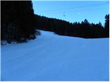 18
18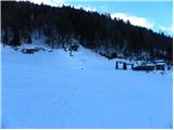 19
19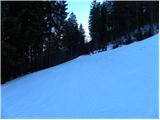 20
20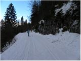 21
21 22
22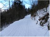 23
23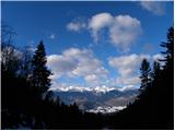 24
24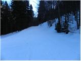 25
25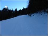 26
26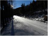 27
27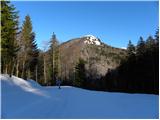 28
28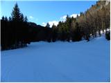 29
29 30
30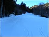 31
31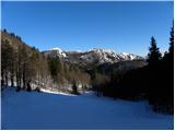 32
32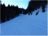 33
33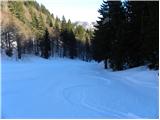 34
34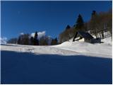 35
35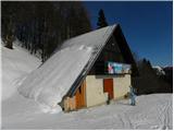 36
36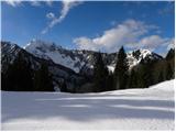 37
37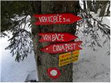 38
38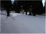 39
39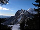 40
40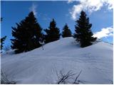 41
41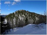 42
42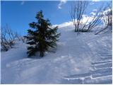 43
43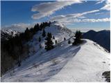 44
44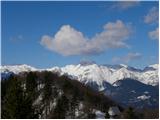 45
45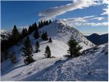 46
46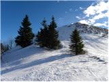 47
47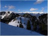 48
48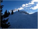 49
49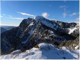 50
50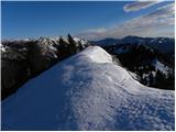 51
51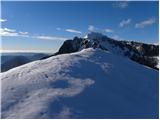 52
52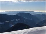 53
53
Discussion about the trail Bohinjska Bistrica - Krevl (on ski track)
|
| marinka6719. 03. 2014 |
V zgodnji jeseni planiramo izlet z vlakom iz Boh. B skozi tunel v Podbrdo in peš nazaj čez Krevl oz. Koblo. Ker je s Koble do Bistrice nemarkirano, me skrbi, da se ne bi izgubili, sploh ker imamo otroke. Kaj menite?
|
|
|
|
| kabe20. 03. 2014 |
Če dobro preštudiraš zemljevid in imaš vsaj malo orientacije, se zgubit skorajda ne moreš. V kolikor imaš pa že sedaj pomisleke, kaj bo če bo, ti predlagam, da za začetek izbereš kakšno lažjo, predvsem pa markirano turco. Glede otrok pa, četudi kam zaidete, ne delaj panike...s tem vse le poslabšaš! Pa srečno in veselo
|
|
|
|
| kabe20. 03. 2014 |
Pa še to...po smučišču se bolj težko izgubiš, razen če si 
|
|
|
|
| Gora Trma20. 03. 2014 |
Po smučišču dol proti Bohinjski Bistrici je orientacijsko zelo enostavno. Glede primernosti terena za varno hojo, pa lahko povem, da je po smučišču navzdol v smeri vaše planirane poti ves čas stezica.
Srečno pot!
|
|
|
|
| mrak.miša@gmail.com20. 03. 2014 |
jaz sem to pot prehodila predlanskim- brez zemljevida! Ni šans, da se zgubite ali zaidete, le slediti smučišču proti Bistrici...in držat se levo...
|
|
|
|
| marinka6721. 03. 2014 |
Hvala, ste me potolažili. Saj sem morda malo nerodno zapisala, nisem panična, pa tudi naš začetek to ni , moji otroci tudi poplezajo, če je treba, tako da to ni problem. Bolj me je skrbelo tavanje po gozdu, kjer si tudi z zemljevidom ne moreš pomagati.(razen če si  ) Ampak, če pravite, da ni problem.... OK. Z zgornjimi slikami si pač ne morem veliko pomagati, sicer so krasne, teren se pa ne vidi dobro. Skratka: hvala vsem!
|
|
|
|
| KarmenT9. 07. 2025 10:05:09 |
Ni mi jasno, zakaj je na vrhu Krevla žig za vrh Koble? Tudi na smerni tabli 15 min pod vrhom piše vrh Koble in ne Krevl.
|
|
|
|
| Hribo Vanja10. 07. 2025 06:39:36 |
Tkole je Tadej razložil pri komentarjih izleta Podbrdo-Krevl:
"Opis je narejen s pomočjo zemljevida TNP 1:50.000 PZS, zemljevida Škofjeloško in Cerkljansko hribovje 1:50.000 Kod&Kam in spletne aplikacije Atlas okolja (ARSO - ministrstvo za okolje in prostor RS).
V vseh omenjenih virih se vrh s koto 1515 m imenuje Krevl, vrh Kobla pa je označen na koti 1492 m, ki pa ni najvišja točka grebena Koble (najvišji vrh Koble se nahaja nekoliko SZ od kote 1492 in meri v višino 1498 m).
Torej je do napake najverjetneje prišlo, ko so postavljali smerne table in žig.
Upam, da sem kaj pomagal."
Na zemljevidu Bohinj (Sidarta) tega vrha sploh ni...
|
|
|
|
| KarmenT11. 07. 2025 14:18:33 |
Hvala.
|
|
|