Bohinjska Bistrica - Izvir Bohinjske Bistrice
Starting point: Bohinjska Bistrica (523 m)
| Lat/Lon: | 46,26451°N 13,94221°E |
| |
Time of walking: 50 min
Difficulty: easy marked way
Altitude difference: 107 m
Altitude difference po putu: 87 m
Map: TNP 1:50.000
Recommended equipment (summer):
Recommended equipment (winter):
Views: 36.581
 | 3 people like this post |
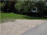
Access to the starting point:
From the local road Bled - Bohinj, turn left at the exit from Bohinjska Bistrica, at the bridge, and then follow the stream for another kilometre until the end of the asphalt and the signpost for the Bistrica spring.
Path description:
From the parking lot, continue in the direction of the signpost (Bistrica spring). The path climbs moderately along the forest path and after 25 minutes of walking we reach a wider macadam road where the path forks, we continue to the right, in the direction of the poorly visible sign for the spring. Continue following the signs to the first waterfall, where the path is made a little more difficult by a stream flowing down the road. Next we come to a wooden bridge, which we do not cross, but continue straight on, where signs direct us over a footbridge. Five minutes of further walking (sometimes dangerous for slipping) takes you to the source of the Bistrica River.
Pictures:
 1
1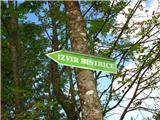 2
2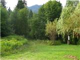 3
3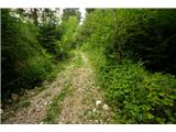 4
4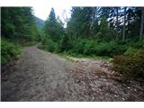 5
5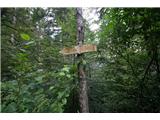 6
6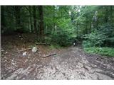 7
7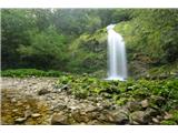 8
8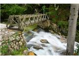 9
9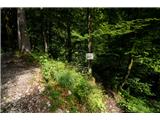 10
10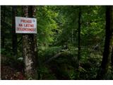 11
11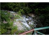 12
12 13
13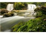 14
14
Discussion about the trail Bohinjska Bistrica - Izvir Bohinjske Bistrice
|
| KANA30. 08. 2010 |
Ko greste pri izhodu iz Boh. Bistrice čez most in levo, pot ni več makadamska, ampak lepo asfaltirana. Čez 1 km pa se začne makadam, ampak vi nadaljujete levo čez mostiček (oznake tam ni nobene), še vedno po asfaltu. Nato pa pridete do parkirišča.
Pot je kar lepa, nezahtevna.
Prejšnji vikend (22.08.2010) sicer zelo razmočena in blatna od vleke hlodovine.
Markacije pa malo tudi za obnoviti.
|
|
|
|
| bostjan8530. 08. 2010 |
ja res je asfaltirana,tiskarski škrat 
|
|
|
|
| PeterZ22. 05. 2016 |
Danes bil tam z družino dva majhna otroka, dlje od prvega slapa nismo šli, ker je bila voda čez pot pregloboka. Pot traja cca 1h, je sicer nezahtevna, na nekaterih delih mokra in zdrsljiva(obdobje taljenja snega), drevesa na poti, ki pa niso prevelika ovira. Višinska razlika je najbrž res cca 90m, a višinska razlika po poti je večja, saj se pot večkrat dviguje in spušča. Označbe bi lahko bile boljše, a po opisu, če si ga vsaj približno zapomnete, ne morete zgrešiti. Narava je tu čudovita, priporočam.
|
|
|
|
| vele16. 08. 2021 23:08:17 |
Pot je res lahka, tudi za družine z majhnimi otroci. Parkirišče v Bohinjski Bistrici (cel dan 2 EUR), varno in dostopno.
|
|
|