Blejska Dobrava (cemetery) - Hom at Bled (via Katarina)
Starting point: Blejska Dobrava (cemetery) (560 m)
| Lat/Lon: | 46,4068°N 14,1066°E |
| |
Name of path: via Katarina
Time of walking: 1 h 25 min
Difficulty: easy unmarked way
Altitude difference: 274 m
Altitude difference po putu: 354 m
Map: TNP 1 : 50.000
Recommended equipment (summer): crampons
Recommended equipment (winter):
Views: 6.213
 | 4 people like this post |
Access to the starting point:
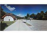
From the motorway Ljubljana - Jesenice take the exit Lipce, where you turn left (direction Blejska Dobrava and Spodnje Gorje). After 100 m of driving, just after passing through the railway underpass, you will come to the next junction, where you turn left uphill to Blejska Dobrava (right Bled, Gorje). When the road soon becomes level, drive straight through the village, where you will follow the signs for Vintgar and the cemetery. After about 1 km you will come to a railway tunnel. On the other side, where the road splits, turn right and after a further 100 m you will arrive at a large parking lot located near the cemetery.
Path description:
From the parking lot, continue on foot in the same direction, straight past the cemetery and the buildings next to it, on your right. Shortly after we have entered the dirt road, it turns right and starts to descend gently. The road soon leads into a mixed forest, where it continues to descend gently through bends. Then, as it flattens out, it leads us close to the river Radovna and soon to a bridge where we cross the river. On the other side, turn right up the hill (with the hydroelectric power station on the left), and you will reach a parking lot, at the end of which you will see concrete steps. Climb up the steps to the log cabin (in season a buffet and ticket sales for the gorge) from behind which you can also see the Šum waterfall from the top down on the bridge past the pergola. From the log cabin, continue up the stairs on the far left in the route marked "Katarina Bled". The path leads us past a small abandoned house quickly into the forest and climbs moderately for a short time at first. Shortly afterwards, when it levels off, we take a left at a crossroads and a little later we cross a small stream. Soon we are back at the 'crossroads', where we continue straight on, and the path briefly leads us to a clearing, beyond which it climbs only slightly to the left, back into the forest. A little higher up the path we encounter a small spring, and then the path turns slightly right and soon leads us out of the forest and onto the plain, where we see the Church of St Catherine. There is a restaurant on our right and benches across the parking lot on the opposite side, where we can rest and enjoy the view.
Continue to the right, past the aforementioned restaurant and the left fork of the footpath to Gorje and Vintgar, along the forest track in a north-westerly direction. This road initially turns slightly to the right as it climbs slightly. Ignore a left fork and follow cart track until its (apparent) end in an open part of the forest, where at least two logging trail climb up the hillside on the left. Here continue slightly (not perpendicularly!) to the right, or straight on, where you can see that the track actually continues into the forest. Then, after the next open part, when it leads back into the woods, the track narrows to a lane as it climbs moderately. This soon leads to a small pass where there is an unmarked crossroads. Here, leave the wider path and turn left onto the slope of Homa (straight ahead: the destroyed and dangerous path above the gorge, right: the path down, which is lost). When the path takes us over the clearing, enter the forest and climb the slope quite steeply towards the summit. Although the trail occasionally loses its way in this part, the indicated direction is not difficult to follow. When you reach the top, the path turns slightly right and briefly lays down, then takes you through a narrow lane copse. After this, there is a final moderate climb along the edge of the north-west slope, to the summit of Homa. Here we come across a large wooden cross, and boxes with a register and a summit stamp.

Pictures:
 1
1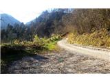 2
2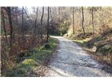 3
3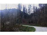 4
4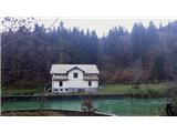 5
5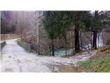 6
6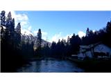 7
7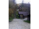 8
8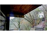 9
9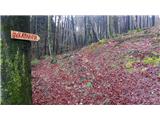 10
10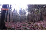 11
11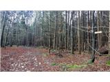 12
12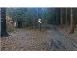 13
13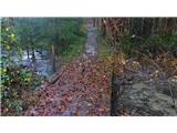 14
14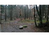 15
15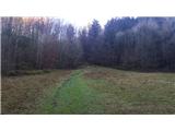 16
16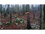 17
17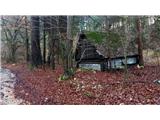 18
18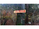 19
19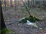 20
20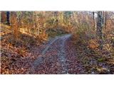 21
21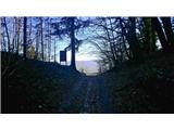 22
22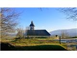 23
23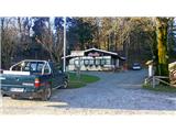 24
24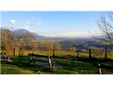 25
25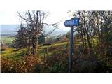 26
26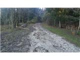 27
27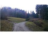 28
28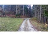 29
29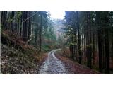 30
30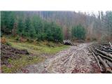 31
31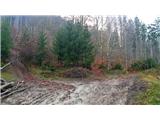 32
32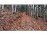 33
33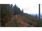 34
34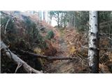 35
35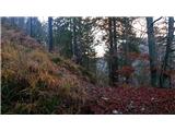 36
36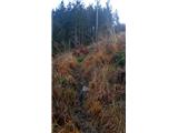 37
37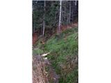 38
38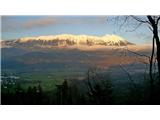 39
39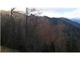 40
40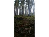 41
41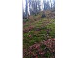 42
42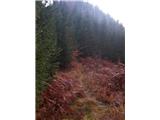 43
43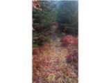 44
44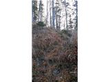 45
45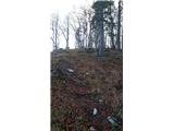 46
46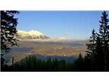 47
47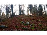 48
48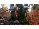 49
49 50
50
Discussion about the trail Blejska Dobrava (cemetery) - Hom at Bled (via Katarina)
|
| heinz4. 12. 2019 |
Majda nisi šla povsem po zg opisu, po katerem pot na vrh pristopi s severo/vzhoda.
|
|
|
|
| Majdag4. 12. 2019 |
Ja, heiz, šla sem po markacijah, mi je bilo lažje.. 
|
|
|
|
| Jusk6. 08. 2020 |
Danes sicer ne ravno po tej poti,ampak po poti ki zavije levo na sliki 29,lepa,označena in ne ravno strma pot v zgornjem delu tik pred vrhom in na vrhu je zelo zaraščeno. Povratek po isti poti do Sv.Katarine in naprej okoli Homa do Vintgarja,pa čez Strmo nazaj na Bl.Dobravo,ta pot pa je polna ljudi zdaj ko se vračajo iz Vintgarja nazaj v Podhom
|
|
|
|
| Enka20. 04. 2022 11:16:42 |
Na pobočjih Homa naj bi se nahajalo nekaj (dokaj zaraščenih) ostankov Rupnikove linije. Jih je kdo morda opazil?
|
|
|
|
| Majdag24. 04. 2022 14:12:50 |
stefanb hvala, bunker nad žel progo je še dobro ohranjen. Ni poti, strmina, nisem pa vedela da je to tudi Rupnikova linija.
|
|
|
|
| Jusk24. 04. 2022 17:30:03 |
Majda,mimo bunkerja nad progo je pot. Začne se pred tunelom,se vzpne,mimo bunkerja,čez nekaj minut pa se združi z označeno potjo na Katarino. Sem pa tudi že našel pot ki gre po desnem bregu Radovne,omenjeno v članku. No ni ravno pot,bolj zaraščena stezica,ki se je zaradi slabega stanja in strmine raje nisem lotil raziskat. Če sploh gre za to pot seveda
|
|
|
|
| Majdag12. 03. 2023 18:28:20 |
11.3....Cesta do mostu nad reko Radovno je na grobo asfaltirana. Most pa je zaprt. Pohodniška pot je zelo dobro uhojena, označena s stebrički in puščicami. Povsem drugačna kot pri opisu poti. Od cerkve sv. Katarine sva ubrali panoramsko pot do Podhomskega roba. Lepa suha stezica. Nadaljevali do kolovoza za Hom. Vse do vrha se lahko gre po njem. Je ena bližnjica vmes, pa je ni treba uporabiti. Sestopali sva po drugi strani, je široka pot, označena na stebričkih. In prišli nazaj do gostišča pri sv. Katarini. Luštno potepanje in razgledi do Podhomskega roba čudoviti. https://jelenkamenmajdag.blogspot.com/2023/03/pomlad-se-cuti-v-zraku-hom.html
|
|
|