Begunje - Velika Špička (via Cemarovnik)
Starting point: Begunje (611 m)
| Lat/Lon: | 45,8218°N 14,3837°E |
| |
Name of path: via Cemarovnik
Time of walking: 1 h
Difficulty: easy marked way
Altitude difference: 344 m
Altitude difference po putu: 350 m
Map: Snežnik 1:50.000
Recommended equipment (summer):
Recommended equipment (winter): crampons
Views: 10.137
 | 2 people like this post |
Access to the starting point:
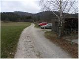
From the motorway Ljubljana - Koper take the exit Unec and follow the road towards Cerknica. Just before Cerknica, turn left in the direction of Begunj, and then follow the slightly more winding road to the village mentioned above. In Begunj, continue along the main road, then at the crossroads by the Mercator shop, continue straight on the macadam road, along which you will see signs for Špičasto Stražišče (Bezuljak on the left, Selšček on the right). Follow the dirt road to a small parking area next to the village bowling alley.
Path description:
From the starting point, we continue on a less good macadam road, which after a few 10 steps of easy walking leads us to a crossroads of three kolovozov. Continue along the leftmost (or middle) cart track, which leads us in a slight ascent to the next marked crossroads. This time continue on the right path (at the crossroads there are signs for Špičko to the left and right), which leads us along the upper edge of the vast karst meadows. After a few minutes of walking, the markings direct us left (straight Selšček) on a slightly steeper footpath, which gradually leads us to an increasingly scenic grassy slope. We climb straight up the slope and follow the trail all the way to the edge of the forest, by which there is a nice bench (view of Begunje and the surrounding area). The way forward starts to climb a little steeper through the lane of a forest, and then it is laid and after a few steps of further walking leads us to a scenic peak.
From Cemarovnik, continue slightly to the left along the marked mountain path, which first descends slightly and then begins to turn slightly to the right. After a few minutes' walk, join the path from the village Selšček and continue the ascent along a slightly wider path, which leads us higher into a slightly younger or more sparse forest. The path ahead climbs steeply for a short time, then leads us to a woded ridge where we are joined on the left by another path from Begunj (possibility of descent). Continue to the right along a relatively gently sloping mountain path, which in less than 5 minutes of further walking will take you to the top of Veliki Špička.

Pictures:
 1
1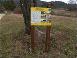 2
2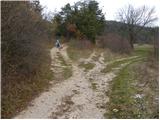 3
3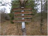 4
4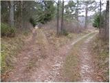 5
5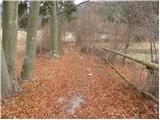 6
6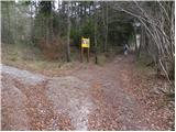 7
7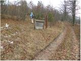 8
8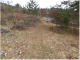 9
9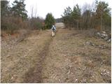 10
10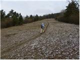 11
11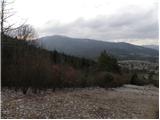 12
12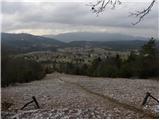 13
13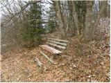 14
14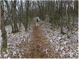 15
15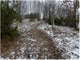 16
16 17
17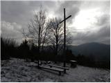 18
18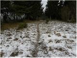 19
19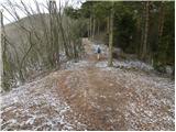 20
20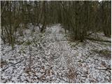 21
21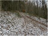 22
22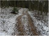 23
23 24
24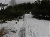 25
25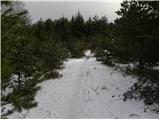 26
26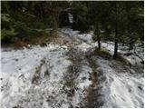 27
27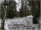 28
28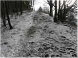 29
29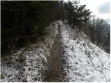 30
30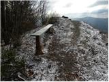 31
31 32
32
Discussion about the trail Begunje - Velika Špička (via Cemarovnik)
|
| akbara15. 12. 2009 |
Jaz sem na drugem razpotju, tam kjer je za Špičko označeno levo in desno, šla levo in pot se mi je zdela čudovita. Sploh zadnji del, kjer se svet odpre. Je pa verjetno bolj fajn, da se gre gor po poti, opisani zgoraj, in nazaj po "moji" varjanti.
|
|
|
|
| Lj30. 05. 2010 |
Danes smo srečno ujele čas za to prijetno turco, ne da bi nas opralo. Gor čez Cumarovnik t.j. po zgornjem opisu, dol pa krožno po varianti, ki jo opisuje akbara. Dobra kombinacija, gor bolj strmo, nazaj bolj razpotegnjeno. Hoja po gozdu in vmes po lepih jasah, kjer imaš kaj nabirat, če poznaš zelišča.
|
|
|
|
| katjuša21. 06. 2010 |
Za vse,ki se boste še podali na tole pot.
Klopov kar mrgoli in pa tele dni veselo lomastita dva medveda.Ker pa bo pašnik pod klopco kmalu poln drobnice bo še bolj zanimivo za kosmatinca.
|
|
|
|
| katjuša21. 06. 2010 |
Aja pa še tole
čez Cemarovnik pravimo domačini,Cumarovnik slišim prvič.
|
|
|
|
| klavdipo17. 01. 2013 |
Pozdravljeni!
Kako je s potjo v tem zimskem času? Je štampiljka še živa?
LP
|
|
|
|
| sk217. 01. 2013 |
Zasnežena a zgažena žig je 
|
|
|
|
| demo2313. 04. 2014 |
Pot cez Cemarovnik je meni od vseh variant pristopa najbolj fajn, razgledna ... žig je ampak v bolj slabem stanju 
|
|
|
|
| sk213. 04. 2014 |
Žig je nov od 11.04.2014
|
|
|