Starting point: Bašelj (590 m)
| Lat/Lon: | 46,321°N 14,4002°E |
| |
Time of walking: 4 h
Difficulty: difficult marked way
Altitude difference: 1542 m
Altitude difference po putu: 1542 m
Map: Karavanke - osrednji del 1:50.000
Recommended equipment (summer):
Recommended equipment (winter): ice axe, crampons
Views: 24.872
 | 1 person likes this post |
Access to the starting point:
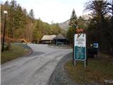
a) From the motorway Ljubljana - Jesenice, take the exit Kranj - East, then continue driving in the direction of Jezersko. When you reach Preddvor, leave the main road and turn left towards the centre of the town, and from there follow the signs for Bašelj. When you reach Bašelj, at the point where the main road makes a long left turn, leave the main road and continue straight ahead in the direction of the Gamsova cesta (Gamsova cesta). Continue along the narrow asphalt road that leads between the houses and the Belica stream. Park in the parking lot next to the Bašelj Tourist Board.
b) From the motorway Jesenice - Ljubljana, take the exit Kranj - West and turn left at the first junction. Continue through the underpass under the motorway and then to the roundabout, from where you continue in the direction of Golnik. The road continues through Mlaka pri Kranju, and at the end of the village we turn right in the direction of Srakovlje. We then drive through Srakovlje, Spodnja Bela, Srednja Bela, Zgornja Bela (in Zgornja Bela we join the road from Preddvor) to Bašlja, where the main road makes a long left turn, we leave it and continue straight on in the direction of Gamsova cesta. Continue along the narrow asphalt road that leads between houses and the Belica stream. Park in the parking lot next to the Bašelj Tourist Board.
Path description:
From the parking lot, continue in the direction of the Belica spring, Kališe and Storžič (Gamsov raj on the left) along the macadam road closed to public traffic, passing the Belica Sports and Tourist Park hut on the right. The road, from which we initially have a nice view of Storžič, leads us past the football and basketball pitches and leads us in about 10 minutes to a marked crossroads at the turning point of the road.
From the turning point, continue right in the direction of Kališe along the marked path (left Kališe along the forest road, and also Gradišče) and Kališe past the Košuta Hospital), which begins to climb along the left tributary of the Belice. The way ahead leads through the forest, initially along the left side of the ravine, then crosses it and passes to the right side, where after a short climb you reach a worse forest road or cart track. Follow Cart track for a few minutes, then the signs direct you right into the forest through which you climb quite steeply. Cross an overgrown clearing or old coppice, then rejoin the wide cart track. This time walk only a few steps on cart track, as at the first bend you continue straight on a gradually less steep path. A little further on, cross another cart track and, above it, approach the wide cart track. At the point where we approach the cart track there is a mountain direction signpost marking the way down. Continue straight ahead here and after a minute or two of further walking join the more beaten track from Mač.
From the crossroads continue left in the direction Kališe (straight Mače on the road, right Mače on the footpath) and continue through the short lane of the compacted forest. The dense spruce forest ends quickly and we enter a less good forest road leading out of the valley of the Belica stream. We climb along the road, which soon makes a left turn, for a few minutes, and then on the right we see the continuation of the mountain path (the branch is well marked). The path continues on to a steeper slope and climbs quite steeply in a number of bends. Higher up, the forest thins out and we get a nice view to the south. A wooden bench in a part of the sparse forest gives us a pleasant rest, and a little further on we are "surprised" by a working clock on a tree. Continue for a little longer, crossing to the right to reach the forested southern ridge Kališe. At the ridge, the trail turns sharp left, then climbs in a few switchbacks to Lower Kališe, from where we get a nice view of Storžič. When the path returns to the forest above Spodnje Kališem, the path from Laško (also the path from Bašlja past the Košuta hospital) joins us from the left. After a few minutes of walking through the forest, we reach a beautiful lookout point, from where a beautiful view opens up towards the nearby Dom na Kališču, Maly Grintovec, the ridge of Lanež, Krvavec. . . From the lookout point, it's just a short climb and we're at Dom na Kališe.
After Dom na Kališču we see a mountain direction sign with a number of possibilities to continue the route. Continue along the gently sloping and scenic ridge path in the direction of Storžič, Bašeljski vrh. . . , which continues northwards. After a few minutes of easy walking with beautiful views as far as Julian Alps, we arrive at a crossroads where the path branches off to the left towards the Church of St. Lawrence above Bašelj, mountain pasture Javornik and Kriška gora, the path branches off to the right to Bašeljski vrh and Mali Grintovec, and we continue straight on in the direction of Storžič. A few minutes of crossing the mostly western slopes of Bašeljski vrh (Bašeljski Peak) is followed, and then we arrive at the grassy Bašelj preval, where the trail from Jezersko (the starting point of Jekarica in the descriptions) joins us from the right.
Continue straight on again in the direction of Storžič, this time on the path which begins to climb steeply through lane of dwarf pines. After about 30 minutes of ascent from the saddle, we reach the ridge Storžič, which we soon leave as the trail ascends to the southern slopes of the mountain. The southern slopes are quite steep and the ascent is on a steep path which is dangerous to slip on in several places, especially in wet conditions. At higher altitudes, the path flattens out a little and returns to the ridge, along which it continues. Just below the summit, the path from St. Lovrenec, mountain pasture Javornik and the paths over Psica and through Žrelo join the increasingly scenic path from the left. Here you continue slightly to the right and in a few steps you reach one of the most visited two-thousanders in Slovenia.
Bašelj - Kališe 2:30, Kališe - Storžič 1:30.

Pictures:
 1
1 2
2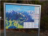 3
3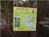 4
4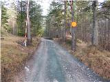 5
5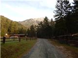 6
6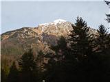 7
7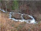 8
8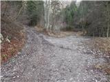 9
9 10
10 11
11 12
12 13
13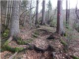 14
14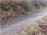 15
15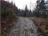 16
16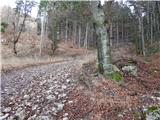 17
17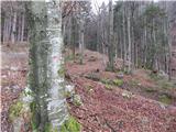 18
18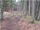 19
19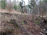 20
20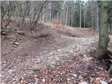 21
21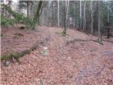 22
22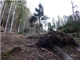 23
23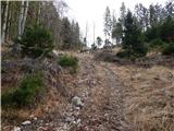 24
24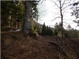 25
25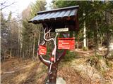 26
26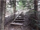 27
27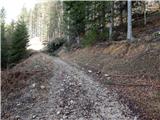 28
28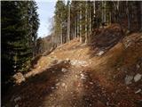 29
29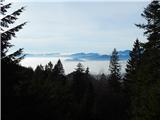 30
30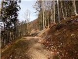 31
31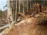 32
32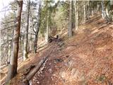 33
33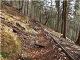 34
34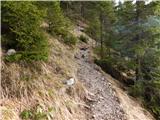 35
35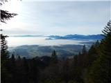 36
36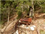 37
37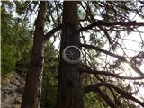 38
38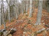 39
39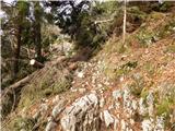 40
40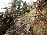 41
41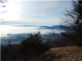 42
42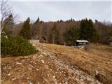 43
43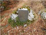 44
44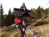 45
45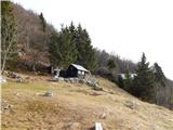 46
46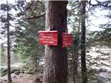 47
47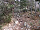 48
48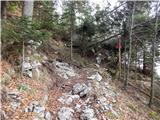 49
49 50
50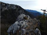 51
51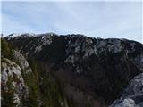 52
52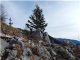 53
53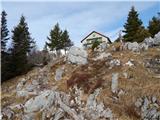 54
54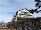 55
55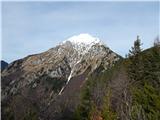 56
56 57
57 58
58 59
59 60
60 61
61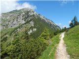 62
62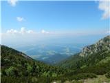 63
63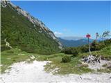 64
64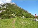 65
65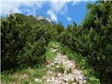 66
66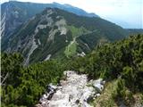 67
67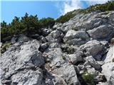 68
68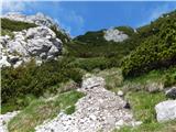 69
69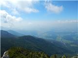 70
70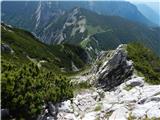 71
71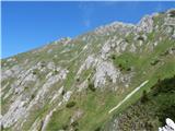 72
72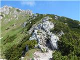 73
73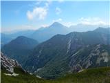 74
74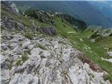 75
75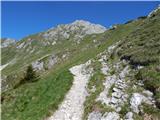 76
76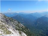 77
77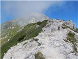 78
78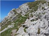 79
79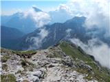 80
80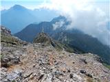 81
81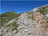 82
82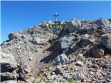 83
83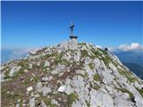 84
84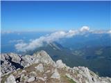 85
85 86
86
Discussion about the trail Bašelj - Storžič
|
| Žiga Šubic21. 11. 2021 19:36:19 |
Od izhodišča pa do Doma Kokrškega odreda na Kališču je pot označena oz. vidna bolj tako-tako. Ponekod zmanjka markacij in potrebno je slediti stopinjam predhodnikov, v kolikor so le-te vidne. Malo iznajdljivosti in improvizacije, saj se sicer hitro izgubiš. Sicer pa zanimiva pot, pa še ob Partizanski bolnici Košuta se lahko ustaviš po poti 
|
|
|
|
| trdi22. 11. 2021 17:27:59 |
Verjetno misliš Planinski dom na Kališču, kot se ta dom imenuje že od leta 1992....
|
|
|
|
| turbo23. 11. 2021 07:10:14 |
|
|
|
|
| GreenAngel24. 05. 2024 14:27:58 |
Alo je ze kdo bil ta cajt. Ali je zahtevna tura?
|
|
|
|
| Po Hodnik24. 05. 2024 16:30:16 |
Zahtevna tehnično ni, mogoče pod vrhom. Seveda je pa to subjektivna stvar. Do sedla pa brez problemov.
|
|
|
|
| jprim27. 05. 2024 18:45:49 |
Ko berem ta zanimiva vprašanja, kot ali je pot zahtevna,... pa saj piše v opisu - zahtevna.Težavnosti opisov lahko zaupamo na tej strani.
Lp
|
|
|