Baita Sun Bar - Punta dei Ross
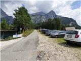
Starting point: Baita Sun Bar (1150 m)
| Lat/Lon: | 46,46419°N 12,21575°E |
| |
Time of walking: 4 h
Difficulty: difficult pathless terrain
Altitude difference: 1310 m
Altitude difference po putu: 1330 m
Map: Tabacco 03 1:25.000
Recommended equipment (summer): helmet
Recommended equipment (winter): helmet, ice axe, crampons
Views: 374
 | 2 people like this post |
Access to the starting point:
Access from Gorenjska: Via Border crossing Rateče or Predel to Trbiž / Tarvisio and then along the motorway towards Udine to the Tolmezzo exit. From Tolmezzo, follow the road towards Ampezzo and the Passo della Mauria mountain pass. The road then descends and leads to a crossroads where you turn left towards Cortina d'Ampezzo. At all subsequent junctions, follow the signs for Cortina d'Ampezzo. Follow the road until San Vito di Cadore, where you leave the main road towards Cortina d'Ampezzo and turn right, following the signs for the Rifugio Scotter hut and the Ski San Vito ski resort. There is a church on the left side of the road at the crossroads. The road then turns to the right and leads to a crossroads. Turn left up the road and follow the signs for the Rifugio Scotter hut. Follow the road to the Sun Bar where there are also signs forbidding further traffic. Park in the large parking lot on the right hand side of the road.
From the coastal side. At Portogruaro, leave the motorway towards Venice and turn right on the motorway towards Pordenone. At the next motorway junction near Conegliano, turn right towards Belluno. The motorway ends near Belluno and we continue towards Cortina d'Ampezzo at the next junctions. Continue as described above.
Path description:
The road, which runs straight ahead and was originally asphalted, was destroyed by the collapse and is closed. It is also closed to pedestrians and cyclists. We turn left at the starting point onto a dirt road. The relatively level road soon crosses a barrier and leads us above the torrent bed. The road then turns left and crosses the stream. There are also warning signs indicating that crossing the riverbed in the event of heavi rain is dangerous due to the possibility of sudden large waves. The road then climbs steeply and is paved in places. The ascent is mainly through the forest and the road then turns right to a footpath leading to the Rifugio Scotter hut. The forest then becomes thinner and thinner and beautiful views of the surrounding peaks begin to open up, with the nearby Monte Antelao standing out in particular. Soon we come to a crossroads where the old road, which is closed, joins us from the right.
Continue walking along the road, which is also asphalted for a short stretch. Just before the cottage, we come to a crossroads where we continue to the right and follow a few steps to the Rifugio Scotter Palatini cottage.
There is also an organised shuttle service from the starting point to the hut. They start at 8:30, return ticket price is 10€ (August 2018).
At the hut, turn left and go back up the steps to the road. Leave the road just above the hut and take the footpath to the Rifugio San Marco. The footpath initially climbs through dwarf pines and turns slightly to the left and then crosses the slopes to the north-east in a gentle ascent for some time. A little later we cross a wide torrent bed, and then the path soon leads us into the woods, where a path from the end of the road joins us from the right. We then start to climb a little steeper through the woods and then cross a small stream by which a sign on a board warns us of the danger of falling rocks. Then it's back up through the woods again, from which we still occasionally get beautiful views towards Monte Pelmo and Monte Antelau. Following this path, we soon reach the Rifugio San Marco hut.
At the crossroads behind the hut, turn left up trail 226 towards the Forcella Grande notch. From the crossroads, first climb slightly through a sparse forest and then, mostly in a gentle ascent, cross slightly steeper slopes to the north-west. The trail then leads past a water reservoir and soon turns right up a torrential gully. The path soon leaves the ravine and then climbs through dwarf pines on the left side of the ravine. A little higher up, the path leaves dwarf pines and then turns slightly to the right and crosses the ravine. There is a lot of compacted sand on the slope and if the path is not well trodden it can be dangerous to slip. The slope then becomes less steep and the path leads through a wide valley towards the Forcella Grande notch. At the crossroads just before the notch, turn left and the right path leads down towards the Val di San Vito. After a short crossing, the trail then leads to the signposts at the Forcella Grande notch, which offers magnificent views of Monte Sorapiss and the other precipitous peaks in the vicinity.
At the signposts, leave the marked trail 246 towards the Slataper bivouac and take the unmarked trail that leads slightly to the left of the marked trail. Our path crosses the scree in a slight ascent and runs parallel to the marked path visible below us. We continue to cross the scree on the north side of Punta Taiola, which is interrupted by a short lane of very steep slope. Here the path becomes more difficult and crosses an exposed slope on a narrow shelf. Considerable care is needed when crossing. This part can be avoided if you continue on the marked path from the notch for a while and turn left onto the pathless area later when the slope is no longer so steep.
After crossing the steep slope, you will soon reach a grassy area where the path disappears. Continue walking westwards and climb the pathless grassy slope towards the notch Forcella Pala di Dentro where there is also a wooden cross.
A slightly more challenging ridge to the left leads to the summit of Punta Taiola, and we turn right at the notch and continue along the ridge to the summit of Punta dei Ross. We then continue up the grassy slope along the ridge, which is precipitous to the west. This terrain then soon leads to a very scenic summit.
Let's go down the ascent route.

Pictures:
 1
1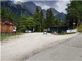 2
2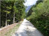 3
3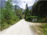 4
4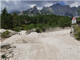 5
5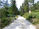 6
6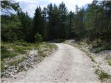 7
7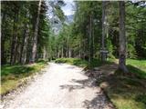 8
8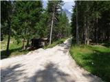 9
9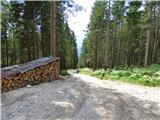 10
10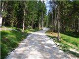 11
11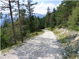 12
12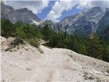 13
13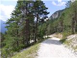 14
14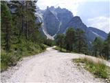 15
15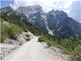 16
16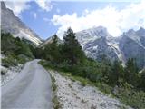 17
17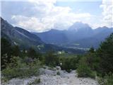 18
18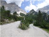 19
19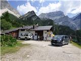 20
20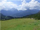 21
21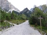 22
22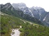 23
23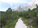 24
24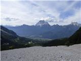 25
25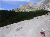 26
26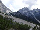 27
27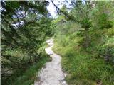 28
28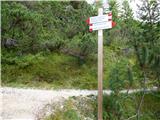 29
29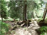 30
30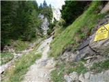 31
31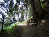 32
32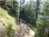 33
33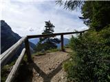 34
34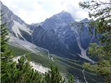 35
35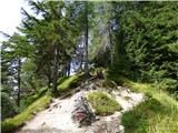 36
36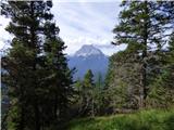 37
37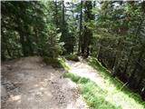 38
38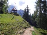 39
39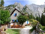 40
40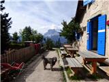 41
41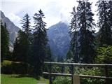 42
42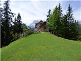 43
43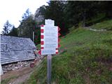 44
44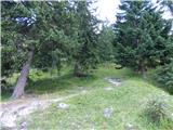 45
45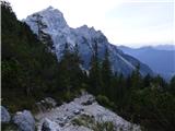 46
46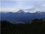 47
47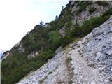 48
48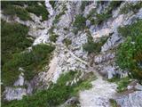 49
49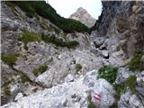 50
50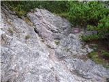 51
51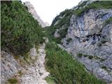 52
52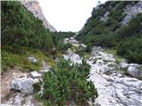 53
53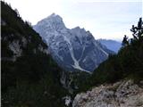 54
54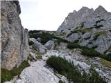 55
55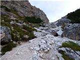 56
56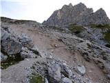 57
57 58
58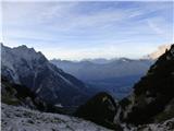 59
59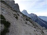 60
60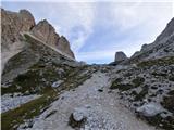 61
61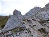 62
62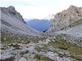 63
63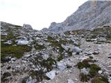 64
64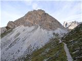 65
65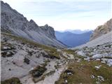 66
66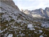 67
67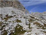 68
68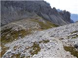 69
69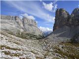 70
70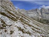 71
71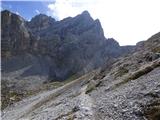 72
72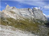 73
73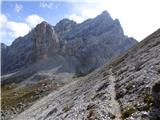 74
74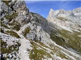 75
75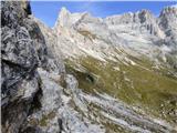 76
76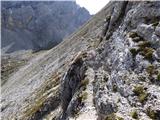 77
77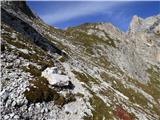 78
78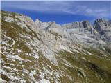 79
79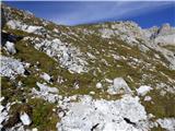 80
80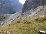 81
81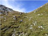 82
82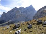 83
83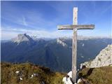 84
84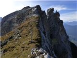 85
85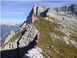 86
86
Discussion about the trail Baita Sun Bar - Punta dei Ross