Aljažev dom v Vratih - Kriški rob (via Sovatna and Pogačnikov dom)
Starting point: Aljažev dom v Vratih (1015 m)
| Lat/Lon: | 46,4128°N 13,8466°E |
| |
Name of path: via Sovatna and Pogačnikov dom
Time of walking: 5 h 45 min
Difficulty: partly demanding marked way, difficult pathless terrain
Altitude difference: 1351 m
Altitude difference po putu: 1530 m
Map: TNP 1:50.000
Recommended equipment (summer): helmet
Recommended equipment (winter): helmet, ice axe, crampons
Views: 4.534
 | 2 people like this post |
Access to the starting point:
Leave the Gorenjska motorway at the Hrušica exit and follow the road towards Kranjska Gora. Just before the village of Dovje, the road branches off to the left and leads to Mojstrana (Vrata, Kot and Krma). Follow the road in the direction of the Vrata valley and follow it to the large parking lot near the Aljaž's home.
Path description:
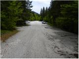
From the parking lot, continue along the macadam road, which after a 3-minute walk leads to the crossroads at Aljaževem dom. Continue straight ahead in the direction of Triglav, Luknja and Pogačnik's home (right Škrlatica) along the wide path that goes behind the chapel (on the right) and Aljaž's home (on the left) into the lane of a forest. A wide tourist-walking path leads us past the winter bivouac out of the forest, where we see the famous wedge (a monument dedicated to the fallen partisan mountaineers) in front of us. Continue straight ahead (Tominškova cesta on the left) along the path which returns to the forest and leads us to the next crossroads (Tominškova cesta on the left). Continue right in the direction of Pogačnik's home (straight on the path over Prag and Luknja) along the path which begins to climb steeply through the forest. After a few minutes of further walking, cross a short lookout clearing, then return to the forest and start climbing even steeper. At a height of 1300m, you will see a small spring along the path (it dries up in dry periods), after which you will soon leave the forest at the foot of the steep Sovatna. Here the path to the bivouac under Luknja branches off to the left, and we continue straight ahead along the steeper and steeper path. The path continues from grassy slopes to rubbly slopes (take care when descending) and occasionally climbs over a short rocky jump. The Sovatna valley then gradually narrows and the path leads us to a short slightly difficult place (over the Skok). Using the fixed safety gear, we climb a step higher, where the steepness eases slightly. Further on, the increasingly scenic route quickly leads to the crossroads at Dovški vratci.
Continue left in the direction of Pogačnik's home and Bovški Gamsovec (right Stenar and Križ) along the path from which the path to Bovški Gamsovec branches off after a few steps. Continue slightly to the right and gradually descend through the increasingly beautiful high mountains. From the path, which continues to descend slowly, the marked path to Pihavec branches off to the left, and we continue along the lower path towards Pogačnik's home. The path then crosses the slopes above Spodnje Kriško jezero, which can be seen to the left below us. The path then descends a little further and leads to the next crossroads, where we continue right up (left down Trenta) and in less than five minutes of further walking we reach Pogačnik's home, situated on a lookout. From home, continue past the upper station of the cargo cableway, along the marked path, which leads us in two minutes of gentle descent to a marked crossroads, where we continue slightly right in the direction of Križa and Škrlatica (left Razor and Planja). Continue moderately climbing over the vast Kriška Pod Pods on a path that leads past a spring and numerous potholes to a less visible crossroads (at the crossroads there is a small cairn). Continue left (straight Zgornje Kriško jezero for 5 minutes) on the marked path, which climbs steeply for a short time, then turns to the right, where it crosses a small scree slope.
At the point where you cross the scree, leave the marked path and continue climbing steeply upwards along the scree. The scree narrows at a higher level and the 'path' leads us into a small partly rubbly ravine (especially when descending, danger of slipping), which we climb to the top of the ravine. At the top of the gully, continue to the right and after a few steps of easier climbing, you will reach the top of the slope, which you will then climb in a few steps to the top.
The summit can also be reached by following the marked path to the saddle between Kriški rob and Križ and then climbing the steep grassy slope to the top. This route is slightly longer and, in dry conditions, a little easier.
Door - Dovška vrata 4:00, Dovška vrata - Pogačnikov dom na Kriških podih 30 minutes, Pogačnikov dom na Kriških podih - Kriški rob 1:15.

Pictures:
 1
1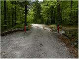 2
2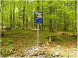 3
3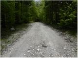 4
4 5
5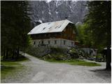 6
6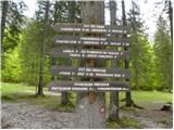 7
7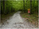 8
8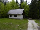 9
9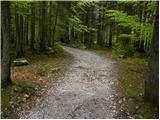 10
10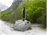 11
11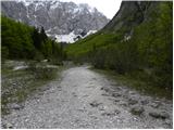 12
12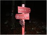 13
13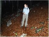 14
14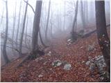 15
15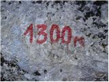 16
16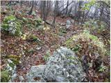 17
17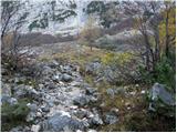 18
18 19
19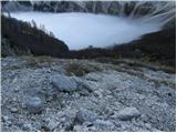 20
20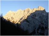 21
21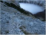 22
22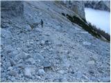 23
23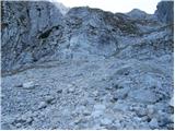 24
24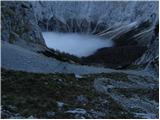 25
25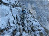 26
26 27
27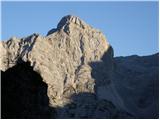 28
28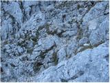 29
29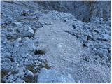 30
30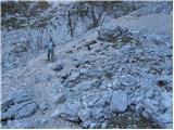 31
31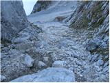 32
32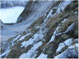 33
33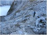 34
34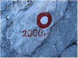 35
35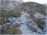 36
36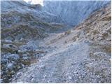 37
37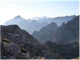 38
38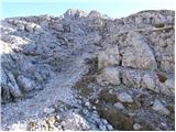 39
39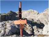 40
40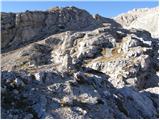 41
41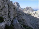 42
42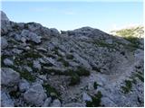 43
43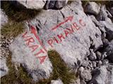 44
44 45
45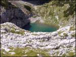 46
46 47
47 48
48 49
49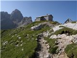 50
50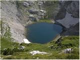 51
51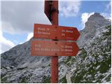 52
52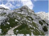 53
53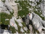 54
54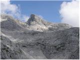 55
55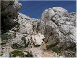 56
56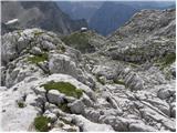 57
57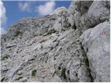 58
58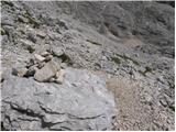 59
59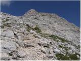 60
60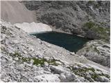 61
61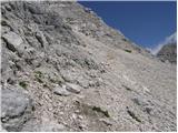 62
62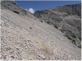 63
63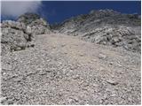 64
64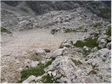 65
65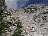 66
66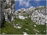 67
67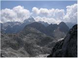 68
68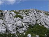 69
69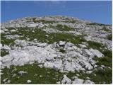 70
70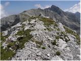 71
71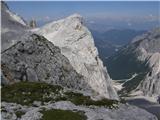 72
72
Discussion about the trail Aljažev dom v Vratih - Kriški rob (via Sovatna and Pogačnikov dom)
|
| kolosej15. 07. 2024 21:58:08 |
Če boste v Pogačnikovem domu spraševali za Kriški rob, vas bodo gledali kot čuka. A kavbojca imate v mislih, smo bili naposled sklepčni.
Napadel sem ga malo naprej od sedla med Križem in Kriškim robom... po strmih travah do vrha, na 'poti' sem postavil možice, ki so mi olajšali povratek...Srečno
|
|
|