Reka (Kozarska grapa) - Črvov vrh (via Kozarska grapa)
Starting point: Reka (Kozarska grapa) (232 m)
| Lat/Lon: | 46,1183°N 13,9172°E |
| |
Name of path: via Kozarska grapa
Time of walking: 3 h 15 min
Difficulty: difficult pathless terrain
Altitude difference: 742 m
Altitude difference po putu: 800 m
Map:
Recommended equipment (summer): helmet
Recommended equipment (winter): helmet, ice axe, crampons
Views: 523
 | 3 people like this post |
Access to the starting point:
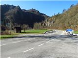
a) From Idrija or Cerkno drive towards Tolmin, where at Reka become aware of the approaching start of the route. When you reach the bridge where the main road crosses the Kozarska grapa stream and where you see a carpenter's workshop on the right, turn left and park on the widened asphalt along the main road.
b) Drive to Bača pri Modreju (to get here from Most na Soči or Podbrdo), then continue driving towards Idrija. In Reka, just after the bridge where you cross the Kozarska grapa stream, turn right and park on the widened tarmac along the main road.
Path description:
From the starting point, cross the Kozarska grapa (also Kazarska grapa) stream and immediately after the bridge turn right onto cart track, which continues along the right bank of the stream to the weekend. Just before the weekend, a shortcut leads left into the bank if you don't want to walk along the ravine. The shortcut soon has a fork. Follow the right-hand variant and you will reach a crossroads at Lipje. Here it joins the path described below.
If you follow the Kozarski Grape, bypass the weekend and go through the passage under the leaning tower to the disused power station. Go around it on the left and follow the route of the abandoned pipeline. Walk along the right bank to the exit of the stream from the gorge. Here, cross over to the left bank and climb a steep gully (Iron Gully) to a height where you can safely continue parallel to the gorge. Soon you will come across a track and follow it up along the stream. When you reach the rapids, above which you can see the walls of the Lutne Skale climbing area, go around them on the right, or better still, by climbing over the boulders, right next to the water. Continue to the bridge, where you cross to the right bank and follow cart track, back in the direction of arrival. When the cart track splits, follow the right-hand branch into the bank. Follow this path to the crossroads at Lipje, where you can see the Poličanka stream on the other side.
About twenty metres before the summit, the above-mentioned shortcut joins us on the left out of the forest.
Continuing towards the village of Police, take the cart track signpost, which leads right from the crossroads into the bank. Follow Cart track, which is interrupted in places by the reclamation of a meadow, right next to the forest. When the meadow is crossed by the power line, follow cart track down into the Poličanka ravine. Cross this and follow the right-hand, more distinct cart track upwards. Soon we reach an asphalt road, where we turn left and after walking for less than a kilometre, we are in the village of Police, where first a road branches off to the left to the nearby church, and a little further on, a path joins us from the left, leading through the Sjaunk (Sejalnik) ravine, where there is one of the possibilities of descending into the valley. At a small crossroads, bear slightly left, and at the next crossroads, bear slightly right in the direction Šentviška Gora (slightly left Shelf of house no. 20-23). Here the asphalt ends, and after a few steps we reach the next fork, where the marked path to Šentviška Gora continues along the lower path, and we continue along the upper path and continue on the macadam road. It is followed by a mostly cross-country climb up the slopes of Košarica (961 m), from where we occasionally get a nice view, and the path also leads us past two small streams, the second of which has a nice trough where we can fill up with water. Continuing down the slope, we reach the plateau and pass a few houses to reach the asphalt road Šentviška Gora - Bukovo Vrh.
Follow the road to the left (Bukovo Vrh to the right) and in a few steps you will reach the next crossroads from which you continue to the right in the direction of Gorski Vrh.
After the crossroads, the road descends slightly, then begins to climb steeply and leads us past the Travnikar homestead, and a little higher still leads us to the next crossroads.
To the left continues the road towards the settlement Ponikve, to the right the road towards the settlement Bukovo Vrh, and we continue straight on the unmarked unpaved path, which first climbs over the meadow, then transitively passes into the forest, where we cross the first pasture fence, when we get out of the forest we go twice more over the fence.
Here we join the path from the village of Ponikve, and we continue straight on towards Črvov vrh, where we can already see the antenna tower on it. A few minutes of moderate climbing follow, and after crossing the pasture fence we are only a few steps of easy walking away from the top.
You can descend through the ravine of the Sjaunk (Sejalnik) stream, through which a traceable path leads, or along the ridge mentioned in the description of the route through the Poliška ravine, or you can also follow the asphalt access road.
Starting point - Police 1:45, Police - Črvov vrh 1:30.
Description and pictures refer to the situation in December 2019 and February and March 2020.
Images up to No 37 were contributed by Mari Božnar and Tadeja Črv.

Pictures:
 1
1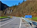 2
2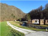 3
3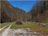 4
4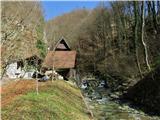 5
5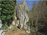 6
6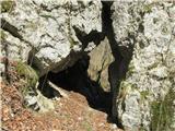 7
7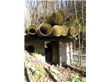 8
8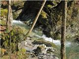 9
9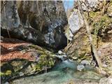 10
10 11
11 12
12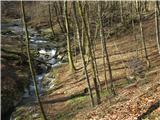 13
13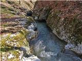 14
14 15
15 16
16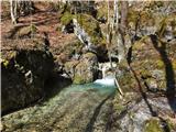 17
17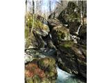 18
18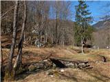 19
19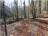 20
20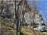 21
21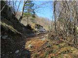 22
22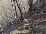 23
23 24
24 25
25 26
26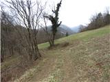 27
27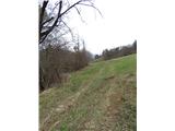 28
28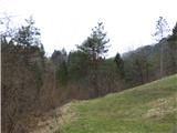 29
29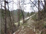 30
30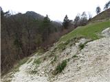 31
31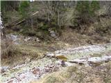 32
32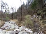 33
33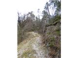 34
34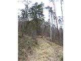 35
35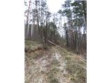 36
36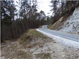 37
37 38
38 39
39 40
40 41
41 42
42 43
43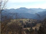 44
44 45
45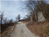 46
46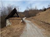 47
47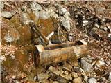 48
48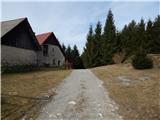 49
49 50
50 51
51 52
52 53
53 54
54 55
55 56
56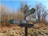 57
57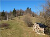 58
58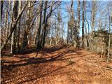 59
59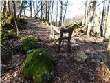 60
60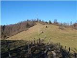 61
61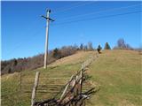 62
62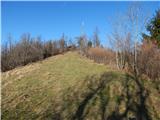 63
63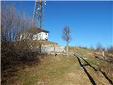 64
64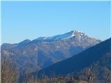 65
65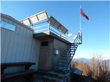 66
66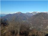 67
67 68
68
Discussion about the trail Reka (Kozarska grapa) - Črvov vrh (via Kozarska grapa)