Predmeja - Kucelj (na Čavnu)
Starting point: Predmeja (875 m)
| Lat/Lon: | 45,9466°N 13,8702°E |
| |
Time of walking: 2 h
Difficulty: easy marked way
Altitude difference: 362 m
Altitude difference po putu: 475 m
Map: Goriška 1:50.000
Recommended equipment (summer):
Recommended equipment (winter): crampons
Views: 20.835
 | 1 person likes this post |
Access to the starting point:
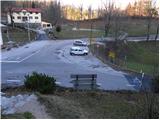
From the expressway Razdrto - Nova Gorica take the exit Ajdovščina and follow the road towards the village Lokavec (Lokavac can be reached from the centre of Ajdovščina, or from the old road Ajdovščina - Nova Gorica, where turn right at Cesta). From Lokavac, continue along the ascending winding road in the direction of Predmeja. Follow this road to the crossroads where the road to Colo branches off to the right. Park in the parking lot in the immediate vicinity of the crossroads.
The starting point can also be reached from Godovič, via Črni vrh and Colo to Predmeja. In this case, drive to the crossroads where the road to Ajdovščina branches off to the left just after the end marker Predmeja. Park in the parking lot close to the junction.
Path description:
From the parking lot at the crossroads, follow the footpath towards the hut at Čavno. The path first climbs past the memorial plaque to Ressel Jožef, then passes into the forest, where it begins to climb, first moderately and then steeply. Higher up, the path leads to a small lookout point (view Predmeja) at which you can see a bench and a thermometer.
At the bench we also join the wide cart track, which turns into a footpath a little higher up, which soon starts climbing steeply again. The relatively steep path, along which you can see a number of large men, leads you higher up to a dirt road, which you follow to the left. The ascent continues along the road, which briefly becomes asphalt. Higher up, the road is laid and leads us out of the forest onto the viewing slopes, from which we have a beautiful view of Golake, the Nanos and Vipava valleys, and later the Adriatic Sea. Follow this road, which slowly turns to the right and which even drops slightly in the last part, all the way to the hut on Čavno.
After the hut, the signs for Kucelj direct us slightly left onto a footpath that begins to descend crosswise. The path crosses a short lane of forest, then turns right, where it continues to descend gently. The path then gradually passes into the forest and the path from the village of Kamnje joins us on the left (there are two turnoffs for Kamnje). Continue in the direction of Kuclj on the path which gradually passes to the right side of the "Čavnov" ridge. The path continues through a large clearing, from which a view of the surrounding hills opens up, and then returns to the forest. A little further on, leave the folded cart track and continue climbing to the left and on through the thick forest. The steepness soon gives way and the path leads us out of the forest onto increasingly scenic grassy slopes. A few minutes of easy walking follows, and then the path leads us under the very top of Kuclja, where it climbs steeply again. This path, which offers increasingly beautiful views, is then followed all the way to the top of Kuclja, which is reached after a few minutes of further walking.
Predmeja - Koča na Čavnu 1:15, Koča na Čavnu - Kucelj 45 minutes.

Pictures:
 1
1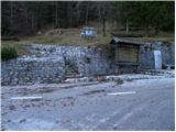 2
2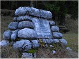 3
3 4
4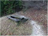 5
5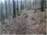 6
6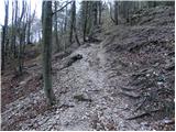 7
7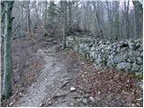 8
8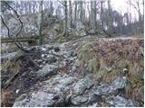 9
9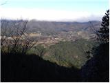 10
10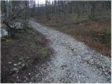 11
11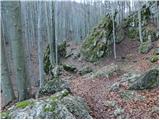 12
12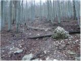 13
13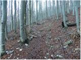 14
14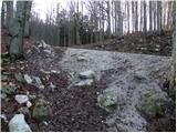 15
15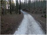 16
16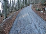 17
17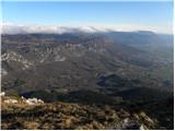 18
18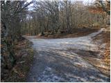 19
19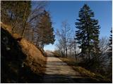 20
20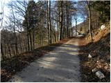 21
21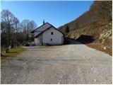 22
22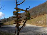 23
23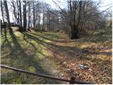 24
24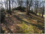 25
25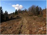 26
26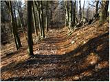 27
27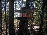 28
28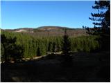 29
29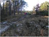 30
30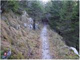 31
31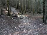 32
32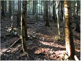 33
33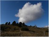 34
34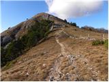 35
35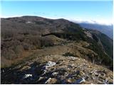 36
36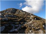 37
37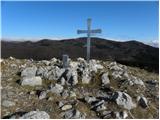 38
38 39
39
Discussion about the trail Predmeja - Kucelj (na Čavnu)
|
| anazala23. 03. 2017 |
Šla sem po Krkini poti. Vse je lepo označeno. Tudi po drugih poteh sem že šla. Vse je označeno. Lep razgled, lepa narava, okusna hrana v koči. Lep izlet. Primeren za mlade in starejše.
|
|
|