Planina Polog - Rdeči rob (via Javorca and Planina Sleme)
Starting point: Planina Polog (457 m)
| Lat/Lon: | 46,238°N 13,7232°E |
| |
Name of path: via Javorca and Planina Sleme
Time of walking: 4 h 30 min
Difficulty: easy marked way, partly demanding unmarked way
Altitude difference: 1456 m
Altitude difference po putu: 1456 m
Map: Julijske Alpe - zahodni del 1:50.000
Recommended equipment (summer): helmet
Recommended equipment (winter): helmet, ice axe, crampons
Views: 1.350
 | 2 people like this post |
Access to the starting point:
First, go to Tolmin, and from there follow the road in the direction of Zatolmin (leave the main road at the traffic lights). In Zatolmin, you will see the mountain signs for Javorca, which will direct you to the ascending road towards Javorca. After about 8 km of driving, the sometimes quite narrow and sometimes precipitous road leads us to a small crossroads where the road to Javorca branches off to the left upwards. We continue straight ahead, following the road for only about 100 m, where we then park at a suitable place next to the ramp.
Path description:
From the starting point, follow the path leading to the parking lot before ascending to the Javorca church, where you will find this paved path. After about 15 minutes, you will reach the World War I church Javorca, and we continue along the road to the left past it. At the paddock, turn left onto the unmade cart track, which passes the farm above Javorca, and the path takes us over a concrete bridge onto the slope below Visoči vrh. At the first fork, turn right through the pasture fence and follow the signs for the Peace Trail, which leads to mountain pasture Črč. From there you can continue along the sloping and well-preserved mulatier to mountain pasture Laška seč or, before mountain pasture, turn left onto a shortcut (the Peace Trail) which leads you to the next mountain pasture - that is mountain pasture Laška seč. Passing this mountain pasture, continue along the mulatier to mountain pasture Medrje, from where you can turn right onto the direct mulatier to mountain pasture Sleme, or follow the road to mountain pasture Pretovč and from there turn right along the paved road to mountain pasture Sleme.
At mountain pasture Sleme, at the partisans' memorial, head uphill towards a signpost pointing left towards Krno and mountain pasture Kuhinja along the lower track, which crosses gravel scree in two places (if the path is worn, the crossing can be dangerous). The upper (old) path is not recommended due to potholes. Follow the marked track to the marked path ascending from mountain pasture Kuhinja to Jezero v Lužnici, and follow this path as well, soon seeing the characteristic red rocks ahead, up to the crossroads for Rdeči rob (right uphill).
At the crossroads we start to ascend along an unmarked and less visible path below the base of the ridge between Rdeči rob and Škofič. Soon you reach the next unmarked crossroads, where you head left uphill to a ridge (right straight ahead to Veliki Stador) surrounded by the characteristic red rocks. The path is rough and quite rugged, so some caution is needed, especially on the descent. The route cannot be missed if you climb all the way to the foot of the ridge (to the cliff).
When you reach the ridge between Škofič and Rdeči rob continue right along the initially gently sloping path, which then climbs steeply along the edge of the precipitous ridge and leads us in 3 minutes of further walking to Rdeči rob.
The second route, from the route of the Big Studor to Rdeči rob is quite exposed, as it is dug into the gravel, without fixed safety gear and therefore also quite dangerous.
Mountain pasture Polog - Javorca 00:20, Javorca - mountain pasture Sleme 02:00, mountain pasture Sleme - Rdeči rob 02:10

Pictures:
 1
1 2
2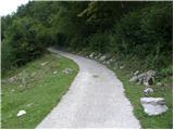 3
3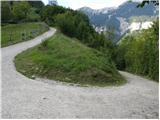 4
4 5
5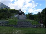 6
6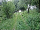 7
7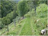 8
8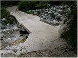 9
9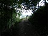 10
10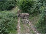 11
11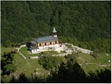 12
12 13
13 14
14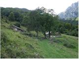 15
15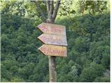 16
16 17
17 18
18 19
19 20
20 21
21 22
22 23
23 24
24 25
25 26
26 27
27 28
28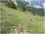 29
29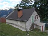 30
30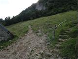 31
31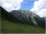 32
32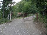 33
33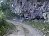 34
34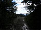 35
35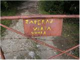 36
36 37
37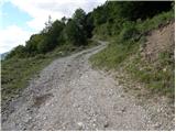 38
38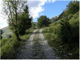 39
39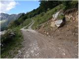 40
40 41
41 42
42 43
43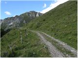 44
44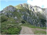 45
45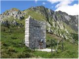 46
46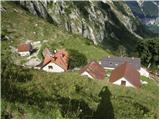 47
47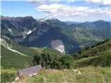 48
48 49
49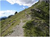 50
50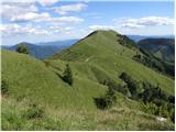 51
51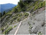 52
52 53
53 54
54 55
55 56
56 57
57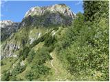 58
58 59
59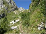 60
60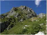 61
61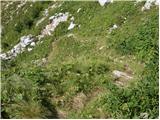 62
62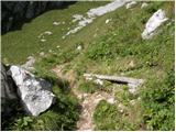 63
63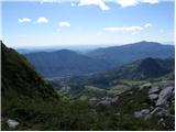 64
64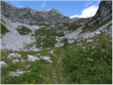 65
65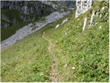 66
66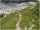 67
67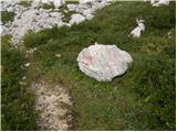 68
68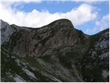 69
69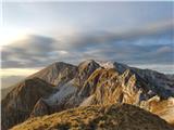 70
70
Discussion about the trail Planina Polog - Rdeči rob (via Javorca and Planina Sleme)
|
| bo_zl8. 10. 2023 18:56:58 |
Od odcepa pri skali (slika 68) do vrha je za 35 do 40 minut hoje.
|
|
|
|
| mirank8. 10. 2023 19:59:02 |
Opis po sistemu okoli riti v varžet. Že na pl Medrja ni potrebe hodit do zgradbe, saj že prej zavijemo s poti naravnost navzgor do roba pašnikov in tu poiščemo stezo v desno. Ta lepo vidna in shojena mulatiera te pripelje direkt na Sleme. Občasno viden alkaten vodovod ob poti. Nad Slemenom sl 50 se držimo desne poti, ki se spočetka drži zgornje poti a se nekje na sredini od le te odcepi levo. Ta dobro shojena steza se priključi markirani poti Leskovca-Lužnica kakih 100m nad spominsko ploščo padlemu v NOB.
|
|
|