| triglavski15. 11. 2009 18:19:05 |
It could have been a very pleasant autumn ramble if there wasn't snow, but the snow didn't bother me at all. The mountains above Ukvama are quite familiar to me, less those north of Žabnice. These areas surely have nice Slovenian names, but sadly I don't know all of them. From Žabnice or (Rutte di Camporosso) I drive another about 2 and a half km up the Bartolo valley (Val Bartolo), at the sign prohibiting traffic or at a small parking lot I leave the car, then on foot along the road through the whole valley to the Bartolo saddle, where I cross into Austria and join the Carnic Trail 403, along it all the way on the road, which is plowed for a while, then no one has walked anymore, snow is around 30-40 cm. This way I reach the Achomitzer alpine pasture, to Ojstrnik it would be decidedly too far, and I've been up there twice already, so above the pasture I check out the bunkers of human madness, then climb to M. Acomizza-Schonwipfel-Sončni vrh, views are quite nice despite cloudy weather, then I descended along the grassy southern slopes to elevation 1760, where there are also underground fortifications and a bit lower joined path 508 leading to Žabnice. I haven't walked such a nice path with such beautiful views of the western Julian Alps for a long time, at Gozdarska koča Cima Muli I caught up with three Italians, sat a bit, then we continued together for a while, but they didn't trust me when I turned left off the cart track and headed towards Val Bartolo on the once-marked path, even though they were heading there too. (Alessio would probably know more about this path - it's a newly extended forest road towards the valley) Anyway in less than 45 minutes along the still quite good path marked with red dots I reached the road about 150 meters below the parking lot at the small bridge, a bit lower there's a climbing wall above the road, a bit higher the marked path 509 turns to Canton saddle and on to Monte Goriane. It was one really nice loop and it needs to be repeated when the larches green up again or next autumn.
 1 1 2 2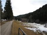 3 3 4 4 5 5 6 6 7 7 8 8 9 9 10 10 11 11 12 12 13 13 14 14 15 15 16 16 17 17 18 18 19 19 20 20
| (+1) |  | |
|
|