Mangart via Via della Vita ferrata
|
| Katja6626. 08. 2013 12:47:26 |
Yes, I admit, born in 1966  . .
So I need to change my question?
Hm... any old guy/old gal around the 50s available for company in the mountains?
For my good, let me say that I'm still in pretty good shape, say I comfortably run a half marathon.
And I never forget diapers
| (+14) |  | |
|
|
|
|
| panda28. 08. 2013 10:37:19 |
Katja: private message sent.
| (+1) | | |
|
|
|
|
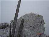
| redbull28. 08. 2013 19:50:19 |
is this Mali K.Mangart (summit)?
 1 1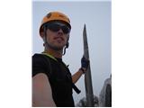 2 2
|
|
|
|
| redbull15. 10. 2013 08:19:19 |
I'm wondering if anyone has photos of Vevnica ridge, is the ferrata dry??
thanks
best
|
|
|
|
| poustr21. 07. 2014 23:16:41 |
Hello,
has anyone gone this path yet this year?
Is it dry?
Thanks, best
|
|
|
|
| MANGRT22. 07. 2014 06:56:41 |
For the entry part winter gear is still needed, lots of snow.
| (+2) | | |
|
|
|
|
| poustr22. 07. 2014 11:28:14 |
Thanks for quick reply MANGRT!
|
|
|
|
| iskalec20. 08. 2014 08:19:39 |
Hello!
Does anyone have info on the condition of the path Remšendol, Mt. Schober, Vraška škrbina and down to Krnica? Somewhere I read that the part dashed on the map is hard to pass.
Thanks for reply
|
|
|
|
| kitina2. 08. 2016 12:04:17 |
Hello!
Has anyone been on this path? Interested in snow conditions, state of fixed protection? Best.
|
|
|
|
| alyas30. 07. 2017 17:07:37 |
Belopeška (Mangartska) Lakes – Via della Vita – Bivacco Tarvisio – Mali Koritniški Mangart – Huda Škrbina – Mangart – Mangart Saddle – over Plazje – Belopeška Lakes … (conditions 29.07.2017)
First an introductory fact – given this year's modest snow cover, there is no snow on the path anywhere. The entrance to ferrata VdV has a new and impeccable cable, further on the condition of the path and ironwork is also OK.
Although the entire path should be marked, in larger parts the marks have unfortunately almost disappeared or faded to the extent that they are barely visible. But let's praise what's praiseworthy: Italians have newly red-marked the path from upper Alp Vecchia over scree to ferrata VdV, and also the path from Mangart Saddle leading down over Plazje (Forcella della Lavina) to Jezerska Planina or to the upper lake, there they have fresh white-red "strips". On our – intermediate part of the path, at least frequent cairns stand, more or less in the right places.
Finally – a bit about the weather (general useful advice), because the wall under Vevnica is mostly in shade, foggy and humid mornings do not provide optimal conditions for such ascent, fog is even more problematic in the continuation towards MKM and Huda Škrbina, as it prevents readability of already sparse and faded path marks. Also the passage on the narrow path amid steep grass from Huda Škrbina onwards above Loška Koritnica can be quite tricky in damp conditions.
For this route you will need approx. 10 hours (without breaks!), of which about 7 hours for ascent and good 3 hours for descent.
 1 1 2 2 3 3 4 4 5 5 6 6 7 7 8 8 9 9 10 10 11 11 12 12 13 13 14 14 15 15") 16 16 17 17 18 18 19 19 20 20 21 21, occasionally without view.") 22 22 23 23 24 24 25 25 26 26 27 27 28 28 29 29.") 30 30 31 31 32 32 33 33 34 34") 35 35 36 36") 37 37 38 38 39 39 40 40 41 41 42 42 43 43
| (+16) | | |
|
|
|
|
| garmont30. 07. 2017 18:20:02 |
Excellent tour. But I don't understand why one has to climb crosses, towers on the mountain top...
Isn't it high enough? 
| (+13) | | |
|
|
|
|
| gams130. 07. 2017 19:50:57 |
alyas, I always like to look at your descriptions and photos  , do you perhaps have any more details on the descent from Huda Škrbina, whether go down directly from the ridge or below more around , do you perhaps have any more details on the descent from Huda Škrbina, whether go down directly from the ridge or below more around 
|
|
|
|
| alyas31. 07. 2017 08:19:29 |
Hmm, ... usually it's like that, where it's more demanding, less photos are taken. But as said: on descent from Huda Škrbina down to the gully there are enough pegs and cables for help, also the first continuing ascent over green grass is secured with a cable.
In dry there won't be any special problems, this descent part is just very demanding, not exceptionally so. Actually from above it's harder to find the traverse, which is otherwise marked and secured. Good luck!
 marked") 1 1 2 2
| (+4) | | |
|
|
|
|
| dprapr31. 07. 2017 08:30:36 |
Maybe this photo will help, where the descent is from behind.
 1 1
| (+2) | | |
|
|
|
|
| gams131. 07. 2017 16:39:00 |
thanks guys for the additional info.
|
|
|
You must log in to post a comment:
If you do not yet have a username, you must first
register.