Debanttal - Keeskopf (Nossberger Weg)
Starting point: Debanttal (1573 m)
Name of path: Nossberger Weg
Time of walking: 5 h
Difficulty: easy marked way, difficult pathless terrain
Altitude difference: 1508 m
Altitude difference po putu: 1508 m
Map: Austria On-line;
Recommended equipment (summer): helmet, lamp
Recommended equipment (winter): helmet, ice axe, crampons, lamp
Views: 8.873
 | 4 people like this post |
Access to the starting point:
From the Karavanke Tunnel, follow the Turkish Autobahn past Belzec to Spital, where you turn towards Lienz. On entering Lienz at the roundabout, follow the signs for the Debanttal valley and the Lienzerhütte. Continue along the road, which is sometimes muddy, to a large parking lot by the gods lift (behind the Wangenitz lakeside hut), where a ramp makes it impossible to continue.
Path description:
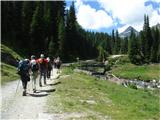
Follow the dirt road, and soon a marked track running parallel to it, up to the Lienzerhütte 1974m, (1h). This cosy hut has a real wod-carved zoo, children's playground, viva, bathroms and shoe dryers. Right in front of the hut, take the marked path towards the Niedere Gradenscharte pass, which leads to the Adolf Nossberger hut at Lake Graden. First, descend a little, cross the stream and follow the path to the left over a slope full of blueberries. A prominent cross along the trail can be reached in about half an hour. A little further on, at a marked fork, turn right (and straight ahead, the path leads to the Gossnitz notch). The comfortable path wraps around the southern ridge of the Keeskopf, becoming a little steeper. The next well-marked fork to the right leads to a better path to the hut at Lake Wangenitz, and we continue straight up. Signposts lead us through the lose granite scree to a notch. A few metres of ropes help us up to the stubble. From the hut to the 2796 m high stub, we (in a group) spend about 3 hours. Here we are surprised by a couple of glacial lakes, one literally just as we reach the stump. From the lakes we see a cross on a conical peak. We walk around the lakes for about 15 minutes until we reach a moraine with a large man, where we leave the marked path and turn left towards the summit. Cairns makes it a bit easier to find your way around the broken terrain, but the path is well worn in places. Just below the summit, you need to be a little more careful, as the path is crumbly and muddy for a few metres. For the less skilled, belaying is recommended here, at least on the way back, but the more skilled can climb around this point (I). There is a large cross at the top with a register, but there is rather little space around it. The view is phenomenal: from Lienz Dolomites to the Hochalmspitze, with only the Great Klek shyly hiding behind the nearby Klammerkopf.
Parking - hut 1 hour; hut - saddle 3 hours, saddle - summit 1 hour.

Pictures:
 1
1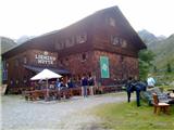 2
2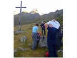 3
3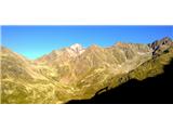 4
4 5
5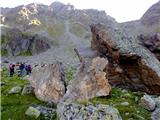 6
6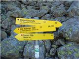 7
7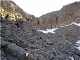 8
8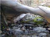 9
9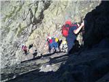 10
10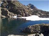 11
11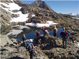 12
12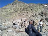 13
13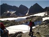 14
14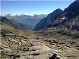 15
15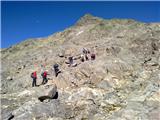 16
16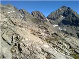 17
17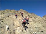 18
18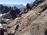 19
19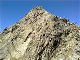 20
20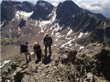 21
21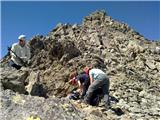 22
22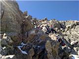 23
23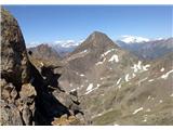 24
24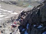 25
25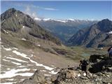 26
26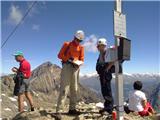 27
27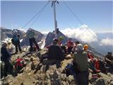 28
28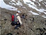 29
29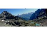 30
30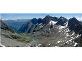 31
31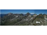 32
32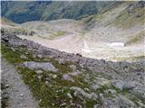 33
33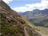 34
34
Discussion about the trail Debanttal - Keeskopf (Nossberger Weg)
|
| pohodnik3334. 09. 2023 21:58:08 |
Tik pod vrhom je napeljana vrv kakih 30 m, lažje je it po desni strani od vrvi do vrha. Drugač nič posebnega, ok markirana.
|
|
|