Parking Stubaier Gletscher (Mutterbergalm) - Zuckerhütl (normal approach from the west)
Starting point: Parking Stubaier Gletscher (Mutterbergalm) (1692 m)
| Lat/Lon: | 47,01324°N 11,15504°E |
| |
Name of path: normal approach from the west
Time of walking: 5 h
Difficulty: very difficult unmarked way
Altitude difference: 1815 m
Altitude difference po putu: 1815 m
Map: Stubaier Alpen Hochstubai, 31/1 1:25.000; Outdooractive Stubai Wanderkarte
Recommended equipment (summer): helmet, ice axe, crampons
Recommended equipment (winter): helmet, ice axe, crampons
Views: 731
 | 3 people like this post |
Access to the starting point:
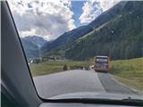
From Ljubljana, take the motorway past Salzburg towards Munich. At the Dreieck Inntal multi-level junction, take the A93 towards Innsbruck/Kufstein/Brenner. On your return to Austria, continue to the Innsbruck-Mitte exit. Here, do not turn towards Innsbruck, but continue on the A13 motorway towards the Brenner Pass. Turn off the motorway at exit 10-Schönberg and follow the comfortable road through the Stubai valley to Neustift im Stubaital, the centre of the Stubai valley, and Volderau, where the still wide asphalt road starts to climb a little more steeply towards Mutterbergalm and the ski resort of the "Stubaier Gletscher". Soon, on the left, we see the large Grawa waterfall and the parking lot of the eponymous mountain pasture, and a little higher up, the parking lot for the climb up to the Sulzenauhütte. After a few minutes' further driving, park in one of the many car parks under the "Stubaier Gletscher" ski slope.
An alternative is to drive through northern Itali: in this case, from central Slovenia, take the A2 motorway to one of the border crossings with Austria and continue to Lienz. Here you continue on the 100 road and pass the Prato alla Drava crossing into Itali. In Itali, follow the SS49 all the way to the junction with the A22 motorway in the direction of the Brenner Pass. After the pass, continue in the direction of Innsbruck to the Schönberg exit. From there, follow the route described above.
Path description:
Most hikers ascend to Zuckerhütl by taking a series of lifts (Eisgrat I and II and Schaufeljoch) to the top station of the Schaufeljoch cable car (3158 m) and descend from there to the Fernaujoch station (the Fernau chairlift does not operate in summer). The following description refers to the more orthodox approach option of walking from the parking lot to the Fernaujoch pass; this option is particularly suitable for the descent and insofar as it is desirable to avoid the considerable ticket price.
Just above the bottom station of the Eigrat I cable car, cross the footbridge and follow the signs to the left to the path leading to the Dresdner Hütte. The well-marked path initially follows a gentle track through sparse vegetation, but after about half an hour's walk it climbs slightly steeper over a grassy slope. After less than an hour and a half, the path, which climbs the slope in curves, leads to the Dresdner Hütte hut.
At the hut, at the edge of the ski slope, you approach a road which leads you along single shortcuts to the lower station of the Fernau chairlift. From here, head firmly south and climb over the Fernauferner glacier to the Fernaujoch pass, which can be seen from a distance. The best way to find your way across the glacier is to roughly follow the route of the chairlift, but as a rule, in summer you will be guided by the tracks of your predecessors. Orientation in clear weather is not difficult.
At Fernaujoch, we join the route coming from the west from the top station of the Schaufeljoch cable car; this route is about an hour and a half shorter than the route described. The ascent continues eastwards along a long ridge which runs from Fernaujoch to the western wall of the Aperer Pfaff; the ridge is craggy but not particularly precipitous, and the cairns helps with orientation.
At approx. 3220 m, the track turns southwards and bypasses the termination of the SW ridge of the Aperer Pffaff. An unmarked track then leads over scree to the obvious Pfaffenjoch Pass (3208 m) at the edge of the Sulzenauferner glacier. In the opposite direction, the somewhat impenetrable terrain sometimes makes it difficult to find the right path between the Pfaffenjoch and the ridge leading to the Fernaujoch.
At the pass, cross the rocks and descend to the Sulzenauferner glacier. It takes just under an hour to walk along the extensive glacier, during which we cross under the entire north face of Zuckerhütla in a south-easterly direction. Due to the popularity of the route, it is reasonable to expect a clear trail throughout the year, which will help us to orientate ourselves and make the crossing more comfortable.
To the east of Zuckerhütl, climb slightly steeper to where you join the trail leading from the summit of Wilder Pfaff (from here it is easily and relatively quickly accessible). From here, climb right of the precipice edge to the base of the rocky summit of Zuckerhütl in a few minutes. It is a good idea to leave your rucksack at the base before the difficult final climb.
The climb over the eastern facade of Zuckerhütl is short, but the precipitous, crumbly terrain exposes it to natural changes and is objectively quite dangerous, especially if there are other hikers climbing above us. The optimal route is somewhat dependent on the prevailing conditions, although individual markings and drill marks are used for orientation, allowing us to belaying at tricky spots.
From the foot of the rocky slope, first ascend over unstable scree, then traverse slightly southwards. After a short exposed traverse, climb to the slightly flatter terrain below the summit at a suitable passage. Following the markers and anchor points, climb over a steep steel cable and cross an easier-to-traverse summit to reach a small but very exposed summit with a large crux.
The final ascent of Zuckerhütl is a short but potentially quite tricky affair, especially so on busy days. The climbing does not go beyond Grade II, but the route is precipitous in places and the rock is very crumbly. Zuckerhütl is also the highest point of the popular "7 summits of Stubai" route.
For the less experienced, I recommend belaying with a rope or accompanied by a mountain guide.

Pictures:
 1
1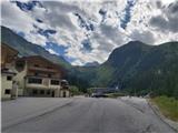 2
2 3
3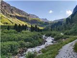 4
4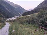 5
5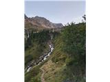 6
6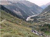 7
7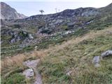 8
8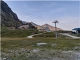 9
9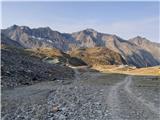 10
10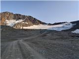 11
11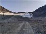 12
12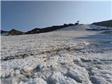 13
13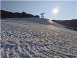 14
14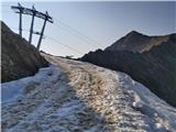 15
15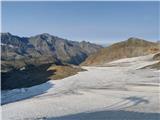 16
16 17
17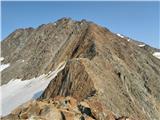 18
18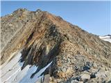 19
19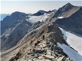 20
20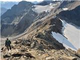 21
21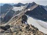 22
22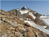 23
23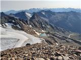 24
24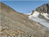 25
25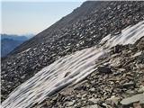 26
26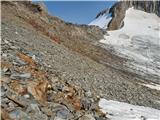 27
27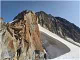 28
28 29
29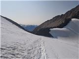 30
30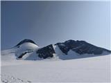 31
31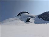 32
32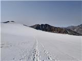 33
33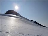 34
34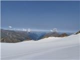 35
35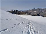 36
36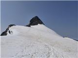 37
37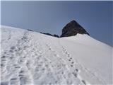 38
38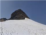 39
39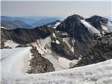 40
40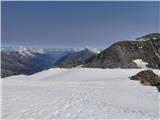 41
41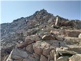 42
42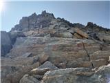 43
43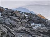 44
44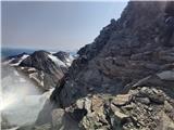 45
45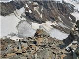 46
46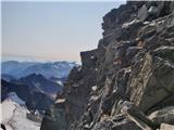 47
47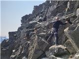 48
48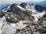 49
49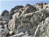 50
50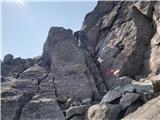 51
51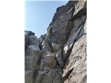 52
52 53
53 54
54
Discussion about the trail Parking Stubaier Gletscher (Mutterbergalm) - Zuckerhütl (normal approach from the west)