Pocol de ra Crosc - Rifugio Duca d'Aosta
Starting point: Pocol de ra Crosc (1928 m)
| Lat/Lon: | 46,52914°N 12,08067°E |
| |
Time of walking: 40 min
Difficulty: easy marked way
Altitude difference: 170 m
Altitude difference po putu: 170 m
Map: Tabacco 03 1:25.000
Recommended equipment (summer):
Recommended equipment (winter):
Views: 360
 | 2 people like this post |
Access to the starting point:
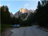
a) Access from Gorenjska: Via Border crossing Rateče or Predel to Trbiž / Tarvisio and then along the motorway towards Udine to the Tolmezzo exit. From Tolmezzo, follow the road towards Ampezzo and the Passo della Mauria mountain pass. The road then descends and leads to a crossroads where you turn left (possibly right) towards Cortina d'Ampezzo. At all subsequent junctions, follow the signs for Cortina d'Ampezzo. In Cortina d'Ampezzo, follow the signs for the Passo di Falzarego Alpine pass. Follow this ascending road to where a road forks off to the right towards the rifugio Dibona hut (the fork is at about 1700 m). Follow the narrow asphalted road to a crossroads where a road forks off to the right towards the Duca d'Aosta hut. Park near the junction where there are a few small car parks along the road.
b) From the coastal side: Take the motorway towards Venice/Venezia. At Portogruaro, leave the motorway towards Venice and turn right on the motorway towards Pordenone. At the next motorway junction near Conegliano, turn right towards Belluno. The motorway ends near Belluno and we continue towards Cortina d'Ampezzo at the next junctions. Continue as described above.
Path description:
Turn right onto the macadam road towards the Duca d'Aosta hut. From the crossroads, the road climbs through the forest and quickly leads to the ski slopes. Continue following the road as it continues along the ski slope. From the road, we can see beautiful views of the Sorapiss and Antelao mountain groups, and even better, the southern wall of the nearby Tofana di Rozes. Later, the road leads to a slightly wider ski slope, where the view opens up towards Cortina d'Ampezzo. Here the road turns left and the forest soon ends. There is one last climb up the increasingly scenic road to the Duca d'Aosta hut.
Pictures:
 1
1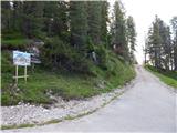 2
2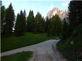 3
3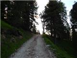 4
4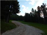 5
5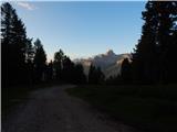 6
6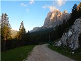 7
7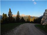 8
8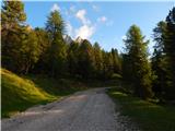 9
9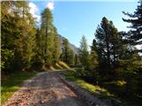 10
10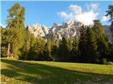 11
11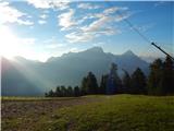 12
12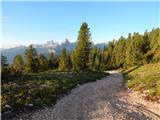 13
13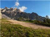 14
14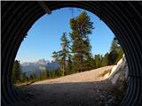 15
15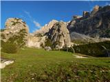 16
16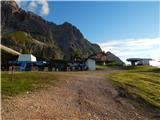 17
17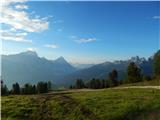 18
18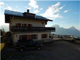 19
19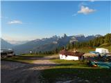 20
20
Discussion about the trail Pocol de ra Crosc - Rifugio Duca d'Aosta