Laško - Storžič (via Sveti Lovrenc and over Bašeljski preval)
Starting point: Laško (740 m)
| Lat/Lon: | 46,3256°N 14,3969°E |
| |
Name of path: via Sveti Lovrenc and over Bašeljski preval
Time of walking: 4 h 30 min
Difficulty: difficult marked way
Altitude difference: 1392 m
Altitude difference po putu: 1425 m
Map: Karavanke - osrednji del 1:50.000
Recommended equipment (summer): helmet
Recommended equipment (winter): helmet, ice axe, crampons
Views: 3.363
 | 1 person likes this post |
Access to the starting point:
a) From the motorway Ljubljana - Jesenice, take the exit Kranj - East, then continue driving towards Jezersko. When you reach Preddvor, leave the main road and turn left towards the centre of the town, and from there follow the signs for Bašelj. When we arrive in Bašelj, first at the beginning of the left turn in the direction of straight ahead there is a narrower road leading to the parking lot at the log cabin TD Bašelj (in the descriptions the starting point Bašelj), and from the mentioned crossroads we continue along the main road for another 100 m to the next crossroads, where we continue to the right along the road towards the Gamsovemu raje and the hamlet Laško (Laško hamlet). Only about 50 m further on, continue along the left-hand road, which gradually starts to climb moderately. At the hamlet of Laško, turn left again, then the asphalt ends and you continue along a steep macadam road, which you follow to a parking area, at a small crossroads. There are red mountain direction signs at the crossroads.
b) From the motorway Jesenice - Ljubljana, take the exit Kranj - West and continue left at the first junction. Continue through the underpass under the motorway and then to the roundabout, from where you continue in the direction of Golnik. The road continues through the village Mlaka pri Kranju, and at the end of the village we turn right in the direction of Srakovlje. Then drive through Srakovlje, Spodnja Bela, Srednja Bela, Zgornja Bela (in Zgornja Bela we join the road from Preddvor) to Bašlja, where the main road makes a long left turn, where a narrower road continues in a straight direction, leading to the parking area at the log cabin TD Bašelj (in the descriptions the starting point Bašelj), and from this junction we continue along the main road for another 100 m to the next junction, where we continue right along the road towards Gamsovem raje and the hamlet of Laško. Only about 50 m further on, continue on the left road, which gradually starts to climb moderately. At the hamlet of Laško, turn left again, then the asphalt ends and you continue along a steep macadam road, which you follow to a parking area, at a small crossroads. There are red mountain direction signs at the crossroads.
Path description:
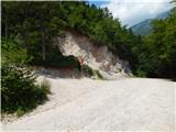
From the parking lot, take the steep cart track towards Lovrenec. After a short steep climb, the cart track leads to a crossroads where a footpath branches off to the right to the Church of St. Lawrence. We continue on the lower dirt track, which again starts to climb steeply and after a 15-minute walk from the starting point leads us to Dom na Lovrencu.
At the house, we continue along the path towards Storžič and after a few steps the path leads us out of the woods and onto the meadows below the church. The Church of St. Lovrenec can be reached in a few minutes on foot through the meadow.
Continue along the meadow past the church and the path soon leads into the woods. The wide path then descends gently to an unmarked saddle, where we join the path from a slightly higher starting point. Continue in the direction of Storžič along the wide path, which climbs slightly. The path soon becomes narrower and then climbs steeply through the forest for some time. Higher up, the path just leads us out of the forest and beautiful views of the southern slopes of Storžiča open up. The steepness continues unabated all the way to the bench at the crossroads.
To the left is a marked path towards Javornik and Poljana, and we turn right towards Kališe. The path from the crossroads becomes slightly narrower and less beaten. We continue for a long time crossing the slopes to the east. The path alternates between forest and grassy slopes, which are also quite steep in places. As you cross, the path climbs slightly steeper at times and descends gently on a few occasions. In the second part of the crossing, the path leads to a spring below Bašeljski sedlo. Here the path turns slightly to the right and continues to cross the slopes until it leads to a marked crossroads.
To the right leads the path to Dom na Kališču which is only a few minutes walk away, and we take a sharp left onto the path towards Storžič. At the crossroads, there is also a trail to Bašeljski vrh and Malý Grintovec. The gentle path with beautiful views then leads us quickly to the Bašelj saddle, where we join the path from Jezersko. At the saddle, a signpost for Storžič directs us to the path going west (straight ahead). The path, which starts to climb steeply through dwarf pines, leads us to the ridge of Storžič after a 30-minute climb. The ridge soon gives way to the steep southern slopes of Storžič. This part of the path is dangerous for slipping, great care is needed in the wet. The steepness then eases a little and the path continues along the ridge or just below it. A few metres below the summit, join the path coming from Žrela (also from mountain pasture Javornik and from Psice). Continue to the right and in a few steps you will reach the top where the cross stands.

Pictures:
 1
1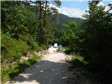 2
2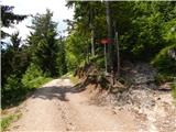 3
3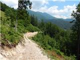 4
4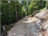 5
5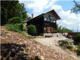 6
6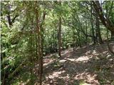 7
7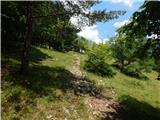 8
8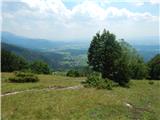 9
9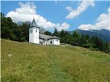 10
10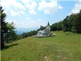 11
11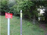 12
12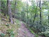 13
13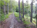 14
14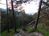 15
15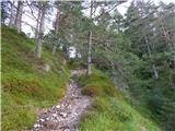 16
16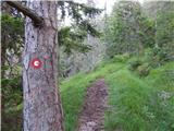 17
17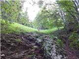 18
18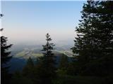 19
19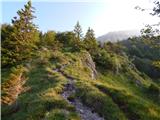 20
20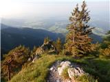 21
21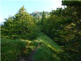 22
22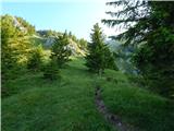 23
23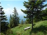 24
24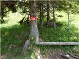 25
25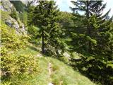 26
26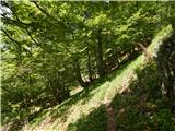 27
27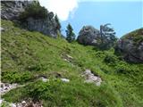 28
28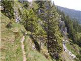 29
29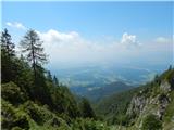 30
30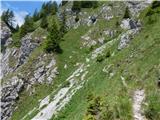 31
31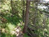 32
32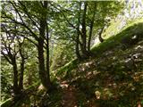 33
33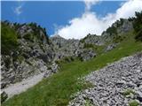 34
34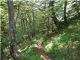 35
35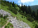 36
36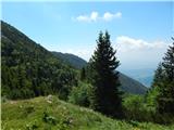 37
37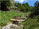 38
38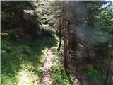 39
39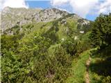 40
40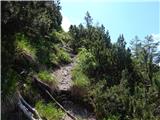 41
41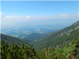 42
42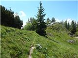 43
43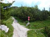 44
44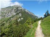 45
45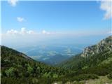 46
46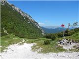 47
47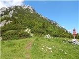 48
48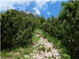 49
49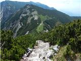 50
50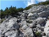 51
51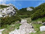 52
52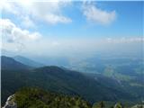 53
53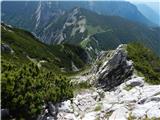 54
54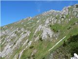 55
55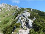 56
56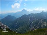 57
57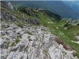 58
58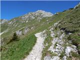 59
59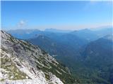 60
60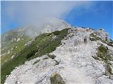 61
61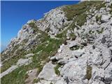 62
62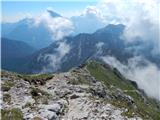 63
63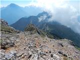 64
64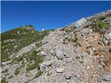 65
65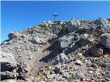 66
66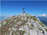 67
67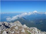 68
68 69
69
Discussion about the trail Laško - Storžič (via Sveti Lovrenc and over Bašeljski preval)