Markova raven - Kompotela (marked way)
Starting point: Markova raven (980 m)
| Lat/Lon: | 46,2969°N 14,5618°E |
| |
Name of path: marked way
Time of walking: 3 h
Difficulty: easy marked way
Altitude difference: 1009 m
Altitude difference po putu: 1050 m
Map: Kamniške in Savinjske Alpe 1:50.000
Recommended equipment (summer):
Recommended equipment (winter): ice axe, crampons
Views: 26.146
 | 2 people like this post |
Access to the starting point:
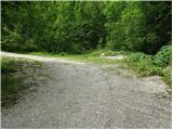
Drive into Kamnik and follow the road towards the Kamniška Bistrica valley. Just a few tens of metres before the bottom station of the pendulum, a forest road branches off to the left down into the Korošica valley. The road then crosses a bridge and shortly afterwards comes to a crossroads where you continue straight ahead. The road then leads to a crossroads again. 1. Turn left over the bridge and follow the road uphill. The Markovo level can be identified by a small parking lot, a stream and a wide cart track which heads up to the left and the road starts to descend steeply. 2. Continue straight on and climb the road which leads to the next crossroads. Continue along the road on the left, which becomes very steep, and follow it to the parking lot at the left-hand bend, from which a wide cart track turns off straight ahead. Park in the parking lot on the roadside.
Path description:
From the parking lot, take the wide cart track road, which after a few dozen metres leads to the next parking lot. Continue straight across the parking lot and continue up the cart track, which turns left. After a few minutes' walk, cart track has a crossroads where you take the marked cart track to the right. Follow this for a few minutes to where the footpath to Krvavec and mountain pasture Koren branches off to the right. The branch is not marked so you have to follow the signs carefully. The path continues up the right side of the torrent quite steeply. The path then leads us to a crossroads where we continue to the right in the route ZA VRATA. The way forward slowly passes into a less dense forest, so that we sometimes cross a small meadow or even a short scree slope. The views are also getting better. Next, the path leads us under the foot of a shorter wall from which an unmarked path branches off to the right up to mountain pasture Koren. Continue slightly up the left side of the wall. The path ahead descends gently and leads to a pleasant small spring. The path continues to the left side of the small spring and starts climbing again. The path then crosses a short lane of dwarf pines and then starts to climb on grass. Further on, the path is more difficult to follow as it quickly gets lost in the grass but the markings, which are more sparse, will help. After 20 minutes of climbing from the well, the path leads us to a wooden house. The path behind the cottage turns left into the forest and after a short climb joins the path with Kriška planina (Krvavec). Continue sharp right and without a significant ascent or descent cross the lane of the forest. Further on, the path starts to climb up slopes covered with dwarf pines and a few trees. After 20 minutes of ascent, the steepness eases and the shepherd's hut at mountain pasture Koren can be seen ahead. The path then descends past a watering point for animals to a shepherd's hut at mountain pasture.
Here our route continues slightly left (slightly right mountain pasture Košutna) through the meadows on the valley flor (the path is initially not very visible). The path then becomes steeper and steeper and after less than 30 minutes of walking leads us to a small puddle where there is a less well marked crossroads. Continue straight ahead (right Košutna) and follow the gently sloping path to the next crossroads, where you continue along the right path in the direction of Kompotela (left Vrh Korena). From here on, the orientation is a little more difficult in the fog, but very difficult. The way forward slowly begins to climb gently on a grassy slope covered with dwarf pines. The path then leads us to the top of Kompotele in beautiful views.
Markov level - mountain pasture Koren 2:00, mountain pasture Koren - Kompotela 1:00.

Pictures:
 1
1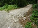 2
2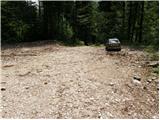 3
3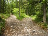 4
4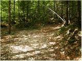 5
5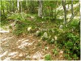 6
6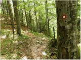 7
7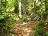 8
8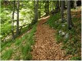 9
9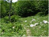 10
10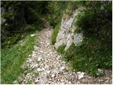 11
11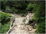 12
12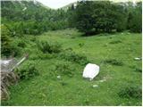 13
13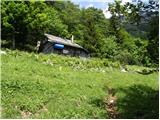 14
14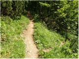 15
15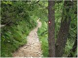 16
16 17
17 18
18 19
19 20
20 21
21 22
22 23
23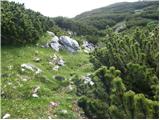 24
24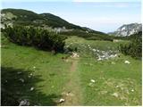 25
25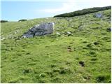 26
26 27
27
Discussion about the trail Markova raven - Kompotela (marked way)
|
| fpetel128. 05. 2011 |
Tam okoli Krvavca moraš kar popaziti na markacije. Sem bil že večkrat na tej poti. Mimo Mokriške jame po brezpotju v lepem vremenu ni težav - tukaj moraš pa kar pazit, da ne prideš s poti.
|
|
|
|
| abes2. 12. 2011 |
Včeraj obiskala Kompotelo, smer pristopa Markova raven, sem zavila desno na lovsko pot proti planini Košutna, pod vrhom sem malo zašla, pa srečno "pregazila" borovce.  Lepa, strma pot, ampak le v suhem vremenu ! Vrnila sem se po markirani poti nazaj v dolino. Razgledi včeraj fantastični, morje megle, ...
|
|
|
|
| atena8527. 12. 2011 |
Cesta po kateri dostopamo do izhodišča je krožna - če gremo v smeri 1. variante (glej zgoraj dostop do izhodišča) je cesta s te smeri nekoliko daljša, a položnejša, razgledna in morda tudi v malenkost boljšem stanju. Če pa ne gremo levo čez most in gremo torej naravnost, varianta 2, je cesta nekoliko bolj strma, a se pride prej.
Sicer je pot zelo lepa, veliko lepša od sosednje na Kriško planino (Krvavec) in manj strma. S planine Koren imamo tudi kar nekaj izhodišč za naprej (Kompotela, Mokrica, vrh Korena, Košutna).
|
|
|
|
| Hribovc9127. 03. 2022 22:54:19 |
27.3.2022 - Cesta (1.varianta) ni ravno v zglednem stanju (2. varianta na bi bila še slabša). Z avtomobili z višjim podvozjem ali manjšimi avti (Clio) še gre, drugače odsvetujem. Veliko padajočega, ostrega kamenja na cesti. Planinska pot od Markovne ravni dalje je sicer zelo lepa. Mogoče je boljše pustiti avto nekoliko nižje in narediti par 100m višincev več.
|
|
|
|
| frover8. 10. 2022 05:55:44 |
Včeraj sva prehodila to pot. Cesta, varianta 2, je lepa, prehodna tudi za nižje avtomobile, varianta 1 pa precej slabša. Pot je zelo lepa, dobro uhojena in lepo označena. Nikoli dvoma z orientacijo. Hvala markacistom Na vrhu pa prelepi razgledi.
|
|
|