Starting point: Mače (600 m)
| Lat/Lon: | 46,3131°N 14,4187°E |
| |
Time of walking: 3 h 15 min
Difficulty: easy marked way
Altitude difference: 1144 m
Altitude difference po putu: 1144 m
Map: Karavanke - osrednji del 1:50.000
Recommended equipment (summer):
Recommended equipment (winter): ice axe, crampons
Views: 25.144
 | 3 people like this post |
Access to the starting point:
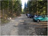
a) From the motorway Ljubljana - Jesenice, take the exit Kranj - East, then continue driving in the direction of Jezersko. When you reach Preddvor, leave the main road and turn left towards the centre of the town, and from there follow the signs for Mače. When you arrive in Mače, continue right at the marked crossroads (left Bašelj, straight ahead St Nicholas Church (the church is not accessible by car)) and follow the narrow road above the village, where there is a large marked parking lot.
b) From the motorway Jesenice - Ljubljana, take the exit Kranj - West and continue left at the first junction. Continue through the underpass under the motorway and then to the roundabout, from where you continue in the direction of Golnik. The road continues through Mlaka pri Kranju, and at the end of the village we turn right in the direction of Srakovlje. We then drive through Srakovlje, Spodnja Bela, Srednja Bela to Zgornja Bela, where we turn right towards Preddvor. At Preddvor we see signs for Mače, which direct us left past the primary school onto the road that climbs up to Maca. When you arrive at Mače, continue right at the marked crossroads (left Bašelj, straight ahead St Nicholas Church (the church is not accessible by car)) and follow the narrow road above the village, where there is a large marked parking lot.
Path description:
From the parking lot, head back to the road you left. Follow this road for about half an hour to the crossroads, where you turn left after the Kališče signs. The path here crosses a stream and climbs steeply immediately afterwards. After a few minutes, the path leads to cart track, which we leave immediately. We take the marked footpath which runs between the two tracks. The path continues to climb moderately in the keys. After a while, the path leads back to the track. Follow it straight up, but only for a few minutes, and then turn onto the track. The track leads us to a bench on a lookout ledge within a few minutes of ascent. The path then leads into the forest and climbs gently at first. This nice walk on a less steep path ends quickly. The path then crosses a track and begins to climb in switchbacks through the forest. We walk along the path ahead, which gives us the feeling that we are gaining altitude quickly. The Gozd then becomes a little thinner so that we can look a little here and there towards Gorenjska. The trail then just leads us to mountain pasture Kališče, where the trail from the neighbouring village (Bašelj, Laško) joins us from the left. From here on we have only 15 minutes to climb back through the forest to the hut at Kišče.
From home, continue along the wide ridge path towards Storžič and Bašeljski vrh. After a few minutes further, the path to Bašeljski vrh branches off to the right. Take this path, which leads you through dwarf pines in a moderate ascent to Bašelj peak. The last metres below the summit are dangerous for slipping in the snow.
Mače - Kališče 2:30, Kališče - Bašelj peak 45 minutes.

Pictures:
 1
1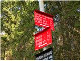 2
2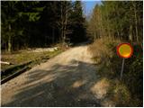 3
3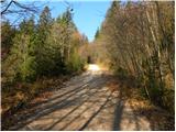 4
4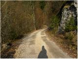 5
5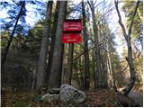 6
6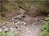 7
7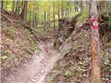 8
8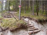 9
9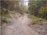 10
10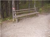 11
11 12
12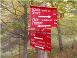 13
13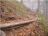 14
14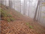 15
15 16
16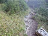 17
17 18
18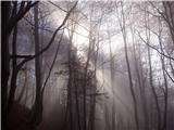 19
19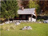 20
20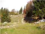 21
21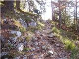 22
22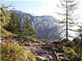 23
23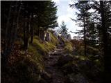 24
24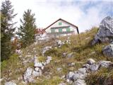 25
25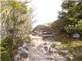 26
26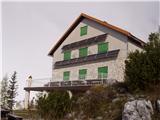 27
27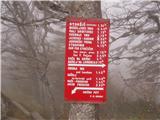 28
28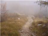 29
29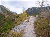 30
30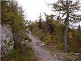 31
31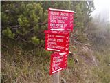 32
32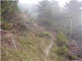 33
33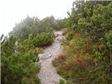 34
34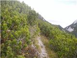 35
35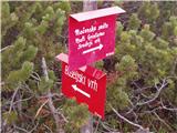 36
36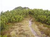 37
37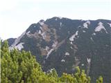 38
38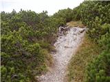 39
39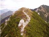 40
40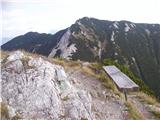 41
41
Discussion about the trail Mače - Bašeljski vrh
|
| ciklama17. 09. 2015 |
Danes sva imela namen osvojiti Storžič, a nama jo je vreme zagodlo. Ko sva v megli in vetru prišla na Kališče, sva morala spremeniti plan. Podala sva se na Bašeljski vrh, Mali Grintovec in se preko Dolge njive vrnila do izhodišča. Nič nisva bila žalostna, ker se nama je Storžič izmuznil, saj bo še priložnost, da ga osvojiva. Je bila pa omenjena pot v danih razmerah prav dobra, sicer malo nenavadna, saj naju je zeblo, hodila sva v kapah in rokavicah, pa še od las nama je kapljalo. Pa kaj hočemo, narava je vedno močnejša od naših želja!
|
|
|
|
| lepenatka27. 05. 2024 18:29:34 |
Po mnogo letih spet po tej poti. Pod Bašeljskim vrhom vse modro od encijana. Na Kališču pa simpatična oskrbnica. 
|
|
|
|
| jprim27. 05. 2024 18:40:20 |
|
|
|
|
| turbo27. 05. 2024 18:44:57 |
|
|
|
|
| jprim27. 05. 2024 18:54:30 |
Uboga ta oskrbnica kakŝne lastnosti ima vse.  :
|
|
|
|
| DVas28. 05. 2024 11:34:10 |
Prav nič uboga, saj so vse pozitivne
|
|
|