Planina Ravne - Caving bivouac on Dleskovška planota (via Zelene trate)
Starting point: Planina Ravne (1500 m)
| Lat/Lon: | 46,3493°N 14,6997°E |
| |
Name of path: via Zelene trate
Time of walking: 2 h
Difficulty: easy pathless terrain
Altitude difference: 410 m
Altitude difference po putu: 525 m
Map: Kamniške in Savinjske Alpe 1:50.000
Recommended equipment (summer):
Recommended equipment (winter): ice axe, crampons
Views: 3.040
 | 2 people like this post |
Access to the starting point:
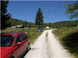
a) First drive to Kamnik, then continue to Stahovica and the Črnivec Pass. A few 100 metres before the Črnivec Pass, leave the main road leading to Gornji Grad and drive sharp left in the direction of the Volovljek Pass (Kranjski Rak). From the above-mentioned pass, continue straight ahead (on the left the road leading to Velika planina, on the right the Štajerski Rak) and start descending towards Luče. Lower down, the road bends slightly and leads to the Podvolovljek valley. In the following, you first pass the road branch leading to the Lučka Bela valley, and then the bar at Gams. After the bar, pay attention, because just a few 100 metres further on, a road branches off to the left, leading to mountain pasture Podveža and mountain pasture Ravne and the Planinšek farm (at the point where you leave the main road, the road marking is approximately 11 km). Continue along the initially still asphalted road, which climbs further towards the Dleskovská plateau. Higher up, the road to Planinšek branches off to the right, and here we continue along the upper left road, which a few 100 metres further on from the turnoff to the Planinšek farm becomes macadam, and this road leads us a little further on to the next crossroads, where we continue straight on in the direction of mountain pasture Ravne (to the left, mountain pasture Podveža). Continue on a slightly less favourable road, then follow to the start of mountain pasture Ravne, where you park at a suitable place on the roadside.
From the main road to mountain pasture Ravne is about 10 km, of which about 4 km are macadam.
b) First drive to Luce, then continue driving towards Kamnik. When you see the road sign by the side of the road indicating 10,5 km, pay attention to the right fork, as just a little further on the road will branch off to the right towards mountain pasture Podveža and Ravne and the Planinšek farm. Continue along the initially still asphalted road, which climbs further towards the Dleskovški plateau. Higher up, the road to Planinšek branches off to the right, and here we continue along the upper left road, which a few 100 metres further on from the turn-off to Planinšek Farm becomes macadam, and this road leads us a little further on to the next crossroads, where we continue straight on in the direction of mountain pasture Ravne (to the left of mountain pasture Podveža). Continue on a slightly less favourable road, then follow to the start of mountain pasture Ravne, where you park in a suitable place on the roadside. From the main road to mountain pasture Ravne is about 10 km, of which about 4 km are macadam.
Path description:
From the starting point, walk via mountain pasture to the shepherd's hut, which you go around on the right by continuing in the direction of Molička mountain pasture and mountain pasture Polšak (the path on the left side of the hut leads across the Dolgo trata). After the hut the path is a bit harder to follow at first, but the markings help us, and a little further on we join the cart track, which branches off the road on the mountain pasture straight at a right-hand bend.
Once on cart track, continue left, initially walking without any significant change in elevation, and then starting a gentle to moderate climb. After a few minutes, you will reach a faint saddle between Dleskovec on the left and Smrekovec on the right. Here a path joins us from the end of the road on the right, and we continue straight ahead over a pasture fence. After the grazing fence there is a short crossing, and then we arrive at the next marked crossroads, where we continue to the left in the direction of Lučka hut, straight mountain pasture Polšak.
The way forward continues in a series of several small valleys, and then leads us to the NOB memorial, next to which there are two benches with a table. From here on, the path climbs slightly steeper, and slightly higher up, the first beautiful views towards Križevnik, Raduha and the surrounding mountains open up. Higher up, we climb moderately for a while through the dwarf pines bands, and then the trail lays down and leads us to Sedelce, where the trail over the Long Lawn joins us from the left.
Continue straight ahead here and for a short distance continue along the marked path towards Korošice and Molička mountain pasture, then continue right in the direction of the marked path to Velika vrh. The way ahead leads along an unmarked valley to the east, then north-east of Velika vrh. When the marked trail to Velika summit turns left towards the slope, we continue straight ahead, and then on the right we see the cave bivouac on the Dleskovški plateau.
The bivouac is seen on the right side some 10 metres lower, and we descend to it by an easier trackless path, along a "path" which leads us between dwarf pines and through the karst world. Although there are quite a few dwarf pines, the passages between dwarf pines are relatively easy, and orientation is not difficult in good weather, as the bivouac can be seen ahead most of the way down. Description and figures refer to the situation in 2016 (August).

Pictures:
 1
1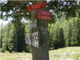 2
2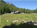 3
3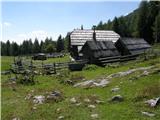 4
4 5
5 6
6 7
7 8
8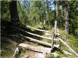 9
9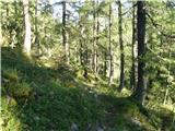 10
10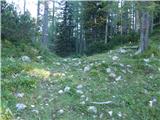 11
11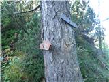 12
12 13
13 14
14 15
15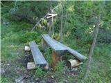 16
16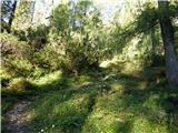 17
17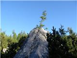 18
18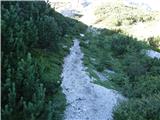 19
19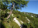 20
20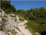 21
21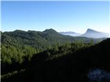 22
22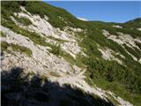 23
23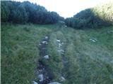 24
24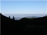 25
25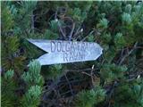 26
26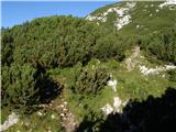 27
27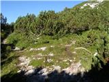 28
28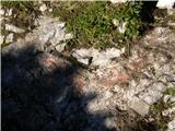 29
29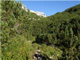 30
30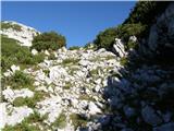 31
31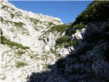 32
32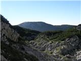 33
33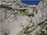 34
34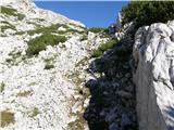 35
35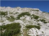 36
36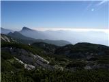 37
37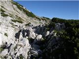 38
38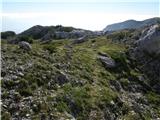 39
39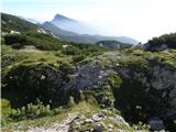 40
40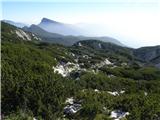 41
41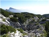 42
42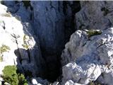 43
43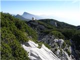 44
44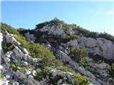 45
45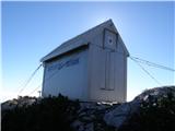 46
46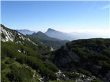 47
47
Discussion about the trail Planina Ravne - Caving bivouac on Dleskovška planota (via Zelene trate)