Brezje nad Kamnikom - Vovar (northern way)
Starting point: Brezje nad Kamnikom (625 m)
| Lat/Lon: | 46,2583°N 14,6226°E |
| |
Name of path: northern way
Time of walking: 1 h
Difficulty: easy unmarked way
Altitude difference: 315 m
Altitude difference po putu: 315 m
Map:
Recommended equipment (summer):
Recommended equipment (winter): ice axe, crampons
Views: 1.250
 | 1 person likes this post |
Access to the starting point:
a) Drive to Kamnik, then continue in the direction of Kamnik Bistrica. At the stadium, leave the main road, which turns left and crosses Kamniško Bistrica, and drive straight on towards Mekinje. Continue past the Mekinje monastery, the Mekinje branch primary school, and then turn right a little after the Zduša settlement towards the Brezje nad Kamnikom settlement. When you reach the settlement, the route described above starts, and you can park in a suitable place on the roadside in front of the settlement or above the settlement; there are no parking spaces in the settlement.
b) Drive to the Volovljek or Črnivec pass and then start descending towards Kamnik. Already in the valley, in the settlement Godič, leave the main road, which turns right over Kamnik Bistrica and continue slightly left. Continue through Godič, and before the end of the settlement turn left towards Brezija, Vodice and Kršič. A little further on, go left at the stop sign and then climb up to Brezje nad Kamnikom, where the route described above begins. You can park in a suitable place on the roadside in front of the settlement or above the settlement, there are no parking spaces in the settlement.
Path description:
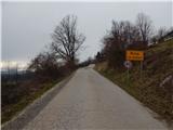
From the beginning of the settlement, cross the asphalt road, which offers beautiful views, and in the middle of the settlement, take a sharp right in the direction of the LO40 cycle path. The path continues past a few houses, and after the settlement the road becomes macadam and turns into a forest. There is a steeper climb through the forest, and at a few small junctions we continue along the wider road. Higher up, the road leads us past a picnic area where two signs stand, and a little further on we reach a place where the western path to Vovar branches off to the right.
Continue along the road and start to climb crosswise up the northern slopes of Vovar, and we follow the road to where it starts to descend.
At the point where the road reaches its highest point, there is a fork to the right, cart track, with signs for Vovar. Continue on cart track, which climbs the north to north-east ridge of Vovar, and higher up, cross some trains, most of which were made after the 2008 windstorm. Higher up, continue on a well-trodden forest track, which you follow all the way to the top, where there are a few benches, a signing-in box with a signing-in book and a stamp, and a bell of wishes.
Description and pictures refer to March 2020.

Pictures:
 1
1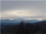 2
2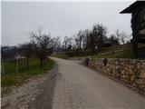 3
3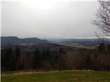 4
4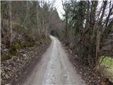 5
5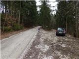 6
6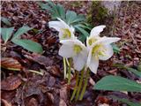 7
7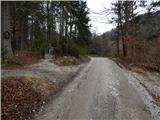 8
8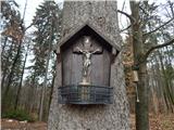 9
9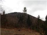 10
10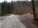 11
11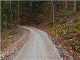 12
12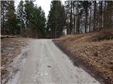 13
13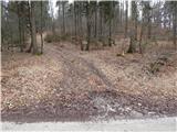 14
14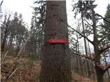 15
15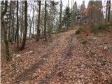 16
16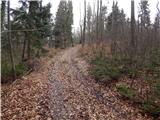 17
17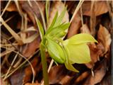 18
18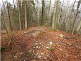 19
19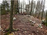 20
20 21
21
Discussion about the trail Brezje nad Kamnikom - Vovar (northern way)