Begunje (Krpin) - Smokuški vrh (on cart track and past sv. Peter)
Starting point: Begunje (Krpin) (585 m)
| Lat/Lon: | 46,3821°N 14,203°E |
| |
Name of path: on cart track and past sv. Peter
Time of walking: 1 h 50 min
Difficulty: easy unmarked way
Altitude difference: 537 m
Altitude difference po putu: 560 m
Map: Karavanke - osrednji del 1:50.000
Recommended equipment (summer):
Recommended equipment (winter): ice axe, crampons
Views: 25.333
 | 2 people like this post |
Access to the starting point:
From the motorway Ljubljana - Jesenice take the exit Radovljica (from the Gorenjska side take the exit Lesce) and follow the road towards Begunj. In Begunje (just after the crossroads where the road to Žirovnica turns off to the left), turn left in the direction of the Krpin Recreation Centre (straight ahead Draga and Tržič). Park in the large parking lot next to the Krpin Recreation Centre.
Path description:
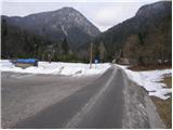
From the parking lot, continue along the asphalted road, which crosses the Blatnica stream via a small bridge and then turns into a macadam road. Follow the road further and it soon leads to a marked crossroads, where you continue along the left-hand road in the direction of St Peter's (to the right St Peter's is a longer path and the Kališča pass). The road, which is getting worse, then quickly leads to the next crossroads, where you continue to the right to cart track (marked). Cart track then starts to climb steeply and leads us higher out of the forest onto the grassy slopes over which we climb in a few minutes to the church from which we get a nice view.
From the church we continue past the eponymous airstrip along the path which soon enters the forest and then continues in a gentle ascent all the way to Sankaška koča.
From the Sankaška hut, continue in the direction of Poljška mountain pasture and Završnica along the path which goes into the forest and climbs steeply for a short time. The steepness then eases and the path leads us after a short descent to two small huts between which stands a wooden cross.
Continue on the marked path, which returns to the forest and gradually starts to climb steeper and steeper. At the hunting lodge, the steepness eases and we continue along the path, which runs along the edge of a broad ridge. Just a little further on, the path turns right, crosses cart track (possibility of continuing on cart track) and a small clearing, and then starts climbing up the rather ruined cart track. Higher up, cart track widens (joining cart track, which we have recently crossed) and leads to a forest road.
Just a few metres before entering the forest road, you will notice an unmarked path on the left-hand side which, after about 10 minutes of further walking, leads to the Smokuč peak.
Starting point - St. Peter 0:50, St. Peter - Sankaška koča 0:10, Sankaška koča - Smokuč vrh 0:50

Pictures:
 1
1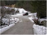 2
2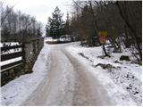 3
3 4
4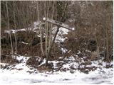 5
5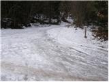 6
6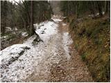 7
7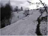 8
8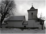 9
9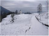 10
10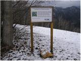 11
11 12
12 13
13 14
14 15
15 16
16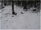 17
17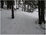 18
18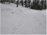 19
19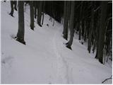 20
20 21
21 22
22 23
23
Discussion about the trail Begunje (Krpin) - Smokuški vrh (on cart track and past sv. Peter)
|
| heinz31. 03. 2009 |
Smokuški vrh je lahek in dokaj hitro dostopen cilj, popolnoma primeren za družinski nedeljski izlet (v lepem vremenu, seveda).
|
|
|
|
| johnybravoslo13. 07. 2012 |
Ja sedaj je gor še všpisna skrinjica in termometer :-)
|
|
|