Dom na Goropekah - Vrh Svetih Treh Kraljev
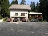
Starting point: Dom na Goropekah (742 m)
| Lat/Lon: | 46,0345°N 14,1256°E |
| |
Time of walking: 1 h 40 min
Difficulty: easy marked way
Altitude difference: 142 m
Altitude difference po putu: 260 m
Map: Škofjeloško in Cerkljansko hribovje 1:50.000
Recommended equipment (summer):
Recommended equipment (winter):
Views: 3.785
 | 1 person likes this post |
Access to the starting point:
From Škofja Loka, drive through Gorenjska vas to Žire. In Žire, the sign for the village Goropeke directs you up to the left (or right if you are coming from Logatec). The road then takes you past the birth house of Leopold Suhadolčan and goes into the forest shortly afterwards. When it comes out of the forest it leads to the village Goropeke, where you continue to the right past the church. The road has another crossroads a little further on, where you continue along the upper left road, which quickly leads you to the parking lot in front of the Goropeki home.
Path description:
From the parking lot, continue along the forest road on the left side of the house. After a few dozen steps, the road leads to a place where a marked trail branches off to the left towards the mountain hut on the top of Sveti Treh kraljev. The initially beautiful dirt path soon leads us to a rather overgrown part of the path (in summer). The marked but sometimes less visible path then leads us to an asphalted road, where we continue to the left. The road then leads us through a small hamlet to a crossroads, where we continue left along the marked path. The dirt road leads us to the next hamlet, where we continue between the houses. Beware of vicious dogs! The path climbs over a meadow and then goes into the wods again. The way ahead soon leads to a dirt road, where we continue to the left. This road then leads us past a goat house to a tarmac road, where we continue up on the left. The road then leads us past a chapel to the next crossroads, where we continue to the right. There is only a short climb past the fire house to the hut at the top of the Hill of the Holy Three Kings.
At the cottage, turn right on the road which, after a short climb, leads out of the forest. It is only a few minutes' walk up the increasingly scenic mountainside. The top of the hill on which the church stands can be reached easily in about ten minutes by a gentle climb from the mountain hut.

Pictures:
 1
1 2
2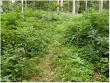 3
3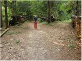 4
4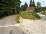 5
5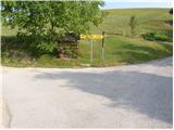 6
6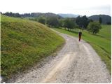 7
7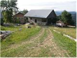 8
8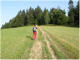 9
9 10
10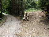 11
11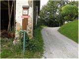 12
12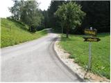 13
13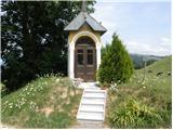 14
14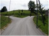 15
15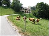 16
16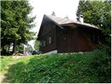 17
17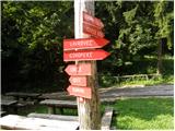 18
18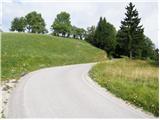 19
19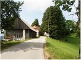 20
20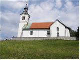 21
21 22
22
Discussion about the trail Dom na Goropekah - Vrh Svetih Treh Kraljev
|
| Isonja10. 08. 2021 11:01:00 |
Ta izlet smo opravili avgusta 2021. Opis večinoma ustreza, pri zaselku, kjer je omenjeno, da lahko srečate hude pse, le-teh ni več, vsaj opazili jih nismo in smo lahko šli nemoteno mimo hiš. Pse sicer imajo pri prejšnjem zaselku, vendar so prijazni, le malo lajajo v pozdrav. Opozarjamo pa na odsek, ki je opisan "Pot naprej se vzpne čez travnik in gre nato ponovno v gozd. Pot naprej nas kmalu pripelje na makadamsko cesto, kjer nadaljujemo levo." Približno na sredi poti skozi gozd se steza odcepi levo s širše poti. Tu je sicer markacija, vendar slabo vidna, zaradi česar lahko skrenete, kakor smo mi. Prišli smo sicer do opisane makadamske ceste, vendar tu ni bilo več markacij. Obrnili smo se levo in ponovno prišli na markirano pot, a opravili nekaj več poti, kot bi jo sicer. Na splošno pa je to lep izlet.
|
|
|