Strma Reber - Firstov rep
Starting point: Strma Reber (993 m)
| Lat/Lon: | 45,5545°N 14,7274°E |
| |
Time of walking: 1 h 5 min
Difficulty: easy marked way
Altitude difference: 9 m
Altitude difference po putu: 135 m
Map:
Recommended equipment (summer):
Recommended equipment (winter): ice axe, crampons
Views: 2.700
 | 2 people like this post |
Access to the starting point:
a) First drive to Ribnica, then continue to Kočevje. After Dolenjja vasja, turn right towards Grčarice, Gotenica and Kočevska Reka. In Kočevska Reka, turn right towards Borovec at Kočevska Reka, Strma Reber Pass and Osilnica. In Borovec, turn right again, then pass the hamlet of Ravne and within a few kilometres you will reach the Strma Reber Pass, which is located at an altitude of 993 m above sea level. From the pass, there is a short descent, and then you arrive at a larger parking area, where you can also see a map of the Kočevje Mountain Route on the left and mountain direction signs for Firstov rep and Cerk. From the junction where you leave the main road Ribnica - Kočevje is about 30 km, a relatively nice asphalt road.
b) From Kočevje drive towards Border crossing Petrina, then at the end of Štalcerji continue right towards Kočevska Reka. In Kočevska Reka turn left towards Borovec at Kočevska Reka, Strma Reber Pass and Osilnica. In Borovec, continue right and then pass the hamlet of Ravne and within a few kilometres you will reach the Strma Reber Pass, which is located at an altitude of 993 m above sea level. From the pass, there is a short descent, and then you arrive at a larger parking area, where you can also see a map of the Kočevje Mountain Route on the left and mountain direction signs for Firstov rep and Cerk. From the junction where you leave the main road Kočevje - Petrina there are about 18 km of asphalt road.
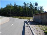
c) From Osilnica or Sel at Osilnica continue in the direction of Žurge, Padova at Osilnica, Zgornji Čačič and the Strma Reber pass. The road continues along a road which is slightly winding at first and then serpentine higher up, and after nineteen marked serpentine roads leads to a crossroads located just 100 m before the Strma Reber Pass. At the crossroads there is a large gravel parking area on both sides of the road, a "house" containing grit (sand for the needs of road maintenance) and a map of the Kočevje Mountain Route. Park in the parking lot. From the centre of Osilnica to the starting point is 8,5 km.
Path description:
From the parking lot, continue east along the road in the direction of Cerka and Firstov tail. The path leads along a forest road, from which after a few minutes a marked path branches off to the right.
Continue on the marked path (it is also possible to continue on the unmarked path, as the marked path returns to the above-mentioned road after a while, and the path along the road is also slightly shorter), which turns into a dense forest. Through the forest, start climbing moderately, following the markings carefully, as the otherwise traceable path is relatively poorly trodden. When the path is slightly higher, you will pass the unmarked peak of Luknja (1079 m) on your left, which can be reached in a few minutes by following the easier trackless path, otherwise continue along the marked trail, which, as written above, passes the peak on your left. There are a few short ascents and descents, followed by a slightly longer descent, which ends when you reach the macadam road.
When you reach the road, continue to the right (on the left, the marked path to Cerk and the road that leads back to the starting point) in the direction of Firstov tail. Follow the road as it climbs gently to moderately, and walk along it to its end or turning point.
On the left-hand side of the turn-off you will see signs for Firstov rep and, for the first time, for Loška stena, directing you to cart track, which gradually starts to descend. After a few minutes, when cart track ends, we see a game salt shed on the left, and we continue straight down the marked footpath, which takes a few steps to reach the registration box on the Firstov's tail.
Description and pictures refer to the situation in 2015 (August).

Pictures:
 1
1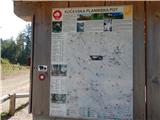 2
2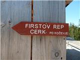 3
3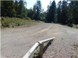 4
4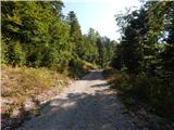 5
5 6
6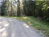 7
7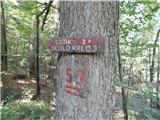 8
8 9
9 10
10 11
11 12
12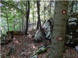 13
13 14
14 15
15 16
16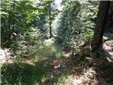 17
17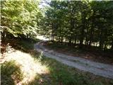 18
18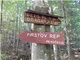 19
19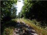 20
20 21
21 22
22 23
23 24
24 25
25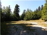 26
26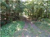 27
27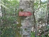 28
28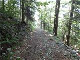 29
29 30
30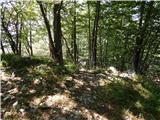 31
31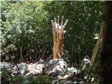 32
32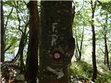 33
33 34
34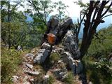 35
35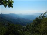 36
36
Discussion about the trail Strma Reber - Firstov rep
|
| grega_p25. 03. 2021 |
Glede na danes prehojeno pot imam nekaj komentarjev:
- po približno 10ih minutah potem, ko se markirana pot odcepi od ceste, so markacije ponekod že precej zbledele. Na enem odcepu od glavnega kolovoza je glede na snežne stopinje tudi mnogo pohodnikov pred mano zgrešilo nadaljevanje v levo, saj se označbo na drevesu že slabo vidi. Pomota traja samo 5min, ko se pot konča, pa vseeno sem tam postavil možica in dal veje na nepravo pot kot orientir.
- ko dosežemo najvišjo točko poti (v bližini Votle luknje 1079m, oziroma preden se pot začne spuščati), se splača zaviti z markirane poti 20 metrov proti desni, kjer se dobro sluti odprt teren. Razgled je fantastičen, redko kje tak v teh nadmorskih višinah. Poleg razgledov na Snežnik, Risnjak, Učko, Snježnik in Bjelolasico, je neverjeten tudi strmo odsekan padec terena v dolino Kolpe.
- ob nadaljevanju poti sem jaz prišel nižje na cesto (nekaj je bilo podrtega drevja, tako da nisem več opazil markacij), in sicer še pred mestom, kjer je razpotje za Cerk. Vseeno je jasno nadaljevanje poti.
- predlagam, da po sliki 29 na velikem ovinku obiščete velike skalne odlome na levi. Tam se tudi začne zelo kratka stezica v hrib, ki po dveh minutah pripelje na še en odličen razglednik - bolj vzhodni pogled, vključno z Loško in Koželjsko steno. Kolpa pod nami je kar 800m nižje!
Kljub nekaj medvedjim stopinjam zelo, zelo priporočam!
|
|
|