Križna jama - Križna gora
Starting point: Križna jama (645 m)
| Lat/Lon: | 45,7456°N 14,4672°E |
| |
Time of walking: 35 min
Difficulty: easy marked way
Altitude difference: 212 m
Altitude difference po putu: 220 m
Map: Snežnik 1:50.000
Recommended equipment (summer):
Recommended equipment (winter): crampons
Views: 7.735
 | 3 people like this post |
Access to the starting point:
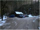
a) From the motorway Ljubljana - Koper take the exit Unec, then follow the road in the direction of Cerknica and further in the direction of Bloška Police. At Bloška Polica, leave the main road towards Nová vas and turn right in the direction of Loš, and follow the road towards the above-mentioned place for only a few 100 metres, after which the signs for Križna jamo direct you right onto a parallel dirt road. The dirt road gradually descends and then leads to a crossroads where we continue straight on towards the Križna jame (to the right Sveta Ana and Žerovnica). From the crossroads, drive for another 300 metres and then reach the parking lot in front of the entrance to the Križna jama.
b) Drive to Velike Lašče or Sodražica and from there continue in the direction of Nová vas na Blokah. From Nová vas, take the main road towards Cerknica, but we only go as far as Bloška Polica, where we turn left at the crossroads in the direction of Loš, and we only go a few 100 metres along the road towards the village, and then the signs for Križna jama direct us to the right onto a parallel dirt road. The dirt road gradually descends and then leads to a crossroads where we continue straight on towards the Križna jame (to the right Sveta Ana and Žerovnica). From the crossroads, drive for another 300 metres and then reach the parking lot in front of the entrance to the Križna jama.
Path description:
At the beginning of the parking lot, you will see a yellow mountain direction sign, which directs you to the right on an initially relatively steep path that begins to climb through the forest. The way forward leads us along a less well-trodden track which climbs crosswise through the forest and, at a higher level, joins the old forest track logging trail. A little higher still, a dirt road is reached at the end, and we start to descend gently, but only for a short time, as the signs for Križna gora then direct us left onto the moderately steep cart track. Climb up the old cart track for a while, then it turns into a path, which after a few minutes of further walking joins the marked path from Bločice.
Here, take a sharp left and continue your ascent along a moderately steep track, which will take you to the top of Križna gora in a few minutes.
The path is well marked at the crossroads, but otherwise mostly unmarked.
Pictures:
 1
1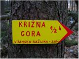 2
2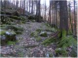 3
3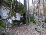 4
4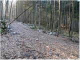 5
5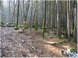 6
6 7
7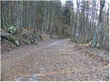 8
8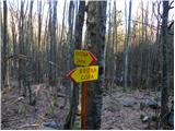 9
9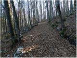 10
10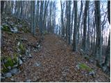 11
11 12
12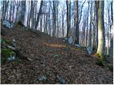 13
13 14
14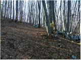 15
15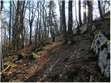 16
16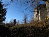 17
17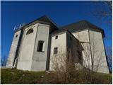 18
18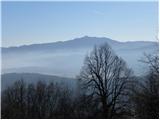 19
19 20
20 21
21
Discussion about the trail Križna jama - Križna gora
|
| demo2313. 04. 2014 |
Lep primer popoldanskega izleta :-) ...bil vceraj iz smeri jame, posledice zledu se vedno mocno vidne tako, da je vmes se malo ovir za premagovanje 
|
|
|
|
| Lisica9. 04. 2017 |
Zraven tega priporočam še ogled Križne jame.  Pot na vrh gore pa je že lepo očiščena in markirana.
|
|
|