Starting point: Podhočar (1090 m)
| Lat/Lon: | 46,1968°N 13,9971°E |
| |
Time of walking: 1 h 20 min
Difficulty: easy pathless terrain
Altitude difference: 424 m
Altitude difference po putu: 424 m
Map: Škofjeloško in Cerkljansko hribovje 1:50.000
Recommended equipment (summer):
Recommended equipment (winter): ice axe, crampons
Views: 2.362
 | 1 person likes this post |
Access to the starting point:
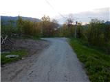
From Podbrdo, Soriška planina or Železniki, drive to Petrovo Brdo, and from there continue south on the road which continues towards the settlement Podporezen and starts to climb. The way ahead leads us along an asphalt road, which leads us higher up to a crossroads, where we continue straight or slightly left (at the crossroads there are only signs for the right road, leading to the farm Pr Robarju and the nearby cross). All the way along the asphalt, but relatively steep road, we then follow it to the Podhočar farm (the last farm), where we park in a suitable place a few metres below the farm.
Path description:
From where you parked, walk to the farm, and there you will see signs on the house for Porezen, which direct you to the right to cart track, which continues behind the house. Continue on cart track (the path to the left across the meadow is closed), which enters the woods and starts to climb moderately. After a few minutes of ascent, cart track starts to turn to the left and leads to an unmarked ridge, where the path turns slightly further to the left to a nearby meadow. When you reach the edge of the meadow, where you can see Blegoš, bear right and the path leads you back into the forest.
In the woods, cart track becomes a pleasant path, which leads gently uphill through an undistinguished valley.
At the part where the valley starts to turn into a steep slope, we join the more beaten track from Petrov Brdo.
The way forward climbs moderately to steeply through the forest and leads us in a few serpentines along the slopes of the lesser-known but scenic peak Hoč (1514 m). It is followed by a crossing in a slight ascent to the right, and then the path leads us out of the forest to a small saddle between the aforementioned Hočem and Pohoškim Kup (Head).
At the saddle, where we leave the marked path towards Porezno, a beautiful view opens up towards Blegoš on the left and the Lower Bohinj Mountains and Triglav on the right.
From the saddle, continue left to the unmarked Hoča ridge, where you quickly enter the forest. Through the forest, stick to the indistinct ridge, and after a few minutes, the rather steep "path" settles on a small level, where you can see a viewpoint on the right, from which you can get a nice view of Porezen. After the part where the slope transitions, the "path" becomes even steeper. Continue to follow the ridge or climb slightly to the left of it. A short, rather steep climb awaits us higher up, then we leave the forest and are only a few steps away from the summit, which we take in the increasingly beautiful views.
Description and pictures refer to the situation in 2015 (May).

Pictures:
 1
1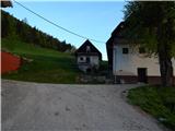 2
2 3
3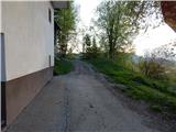 4
4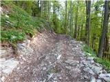 5
5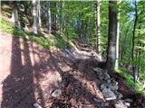 6
6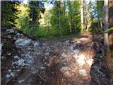 7
7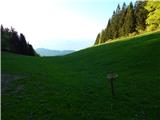 8
8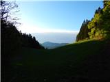 9
9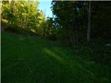 10
10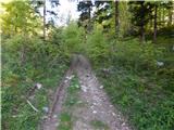 11
11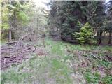 12
12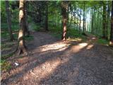 13
13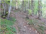 14
14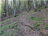 15
15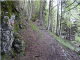 16
16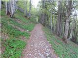 17
17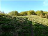 18
18 19
19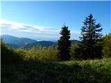 20
20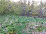 21
21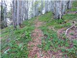 22
22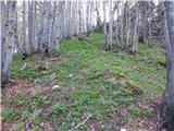 23
23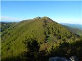 24
24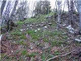 25
25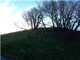 26
26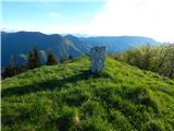 27
27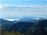 28
28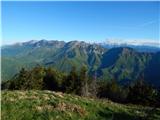 29
29
Discussion about the trail Podhočar - Hoč