Torka - Altemaver (Ratitovec)
Starting point: Torka (1160 m)
| Lat/Lon: | 46,2309°N 14,0807°E |
| |
Time of walking: 1 h 35 min
Difficulty: easy marked way
Altitude difference: 518 m
Altitude difference po putu: 530 m
Map: Škofjeloško in Cerkljansko hribovje 1:50.000
Recommended equipment (summer):
Recommended equipment (winter): ice axe, crampons
Views: 44.474
 | 3 people like this post |
Access to the starting point:
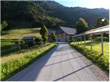
First we drive to Škofja Loka, then we continue to Železniki and on to Podbrdo. Shortly (about 2 to 3 km) after Zali Log, you will notice signs for the villages Ravne and Torka, which direct you to the right on the ascending road. A steep and narrow road leads us higher up to Ravne, where at the crossroads we continue on the right road, which we then follow to the hamlet or farm Torka, which is the starting point for our tour. As there are no suitable parking places at the starting point, it is best to turn right at the farm and follow the forest road for another 100 m and then park at a suitable place along the road.
Path description:
From the farm, continue along the right-hand road, which crosses the slopes in a slight ascent to the right. The road then passes into the forest, where it leads past a small spring and the lower station of the cargo cableway leading to Ratitovec to a place where a mountain direction sign for Ratitovec directs us to the left to the ascending cart track (if you continue along the road, you will arrive at the Po(v)den saddle). After a short climb, a marked trail from the village Prtovč (the trail via Po(v)den) joins us from the right, and we continue to the left and follow cart track for a few more minutes.
When cart track ends, we continue on the well-trodden mountain path, which gradually starts to climb steeper and steeper. The path, which initially passes through a forest, soon leads to uncultivated slopes, where it climbs even steeper. The steep and increasingly scenic path, which passes over steep slopes that are dangerous in winter for slipping and avalanches, suddenly bends higher up and turns left, where it leads us to the grazing areas of Ratitovec. From here it is about 5 minutes of easy walking and the path, which offers beautiful views of Porezen and the surrounding peaks, leads us to the Krekova hut on Ratitovec.
From the hut, continue along the marked path in the direction of Soriška mountain pasture. The path first descends gently to the winter bivouac, where we join the path from the right side with mountain pasture Pečana, and we continue straight to the watering point for animals, where the path stops descending. The way ahead starts to climb steeply along the pasture fence and after a few minutes of climbing leads us to the eastern headland of Altemaver. There is a short descent and then the marked path turns slightly to the right. Exactly at the point where the marked trail leading to Soriška planina turns slightly to the right, we leave it and continue our ascent along a clearly visible trail towards the summit of Altemaver, which continues along the ridge of Ratitovec. Follow this scenic route to the highest peak of Ratitovec, which is reached after a further 10 steps.

Pictures:
 1
1 2
2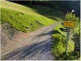 3
3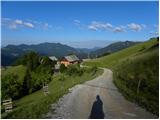 4
4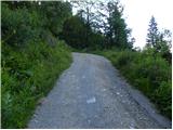 5
5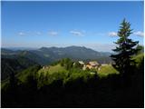 6
6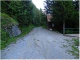 7
7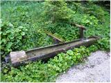 8
8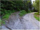 9
9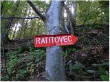 10
10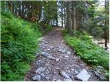 11
11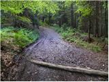 12
12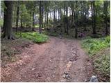 13
13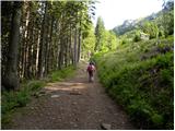 14
14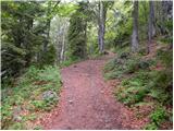 15
15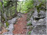 16
16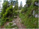 17
17 18
18 19
19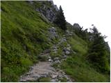 20
20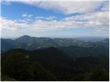 21
21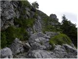 22
22 23
23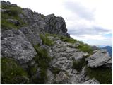 24
24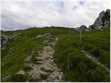 25
25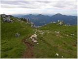 26
26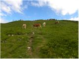 27
27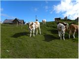 28
28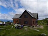 29
29 30
30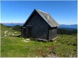 31
31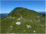 32
32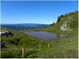 33
33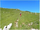 34
34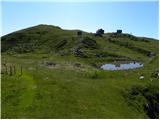 35
35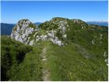 36
36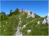 37
37 38
38 39
39
Discussion about the trail Torka - Altemaver (Ratitovec)
|
| trdi10. 09. 2012 |
Z avtom se lahko zapeljemo še par sto metrov višje do sedla Povden in potem imamo do koče eno uro hoda.
|
|
|
|
| Daaam10. 09. 2012 |
...Še sreča da ni do koče cesta  @trdi: a je hudo par minut več peš it...?
|
|
|
|
| GregorC10. 09. 2012 |
Sam res. Še tega se manjka, da bo še na Povdnu polno pleha 
|
|
|
|
| zanesenjak11. 09. 2012 |
Ja, ampak cesta iz Zalega Loga do Povdna je grooozno dolga. Se bolj splača it iz Prtovča.
|
|
|
|
| Daaam12. 09. 2012 |
Sj ni problem če na Torki parkiraš, samo nesmisel je da bi še rinil naprej z avtomobilom po gozdni cesti...
|
|
|
|
| MiaB.17. 03. 2021 |
Katera je najboljsa pot, ce prihajam s Primorske za na Ratitovec in Krekovo koco? Hvala. 
|
|
|
|
| padez17. 03. 2021 |
Odvisno iz katerega kraja si. Primorska sega od Dragonje do Vrsica...
Ce si z Vipavskega, Krasa ali Obale potem imas avtocesto, ki je najbolj primeren dostop do Skofje Loke in naprej po regionalki do izhodisca. Iz Gorice pa do Podbrda in cez Petrovo Brdo do izhodisca.
|
|
|
|
| MiaB.17. 03. 2021 |
Najlepsa hvala...Ja, bi mogla bit bolj natancna..  Prihajam z Goriskega konca. Po Petrovem Brdu sledim kateremu kraju? Torka ali Zgornje Danje?
|
|
|
|
| GregorC18. 03. 2021 |
Na Petrovem brdu pojdi v smeri Sorice in Soriške planine. Potem pa glej table za Zgornje Danje (dejansko pa rečemo Dajne Torka pa je potem še nekaj km naprej od Dajn. Lahko naredite krožno. Iz Zg. Dajn po opisani poti do koče, potem pa sestop po poti čez Poden do Torke in po cesti skozi zaselek Zabrdo nazaj do Zg. Dajn.
|
|
|
|
| MiaB.18. 03. 2021 |
Super, hvala GregorC
|
|
|