Sotina - Sotinski breg (Kugla) (via the source of mineral water)
Starting point: Sotina (258 m)
| Lat/Lon: | 46,83445°N 16,04097°E |
| |
Name of path: via the source of mineral water
Time of walking: 50 min
Difficulty: easy marked way
Altitude difference: 160 m
Altitude difference po putu: 195 m
Map: Pomurje 1:40.000
Recommended equipment (summer):
Recommended equipment (winter):
Views: 4.230
 | 1 person likes this post |
Access to the starting point:
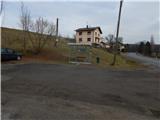
a) Drive to Gederovci (to get here from Radenci or Murska Sobota) and continue driving in the direction of Kuzma. When you arrive in Sotina, pay attention, because the route described above starts at the bus stop, next to which you can see the mountain direction signs. Park in a suitable place nearby.
b) Drive to Kuzma (reachable from Grad, Mačkovci or Petrovci), then continue to Sotina and Austria. When Kuzma ends, there is some climbing and then descending, where you turn left at the junction with the priority road. You will quickly reach Sotina, where you will pass a cemetery, and then about 300 m further on you will arrive at a bus stop with mountain direction signs. Park in a suitable place nearby.
Path description:
From the bus stop, continue along the side road, which climbs gently to the north-west, and at a small crossroads go straight ahead. Before the road crosses a small stream, leave it and continue slightly right on a footpath that continues across a meadow. Go around the nearby field on your left, then cross a small bridge to the left (right bank) of the stream. Walk along the stream, occasionally a few metres above the stream, crossing steeper slopes. A fairly steep path then leads quickly to an interesting peat spring.
From the spring, we continue along a marked path which leads us through an interesting avenue, ending with a marked crossroads.
From the crossroads, go left in the route Sotinski breg (right Činčev breg) and continue ascending along the cart track, which leads us higher out of the forest, where we pass through the yard of a nearby farmhouse (a dog has been let down several times). On the other side of the farmhouse, we continue along the marked trail which continues along the state border with neighbouring Austria, and when we reach a nearby house, where we can see a peak on the right, we go left downhill. The road descends a little, and then the signs direct us to the right, where we pass through an orchard and arrive in lane of bushes and lower forest. The short descent ends in a small meadow, where the road is seen on the left, and we go right up a waymarked path which returns to the forest. A few minutes higher up, we reach an asphalt road and follow it to the right, where we reach an interesting ski fence with increasingly beautiful views.
Go left here and, after 2 minutes of further walking, you will reach a lookout tower on the highest peak of Prekmurje.
Description and pictures refer to the situation in February 2021.

Pictures:
 1
1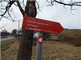 2
2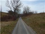 3
3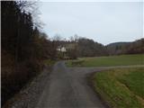 4
4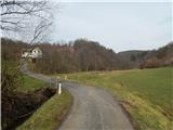 5
5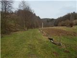 6
6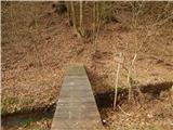 7
7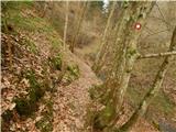 8
8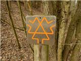 9
9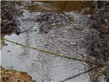 10
10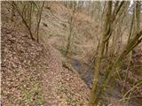 11
11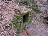 12
12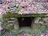 13
13 14
14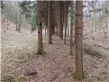 15
15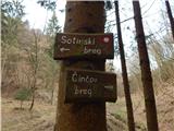 16
16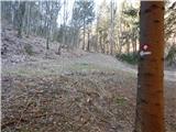 17
17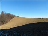 18
18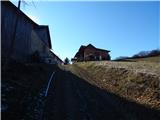 19
19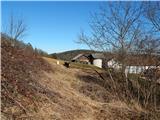 20
20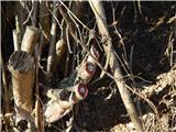 21
21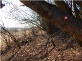 22
22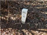 23
23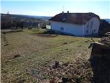 24
24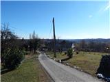 25
25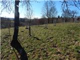 26
26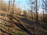 27
27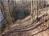 28
28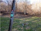 29
29 30
30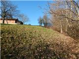 31
31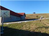 32
32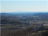 33
33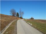 34
34 35
35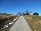 36
36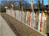 37
37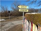 38
38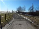 39
39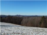 40
40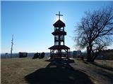 41
41 42
42
Discussion about the trail Sotina - Sotinski breg (Kugla) (via the source of mineral water)
|
| Nastasja24. 10. 2021 21:53:42 |
Danes sem se sprehodila po tej poti. Je sicer simpatična, ampak malo nesrečno speljana preko privatnih zemljišč, vsaj tako zgleda. Pri domačiji, ki je tudi na sliki, imajo spuščenega psa, ki je pritekel do mene in na ves glas lajal. Naokoli niti žive duše, ki bi ga obvladala in priklenila. Ista zgodba pri sadovnjaku - še en spuščen pes ... Z izjemo lepih razgledov na vrhu in lepega dne ravno zato ni bil ravno prijeten izlet. 
|
|
|
|
| Slavek12. 02. 2022 13:26:06 |
Prosim če to lastniki domačij ob cesti uredijo in zaprejo pse oz jih dajo na verigo, kot je to treba... Hvala
|
|
|
|
| georgia30. 12. 2022 14:07:43 |
Konec decembra sva bila prvič na najvišjem vrhu Prekmurja. Želela sva narediti krožno pot, zato sva šla iz Sotine po tej gor, dol pa po cesti in po vasi nazaj do avtobusne postaje, kjer sva parkirala. Omenjenih psov nisva srečala. Sem bila skeptična zaradi komentarjev, ali res po tej poti, saj sva s sabo imela psa. Prijetna, razgibana in razgledna pot, ki je odlično markirana. Se je pa treba malo pomatrat do vrha. 
|
|
|