Trdkova - Tromejnik / Dreiländerecke / Harmashatar (on marked path through the forest)
Starting point: Trdkova (288 m)
| Lat/Lon: | 46,85746°N 16,0861°E |
| |
Name of path: on marked path through the forest
Time of walking: 20 min
Difficulty: easy marked way
Altitude difference: 102 m
Altitude difference po putu: 102 m
Map: Pomurje 1:40.000
Recommended equipment (summer):
Recommended equipment (winter):
Views: 508
 | 1 person likes this post |
Access to the starting point:
a) We take the road Gorenji Petrovci - Kuzma, and we follow the road towards Kuzma to the beginning of the village Martinje (Martinje Trdkova on the signs). Here, only a few 10 m before the beginning of the village, we see the signs for Tromejnik, which direct us to the right, on the road which quickly leads to the village Trdkova. The road then climbs moderately and leads us to a crossroads, at which we see the signs for Tromejnik to the left and to the right. Take the road to the left, which starts to descend steeply. The road descends and after a further 100 m leads to the next crossroads, where we continue to the right (direction Tromejnik). We continue along a gently sloping dirt road, which we follow until we reach a marked parking area by the information signs for Tromejnik.
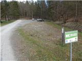
b) Take the road to Kuzma, then follow the road towards Petrovce. Shortly after Kuzma, you will see signs for Trdkova, which will direct you left onto a side road. In Matjaševci go twice right and before the beginning of Trdkova go left in the direction of Tromejnik. After a short drive on a dirt road, you will come to a large dirt parking area, where you park.
Path description:
Before the start of the parking lot, by the hunting observatory, there is a marked path to the left in the direction of arrival, which bypasses the pond on the left and enters the woods through which you begin to climb. Initially, follow the marked cart track, which soon branches off to the right onto the Ježek trail. Continue straight ahead and soon rejoin the Ježkova cesta, which has another branch to the right a little further on. Go straight ahead here too and then there is a cross-climb to the right, where after a few minutes you continue sharp left in the direction of the markings (straight ahead Ježkova pot). A few 10 steps further you reach a worse road - a cycle path, which you follow to the right. There is a short steep climb along the Slovenian-Austrian border to reach the top of Tromejnik.
Description and pictures refer to the situation in April 2021.
Pictures:
 1
1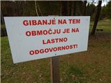 2
2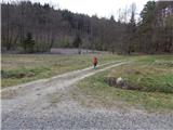 3
3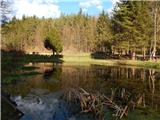 4
4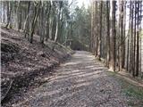 5
5 6
6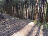 7
7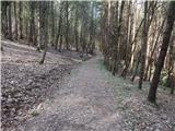 8
8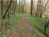 9
9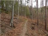 10
10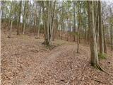 11
11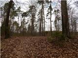 12
12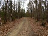 13
13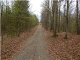 14
14 15
15
Discussion about the trail Trdkova - Tromejnik / Dreiländerecke / Harmashatar (on marked path through the forest)