Trebež (Jesenice) - Javornik waterfalls (by road)
Starting point: Trebež (Jesenice) (590 m)
| Lat/Lon: | 46,4319°N 14,0941°E |
| |
Name of path: by road
Time of walking: 30 min
Difficulty: partly demanding unmarked way
Altitude difference: 100 m
Altitude difference po putu: 100 m
Map: Karavanke - osrednji del 1 : 50.000
Recommended equipment (summer): ice axe
Recommended equipment (winter): ice axe, crampons
Views: 7.594
 | 4 people like this post |
Access to the starting point:
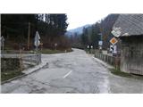
From the motorway Ljubljana - Jesenice take the exit Lipce, where you turn right towards Jesenice. At the first traffic lights (Slovenski Javornik), turn right (direction Lj. ) towards Koroška Bela. At the next traffic-light junction turn left, and soon turn left again towards Javorníške Rovto. After driving for less than a kilometre, you will arrive in the village of Trebež (unmarked), which you can identify by the sharp left turn where there is a bridge over the Javornik stream. Park in a suitable place nearby (you can also park in the same settlement about 100 metres further along the main road).
Path description:
From the bridge at the bend, take the side road leading to Javorniški rovt and walk along it for a while; first past the houses and the business building, and then past the dam and a few more houses. When you come around the left bend where the settlement ends (signposted), you will see a small power station on your right. Here the road starts to climb. When you come around a slightly bigger left bend, you see a wooden house on the right, where you turn right off the road onto a less well-trodden path that leads across a grassy area. After crossing a small bridge near the road, turn right and look up onto a grassy slope with a shortcut to Javorniški Rovt leading uphill along a pipeline. Here, immediately turn even more to the right, first along the stream, across partly overgrown terrain towards the bed of the Javornik stream, from where, especially after rains, you can hear the roar of waterfalls. After a slight descent, you will come close to the riverbed, where you can carefully approach the lower waterfall at a suitable place, or at a point where you can observe two waterfalls: the lower and the middle one. Due to the humidity of the ravine, there is a risk of slipping into the stream bed! Once you have enjoyed the views, return to the surface and, a little higher up the stream, find a place where you can approach the middle waterfall. Then return to the grassy slope where the shortcut passes and climb a few metres uphill. At the end of the wooden scarp, which prevents the ground from sliding, you come to a barely visible path, which eventually leads you to the upper fan-shaped waterfall, which some consider the most beautiful.

Pictures:
 1
1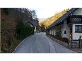 2
2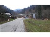 3
3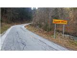 4
4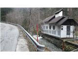 5
5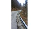 6
6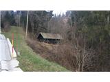 7
7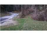 8
8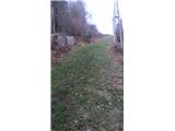 9
9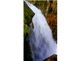 10
10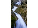 11
11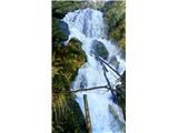 12
12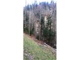 13
13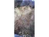 14
14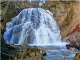 15
15
Discussion about the trail Trebež (Jesenice) - Javornik waterfalls (by road)
|
| Zemlja8. 10. 2019 |
Danes sem si šla pogledat slapove in lahko rečem, da je pot do spodnjih dveh popolnoma neprehodna, razen če sem pot zgrešila 4x. Trenutno je tudi zgornji slap z veliko manj vode, je pa vsaj lepo dostopen. 
|
|
|
|
| heinz17. 10. 2019 |
Pri spodnjih slapovih žal ni poti, zato se je potrebno malce potruditi, da se po svoje prebijemo v bližino struge. Previdno seveda. Slapove je najlepše obiskati ob primerno visokem vodostaju, npr v dneh po malo obilnejšem deževju. Srečno!
|
|
|
|
| Jusk10. 02. 2022 18:21:54 |
Pri sliki 8 je zdaj info tabla in urejena stezica do zgornjega slapa. Lp
|
|
|