Bohinjska Bela (Podklanec) - Galetovec (western way)
Starting point: Bohinjska Bela (Podklanec) (550 m)
| Lat/Lon: | 46,333°N 14,0584°E |
| |
Name of path: western way
Time of walking: 2 h
Difficulty: easy marked way
Altitude difference: 715 m
Altitude difference po putu: 715 m
Map: TNP 1:50.000
Recommended equipment (summer):
Recommended equipment (winter):
Views: 39.752
 | 2 people like this post |
Access to the starting point:
From the motorway Ljubljana - Jesenice take the exit Lesce and follow the road towards Bled and on to Bohinjska Bistrica. 1km after Bled, you will reach a crossroads where you turn right towards Bohinjska Bela. Continue through the village to the railway station, near which the road to Galetovec branches off to the right. Follow this road to the crossroads, where you will see mountain signs and a small parking lot next to them.
Path description:
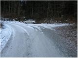
From the parking lot, continue along the road on the left in the direction of Galetovec. Shortly after a long right turn, a poorly marked cart track turns off to the left. Continue the ascent along cart track, which climbs quite steeply in places. The path then crosses a worse forest road, and then rejoins the road we left. Follow the road to the left, which soon leads to a right-hand bend, in the middle of which the ascent continues on foot. The path crosses the forest road a few more times, then leads us over the pasture fence to mountain pasture for the Cave.
From mountain pasture continue straight on the path into the forest. A little further on, the poorly marked path turns right and climbs up a small ravine, after which it emerges onto a road. Walking along the road, however, takes only a short time, as the path leads us to the right to two cottages. Between the two cottages you will see a faded signboard with the inscription Galetovec. The path continues in a moderate ascent through the lane of a forest and leads us to the following houses. The path that continues to climb the uncultivated slopes leads us slightly higher to the crossroads of the path.
Continue right in the direction of Galetovec along the path, which after a few minutes goes into the forest. It takes about five minutes to walk through the forest to the top of Galetovec, from which we get a beautiful view.

Pictures:
 1
1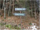 2
2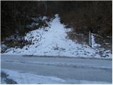 3
3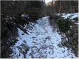 4
4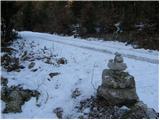 5
5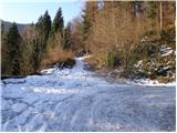 6
6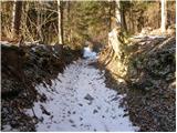 7
7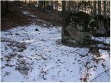 8
8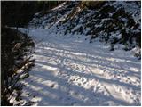 9
9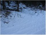 10
10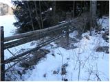 11
11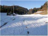 12
12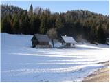 13
13 14
14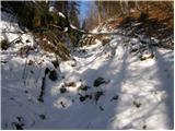 15
15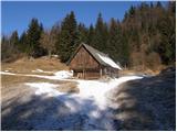 16
16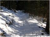 17
17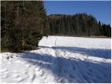 18
18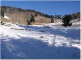 19
19 20
20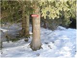 21
21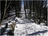 22
22 23
23
Discussion about the trail Bohinjska Bela (Podklanec) - Galetovec (western way)
|
| grega_p14. 03. 2010 |
S kolegico sva se podala na Galetovec z odcepa ceste do Belske planine in naprej, vendar sva malce po svoje delala gaz (šla preveč desno) in pristala skoraj nazaj ob cesti vendar kilometer nižje. Na vrh sva sicer prišla,vendar si ne želim, da bi kdo stopal za nama in bentil - raje naj nadaljuje na koncu Belske planine naravnost do markirane poti pri Turnu..
|
|
|
|
| Anathema2. 07. 2011 |
Očitno sem ne zahaja dosti ljudi. Na sončno sobotno dopoldne s kolegicami nismo srečale žive duše (rezen krav :P)Vzpon ni preveč naporen, razgled pa je res prečudovit. Toplo priporočam.
|
|
|
|
| atoamac18. 02. 2013 |
Včeraj je 16 parov nog naredilo kar spodobno gaz v vrhnjih 20 cm pršiča na kar nekaj trde podlage. Od gostilne v Boh. Beli do vrha. 
|
|
|
|
| Stane71. 01. 2015 |
Je kdo hodil po tej poti v zadnjem času ? Koliko je kaj snega ?
|
|
|
|
| fonko28. 11. 2015 |
Danes bil na Galetovcu. Snega je bilo na poti približno 25 cm. Na vrhu vpisna skrinjica, žig in božanski razgled.
|
|
|
|
| zlatica14. 03. 2017 |
Majda, spet ena lepa pohodna zgodba. 
|
|
|
|
| Majdag14. 03. 2017 |
...Zlatica v tem času, ko ne veš kam bi šel, je kar dobra izbira..
|
|
|
|
| Darxta9. 10. 2017 |
Včeraj bil na Galetovcu. Lep izlet, odlični razgledi.
Pot je sicer dobro markirana, manjka pa markacija na enem razpotju. Med slikama 6 in 8, ko pri desnem ovinku nadaljuješ levo po kolovozu, je po cca 200m majhen odcep v levo (desno nadaljevanje po kolovozu). Tu je potrebno zaviti levo, desno se namreč vrnete na cesto (po kateri pa pridete nazaj na markirano pot).
|
|
|
|
| alenansk19. 01. 2019 |
Je kdo hodil po tej poti danes ? Koliko je kaj snega ?
|
|
|