Pišnica - Špik (via Koča v Krnici)
Starting point: Pišnica (850 m)
| Lat/Lon: | 46,4688°N 13,7833°E |
| |
Name of path: via Koča v Krnici
Time of walking: 5 h 30 min
Difficulty: very difficult marked way
Altitude difference: 1622 m
Altitude difference po putu: 1750 m
Map: TNP 1:50.000
Recommended equipment (summer): helmet
Recommended equipment (winter): helmet, ice axe, crampons
Views: 34.708
 | 3 people like this post |
Access to the starting point:
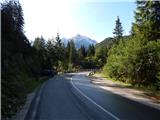
First, drive to Kranjska Gora, then continue in the direction of Bovec. Just past the Jasna guesthouse, you will come to a bridge over the Pišnica River, next to which you park in a small parking lot. You can also park a few 10 m back in the larger parking lot by the TNP sign or near the former Hotel Erika.
Path description:
Just before the bridge over the Velika Pišnica river, a macadam road branches off to the left, leading into the valley Cirque. Take the above-mentioned road, which first leads along the edge of the river and then into the lane of a forest, where it gradually begins to climb. The road quickly leaves the forest and continues to lead us along the ever narrower Velika Pišnica. After a while, the relatively winding path is joined by the path from the 3rd serpentine of the Ruska or vršiška road, and we continue straight in the direction of Cirque along the steeper and steeper road, which slowly turns into a forest. We then follow this relatively steep road in the last part all the way to Koča v Krnici, which is reached after a few minutes of further walking.
From the hut, head left in the direction of Špik (straight Kriška stena), where after a few minutes you will reach a torrential ravine, along which you will then climb. After a good hour's walk from Koča v Krnici, the marked trail crosses the ravine and then climbs to the left of it for some time. At a higher altitude the path turns to the left and begins to climb cross-slope, partly covered with dwarf pines. With fine views of the surrounding peaks, you reach the upper part of Tarman's Gully (a slope descending steeply towards Cirque), where the path climbs steeply, then turns to the right and passes to the north side of Gams' Spit (1931 m). Only a little further on, we reach an unmarked saddle, where the path turns to the left and after a short climb leads us to the more difficult part of the route, where we use the fixed safety gear to climb towards the summit of Liprtica (aka Lipnica).
Continue descending a few metres and cross the steep slopes below the summit of Špika using fixed safety gear. Just a little further on, the path through Kačji graben (possibility of descending into the valley) joins us from the left.
From the crossroads onwards, there is one last very steep climb ahead of us, where we climb up a considerable slope on broken rocks (this part is not guarded and is exposed to falling rocks - helmet required!). After about 15 minutes of climbing on the broken rocks, we reach the top of Špik, from where a really nice view opens up.

Pictures:
 1
1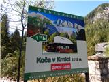 2
2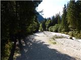 3
3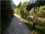 4
4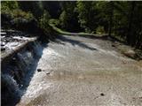 5
5 6
6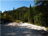 7
7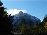 8
8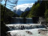 9
9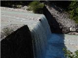 10
10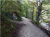 11
11 12
12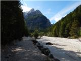 13
13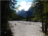 14
14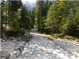 15
15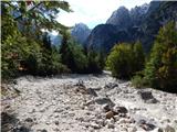 16
16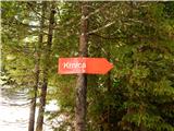 17
17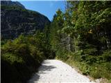 18
18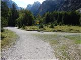 19
19 20
20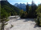 21
21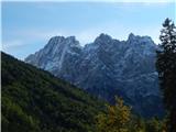 22
22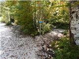 23
23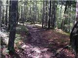 24
24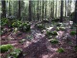 25
25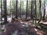 26
26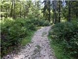 27
27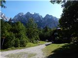 28
28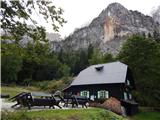 29
29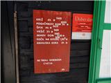 30
30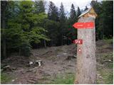 31
31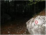 32
32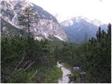 33
33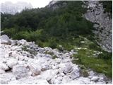 34
34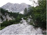 35
35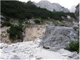 36
36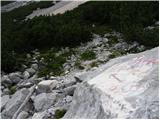 37
37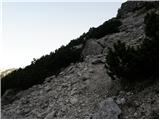 38
38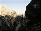 39
39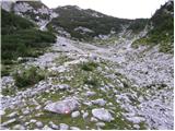 40
40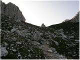 41
41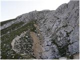 42
42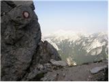 43
43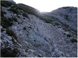 44
44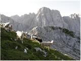 45
45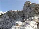 46
46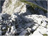 47
47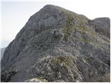 48
48 49
49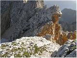 50
50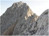 51
51 52
52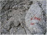 53
53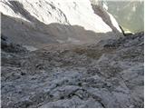 54
54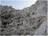 55
55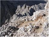 56
56 57
57
Discussion about the trail Pišnica - Špik (via Koča v Krnici)
|
| maks5711. 04. 2019 |
Iskal sem kakršnekoli podatke o Lipnici, pa jih ne najdem. Čudno!
|
|
|
|
| Janez Seliškar12. 04. 2019 |
Vzpon na Špik od Koče v Krnici gre preko Lipnice, torej je v tistih objavah vse napisano.
|
|
|
|
| malihodec7. 07. 2021 23:16:11 |
Ali je bil v tem mesecu kdo na Špiku? Ali je še sneg, kje in koliko ter potrebna oprema???Hvala za info!!
|
|
|