Starting point: Podhom (590 m)
| Lat/Lon: | 46,3903°N 14,085°E |
| |
Time of walking: 40 min
Difficulty: easy unmarked way
Altitude difference: 244 m
Altitude difference po putu: 244 m
Map: TNP 1 : 50.000
Recommended equipment (summer):
Recommended equipment (winter): ice axe, crampons
Views: 5.524
 | 2 people like this post |
Access to the starting point:
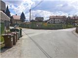
a) From the motorway Ljubljana - Jesenice take the exit Lipce (Jesenice East), where you turn left (direction Blejska Dobrava and Spodnje Gorje). After 100 m of driving, immediately after passing through the railway underpass, you will come to the next junction, where you turn right in the direction of Gorje, Bled (left Blejska Dobrava). After a steeper climb, pass through the village of Kočna and continue towards Spodnje Gorje, where shortly after crossing the river Radovna on a bridge and the road climbs slightly, you will come across a left fork of the road with signs "Zasip, Vintgar, Podhom". Turn left here and after a few 10 m at the crossroads turn left again, in the direction of "Vintgar". Soon we are back at the crossroads, where we do not continue downhill towards Vintgar, but only slightly right or straight uphill to the parking lot (signposted at the roadside at the crossroads). The road on the right leads into the village. Park in the parking lot next to the playground.
b) From Bled, head towards Pokljuka and Spodnje Gorje. In Spodnje Gorje follow the signs Jesenice, Vintgar. At the crossroads a few metres further from the Fortuna Inn, turn right in the direction "Zasip, Vintgar, Podhom". After a few 10 m, turn left at the crossroads in the direction "Vintgar". Soon we are back at the crossroads, where we do not continue downhill towards Vintgar, but only slightly right or straight ahead into the parking area (signposted at the roadside at the crossroads). The road on the right leads into the village. Park in the parking lot next to the playground.
Path description:
From the parking lot, continue across the pasture towards Hom Hill, which you can see ahead. The path turns slightly right in the middle of the pasture and soon starts to climb. Shortly, when the path turns sharp right, leave it and follow logging trail straight uphill towards the forest (to the right of St Katarina na Hom). Logging trail turns left at an uphill and starts to climb quite steeply through the forest, but after a few detours the steepness finally eases. Shortly afterwards, the path turns left and continues increasingly up the western slope of the hill. Here you follow the sloping and rutted logging trail, and overlook a wall off to the right. As the path climbs moderately higher, it narrows to a track below the top of the hill, and at this point the right-hand logging trail branch is again overlooked. The path along the slope, which turns slightly to the right through a predominantly deciduous forest, soon leads to a wooden cross and boxes with a register and a stamp at the top of the 834 m high Homa.

Pictures:
 1
1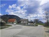 2
2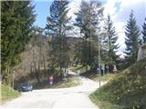 3
3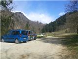 4
4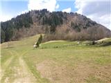 5
5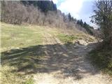 6
6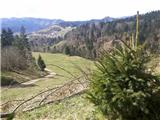 7
7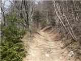 8
8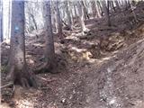 9
9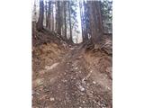 10
10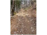 11
11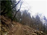 12
12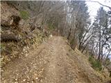 13
13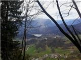 14
14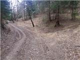 15
15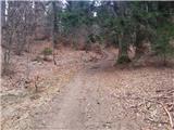 16
16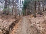 17
17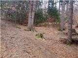 18
18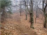 19
19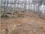 20
20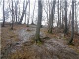 21
21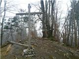 22
22
Discussion about the trail Podhom - Hom pri Bledu
|
| Jusk13. 08. 2020 |
Lepa pot,štart iz Bl.Dobrave na Katarino,okoli Homa,potem pa po tej poti gor. Res je na začetku fajn strmo,sploh te dni v vročini.. pot okoli Homa polna turistov,ta pot pa čisto osamljena..nazaj proti Katarini po označeni poti in proti Bl.Dobravi. en tak na hitro pohod po šihtu  glede na vreme,so se kuhale nevihte,na srečo nič ni bilo
|
|
|
|
| Majdag14. 08. 2020 |
Slika 4 - parkirišča tu ni več..
|
|
|
|
| Jusk15. 08. 2020 |
Ne vem a je ali ni,ampak je bilo parkiranih kar nekaj avtov na tej lokaciji,na sliki 4 na ovinku sigurno ne,na 5ki pa ja
|
|
|
|
| Jusk15. 09. 2020 |
Spet po tej poti iz Bl.Dobrave,mimo Katarine okoli Homa,potem pa na to pot.. po poti vse v vredu,sem šel do vrha in nazaj po isti poti,pa nazaj na Dobravo po Strmi. Čez Strmo pot pa fajn mir,ni več toliko turistov kot poleti
|
|
|