Starting point: Zadnjica (650 m)
| Lat/Lon: | 46,3824°N 13,7604°E |
| |
Time of walking: 8 h 45 min
Difficulty: very difficult marked way
Altitude difference: 2090 m
Altitude difference po putu: 2440 m
Map: Triglav 1:25.000
Recommended equipment (summer): helmet, self belay set, ice axe, crampons
Recommended equipment (winter): helmet, self belay set
Views: 36.062
 | 2 people like this post |
Access to the starting point:
From Kranjska Gora, drive over the Vršič pass towards Bovec or vice versa, but only as far as the 50th serpentine of the Vršiška or Ruska road (near the village of Trenta). Here you turn onto a side road, and then park for a few 100 metres in a roadside parking lot.
Path description:
From the parking lot, continue along the road, which takes you past a few houses (mainly on weekends) and leads you in about 15 minutes to a place where the road splits into two parts (there used to be a parking lot at the crossroads, but now parking is forbidden).
From the old parking lot, take the road to the left in the direction of Pogačnikov dom na Kriških podih (the road to the right leads to Prehodavci and Dolič). After 15 minutes of further walking, the road leads to the bottom station of the cargo cableway, where it ends.
The ascent continues along a marked footpath (mulatjeri) which climbs moderately through the forest. The path climbs above the valley of the White Stream and quickly leads to very steep slopes (risk of falling rocks), over which a very wide footpath leads. The path then crosses the Veliki Presek ravine, after which you reach a short exposed ledge, which you cross with the help of a rope. The path then returns to the forest, where it climbs moderately in a number of switchbacks. A little further on, the path leads us under a small overhang, where we can see a number of sticks that hikers put up to keep the rock from rolling down into the valley (the sticks are put up more as a joke than for real). The path then crosses a couple of small ravines, and then leads us past a chapel to a larger ravine. With a little care (easy) we cross the aforementioned ravine, after which we climb up to a pleasant resting place (two benches along the way) within a few minutes of further walking. Next, cross another larger ravine (in early summer, the possibility of snowfields), and then the path returns to the forest. Higher up, the forest becomes thinner and the path steeper and more scenic.
The path, which continues to climb along an old mulatier, then passes two more benches and leads to lane of dwarf pines, after which we pass into a rockier world. We continue to climb over small scree fields, along an increasingly scenic path, which leads us higher up to a pleasant little spring.
Only a few 10 steps above the spring, we will come to an unmarked crossroads, where an unmarked path branches off to the right towards Spodnje Kriško jezero (2 minutes), and we continue slightly to the left along a further wide mountain path. The path ahead leads us past small ruins, and we follow it all the way to a marked crossroads where the path from the Vrata valley joins us from the right. Continue to the left and after two minutes of further walking you will reach Pogačnik's home at Kriški podi. From Pogačnikova's home continue in the direction of Razor and Križa along the path, which descends slightly and leads us in a few steps to the next crossroads, where we go right (left Razor). Next, we climb up the initially gently sloping, then slightly steeper path, which leads us across the karst world of the Kriški podov. Slightly higher up, a path branches off to the right (or straight ahead), leading to Zgornje Kriško jezero, and we continue straight ahead (or left) on a path that crosses the steep slopes of Kriški rob higher up. When the path reaches the ridge at the end of the Kriški rob crossing, we catch sight of the 2382 m high Šplevta (the mountain in the shape of an Indian). Next, the path climbs steeply over the broken rocks (danger of slipping) and leads us higher up to the Bovška vratica (Bovška vratica).
Here we continue straight down (right Križ for 10 minutes) on a well-trodden path which, after a short descent, leads us to Vrh Kriške stene (2289 m), from where the climbing route from the valley Cirque joins us from the left. Continue in the direction of Škrlatica and the Vrata valley, following the path that leads us further along the area of high-lying plateau. The relatively winding route then soon splits into two parts, and we continue on the left in the direction of Škrlatica. The path then crosses the slopes of Gubno (2403 m) and later the hard-to-reach Dovško Gamsovec (2440 m). After about 30 minutes of easy walking, the path starts to climb steeply again. This time our goal is the approximately 2500 m high Rdeča škrbina, which we can already see clearly in front of us, and we climb up to it on a moderately steep scree slope.
At Rdeča škrbina, where there is a marked crossroads, we continue straight on (right Dolkova špica for 15 minutes) along a path which bypasses the rock rib with the help of a rope, and then leads us into a steep gully on the eastern side of the aforementioned notch. The way forward begins to descend steeply on a less well-beaten path, which is dangerous for slipping due to the considerable steepness and rubble on the path. After a few minutes of steep descent, the path turns to a scree slope, which then descends in a few minutes to Zadnji Dolek, where it joins the path from Vrat.
In Zadnji Dolk, continue left and follow the steep scree slope for 20 minutes, then follow the signs to the right to the west or south-west wall of Škrlatica. The path, which further takes on the character of a climbing route, leads us, with the help of fixed safety gear, to what is probably the most challenging part of the route. Next, with the help of a number of crampons and a rope, we cross smooth and precipitous belly rock, and then the route passes into broken rock, where it then climbs very steeply. Well-guarded and always dangerous for slipping, the path then leads past the window in Škrlatica to the main ridge, where the path is laid. The ascent continues on a slightly less steep path, which leads us further along and along a very scenic ridge. This path, which offers beautiful views of the nearby Rokavi, is then followed all the way to the top of the 2740 m high Škrlatica, which is reached after a few minutes of further walking.

We can extend the trip to the following destinations: Škrlatica
Pictures:
 1
1 2
2 3
3 4
4 5
5 6
6 7
7 8
8 9
9 10
10 11
11 12
12 13
13 14
14 15
15 16
16 17
17 18
18 19
19 20
20 21
21 22
22 23
23 24
24 25
25 26
26 27
27 28
28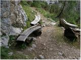 29
29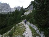 30
30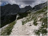 31
31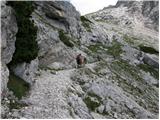 32
32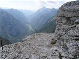 33
33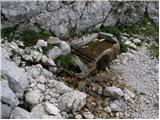 34
34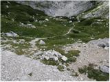 35
35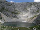 36
36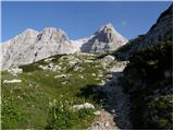 37
37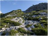 38
38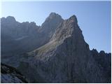 39
39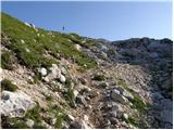 40
40 41
41 42
42 43
43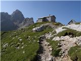 44
44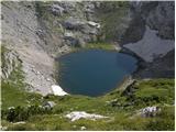 45
45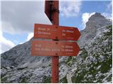 46
46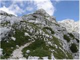 47
47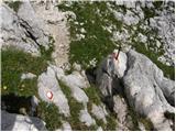 48
48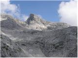 49
49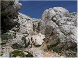 50
50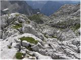 51
51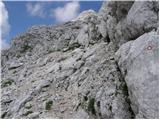 52
52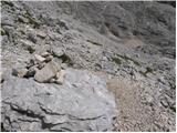 53
53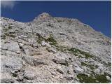 54
54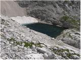 55
55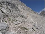 56
56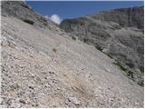 57
57 58
58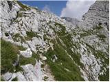 59
59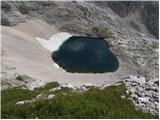 60
60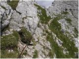 61
61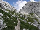 62
62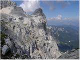 63
63 64
64 65
65 66
66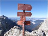 67
67 68
68 69
69 70
70 71
71 72
72 73
73 74
74 75
75 76
76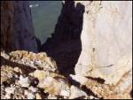 77
77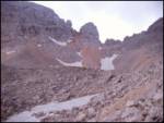 78
78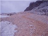 79
79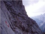 80
80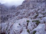 81
81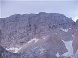 82
82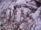 83
83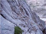 84
84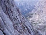 85
85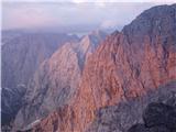 86
86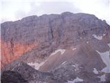 87
87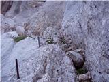 88
88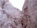 89
89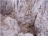 90
90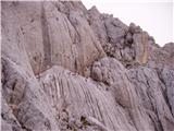 91
91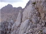 92
92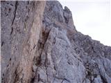 93
93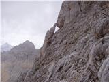 94
94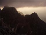 95
95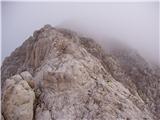 96
96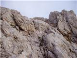 97
97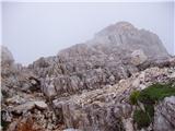 98
98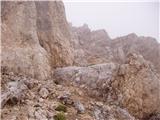 99
99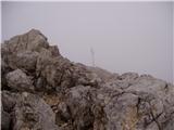 100
100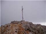 101
101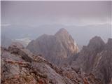 102
102
Discussion about the trail Zadnjica - Škrlatica
|
| anika11. 08. 2010 |
super slike in opis.. moja naslednja tura (:
|
|
|
|
| stanko119. 09. 2010 |
Zanima me, če je kdo zadnje dni bil na Škrlatici in kakšne so razmere. Zanima me še katera pot je boljša iz smeri Kriških podov (leva ali mimo bivaka-desna).
L.p.
Bily
|
|
|
|
| prepolc809. 09. 2010 |
Jaz bi ti predlagal zgornjo, ne izgubiš nobene višine, pa še Dovkovo špico lahko obiščeš(no če spadaš med bolj drzne, si lahko od blizu ogledaš še Rogljico). Kakih težav na poti pa ni, mogoče je malo zoprn edino spust iz Rdeče škrbine.
|
|
|
|
| jozo10. 09. 2010 |
Vsekakor zgornja trditev ne drži  . Sam sem nedavno prehodil to pot. Če greš od Pogačnikovega doma se v vsakem primeru najprej povzpneš do razpotja na višino slabih 2400, nato sledi skoraj 170 m spusta do razpotja, kjer se pot levo odcepi proti Rdeči škrbini, kjer se pot ponovno žačne vzpenjati do višine 2500 m. Na vrhu pa ponovni spust na 2300 m in nato naprej proti Škrlatici. V megli bi ti to pot odsvetoval, saj je tudi markacij bore malo. Lp J 
|
|
|
|
| prepolc8010. 09. 2010 |
Če se pa spustiš do bivaka na rušju, prideš pa na višino 1980mnm. Markacij pa je res mogoče malo manj, je pa pot dokaj jasna in tudi možici te usmerjajo.
|
|
|
|
| viharnik10. 09. 2010 |
Po novem je višna na bivaku IV Na Rušju zrasla na 1991m(PZS karta).
|
|
|
|
| rmitja3. 10. 2011 |
V primeru da koga zanima, kako višinsko zgleda pot iz Kriških podov preko Rdeče škrbine na Škrlatico in potem spust v Vrata si lahko ogleda graf in slike na povezavi Škrlatica
|
|
|
|
| novinsekp4. 10. 2011 |
rmitja: Zelo lepo dokumentirano in čudovite slike! In seveda čestitke ob zaključku SPP. 
|
|
|
|
| dogna4. 10. 2011 |
Mitja, tako lepo dokumentirane poti še nisem videla. Tudi posnetki so enkratni, seveda, saj sta imela čudovito vrme.Čudovito, čudovito.
|
|
|
|
| urbancek4. 10. 2011 |
Teh Šplevt je v naših gorah kar veliko, a če je bila pri opisu mišljena Šplevta ob Pihavcu, tista pomoje ne preseže 2300m... Če pa je bila mišljena kakšna druga pa se opravičujem in bo verjetno držalo 2382, kot napisano...  Sicer pa fajn...
|
|
|
|
| rmitja7. 11. 2011 |
Hvala (za pohvale in čestitke). Na žalost sem opazil, da je povezava pri prejšnji objavi "umrla" zato je tukaj nova Škrlatica
|
|
|
|
| sasgittariusvz5. 07. 2017 |
U obratnom smjeru vjerujem da je bolje ako bi se išlo prvo na Škrlaticu a spavalo u Pogačnikovom domu? Koliko cca treba od vrha Škrlatice do doma?
|
|
|
|
| Boblak35. 07. 2017 |
Z vrh Škrlatice do Pogačnikovega doma je cca 4h
|
|
|
|
| darinka45. 07. 2017 |
Lani sem naredila dvodnevno turo. Dolina Vrat- Sovatna, prespala na Križkih podih. Zjutraj na Škrlatico. Sestop v dolino Vrat.Lepa tura , sploh s Križkih podov na Škrlatico. Kondicijsko je treba biti dobro pripravljen.
|
|
|
|
| orchidlily31. 08. 2017 |
Prije tjedan dana napravila sam turu Zadnjica - Kriški podi - Škrlatica (prek Dolkove špice) - Bivak IV na Rušju - Kriški podi. Tura je jako lijepa, ali zahtijeva dobru kondicijsku spremu jer je visinska razlika u hodu cca. 2880m. https://www.youtube.com/watch?v=WO-0iUpSeSc
|
|
|