Gozd Martuljek - Rutarski Vršič
Starting point: Gozd Martuljek (750 m)
| Lat/Lon: | 46,4821°N 13,8378°E |
| |
Time of walking: 3 h
Difficulty: difficult marked way, easy unmarked way
Altitude difference: 949 m
Altitude difference po putu: 975 m
Map: Kranjska Gora 1:30.000
Recommended equipment (summer): helmet
Recommended equipment (winter): helmet, self belay set, ice axe, crampons
Views: 20.194
 | 3 people like this post |
Access to the starting point:
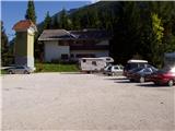
From Mojstrana drive to Kranjska Gora or vice versa, but only as far as the village of Gozd-Martuljek, where you park in the parking lot near the bridge over the Sava Dolinka river (the parking lot is located behind the bridge, or in front if you are coming from Kranjska Gora).
Path description:
From the parking lot, continue along the main road towards Kranjska Gora, but only to the point where the cycle path branches off to the left (there are also mountain signs at the start of the cycle path, which also direct you to the road). Follow the cycle path to the first crossroads, where you continue straight onto the dirt road (the cycle path turns right), which quickly leads you to the next crossroads.
Continue to the right and follow the road closed to traffic until you reach the TNP signpost. Further on, the path splits into two parts. Continue straight up the steep cart track, which climbs up the right-hand side of the Martuljška gorge. The cart track, which climbs mostly through the forest, leads us after 15 minutes to a beautiful viewpoint where a view of the valley opens up. The path then goes back into the forest and continues to climb. A little further on, the path from the waterfall joins us from the left, and a little further on, the path to the bivouac under Špikom branches off to the right. We continue in the direction of Ingot's hut. The way forward leads us to a crossroads, where we continue straight on, the path to the left leads to Ingot's hut to which is a two-minute walk.
The way forward is initially a steep climb but only for a while. The path then crosses a small well and climbs steeply on the other side. The steepness begins to give way to the path leads us to a crossroads, where we continue slightly right in the direction of the bivouac Za Akom (left Zgornji waterfall 10 minutes). The way forward is still some time steeply climbs, and then the path leads us to a more difficult part. First we cross a steep grassy slope with the help of a rope, and then, still using the fixed safety gear, we cross an exposed shelf (watch your head, slightly overhanging rock above us). The path continues to be guarded (the fixed safety gear is there mainly because of the wet terrain), and then it starts to climb more steeply, and after a few minutes of further walking, it leads us to the most difficult part. With the help of artificial steps and a rope, we cross a smooth and damp rock slab, and then cross a short, very steep wall, which is also well guarded (great care is needed because of the damp slope). The steepness of the slopes then eases and after a short climb, the still damp path leads us to the edge of the mighty gravels. At the point where the marking directs us to the left down to the gravel, we continue to the right along the path, which after a few steps climbs steeply. This steep and dangerous path in wet conditions leads us in less than five minutes to the Za Akom bivouac (if the last part of the path is to steep for us, we can continue along the gravel and climb up to the bivouac from the other, less steep side. Both routes are not marked in the last part). From the bivouac return to the beginning or end of the gravel, and here continue along the left gravel (viewed from bottom to top) along which you can see the PP markings on a larger rock (route Planica - Pokljuka). Continue climbing along the edge of the gravel for another 10 steps and then you will notice a small cairn on the left side, which directs you to the path along which you will continue your climb (the way ahead is not marked). The path, which continues for some time along the edge of the torrent, initially offers some views of the northern walls of the Martulj Mountains (the most prominent is the mighty Široka peč wall), but then the path turns slightly to the left and gradually begins to climb more steeply through the dense forest. Further on, we follow an occasionally barely visible path (helped by individual smaller cairns), which turns increasingly to the left. The trail widens higher up (join the hunting trail) and after about an hour's walk from the extensive gravel, leads to a small saddle where we continue to the left (straight down the valley of the White Stream, to the right a viewpoint on the walls of the Martulj Mountains - 20 minutes). The trail continues to climb moderately along the ridge Rutarski Vršič and after 5 minutes of further walking leads us to the summit (the registration box is located completely on the north part of the summit).

Pictures:
 1
1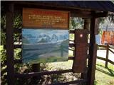 2
2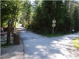 3
3 4
4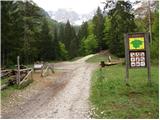 5
5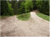 6
6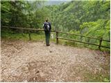 7
7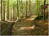 8
8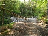 9
9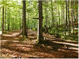 10
10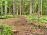 11
11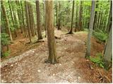 12
12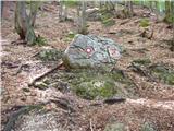 13
13 14
14 15
15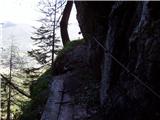 16
16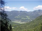 17
17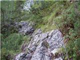 18
18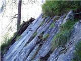 19
19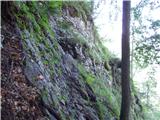 20
20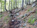 21
21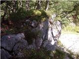 22
22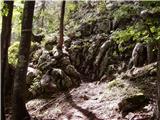 23
23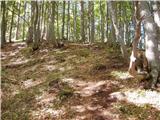 24
24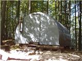 25
25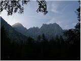 26
26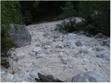 27
27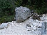 28
28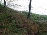 29
29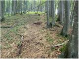 30
30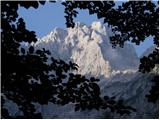 31
31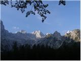 32
32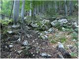 33
33 34
34 35
35 36
36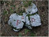 37
37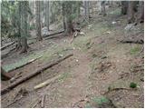 38
38 39
39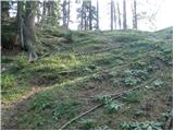 40
40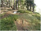 41
41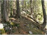 42
42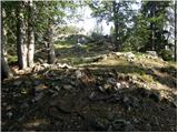 43
43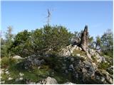 44
44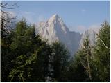 45
45 46
46 47
47
Discussion about the trail Gozd Martuljek - Rutarski Vršič
|
| ljubitelj gora2. 06. 2013 |
Slika 23 sicer se tud tle gor pride do bivaka, ampak je mal bolj strmo, drugače pa se stopi na hodournik, melišče, ko se nam odpre pogled na Martuljške gore, še minuto hoje po tem desnem melišču se na desni strani možici in rahlo vidna steza. Vzpon na Rutarski Vršič, možici so sedaj redki, možno da jih bo kdo postavil, pot se včasih mal zgubi, ampak je še kar komaj sledljivo.
|
|
|
|
| navdušena15. 09. 2017 |
Hvala za opis. A kdo ve, v kakšnem stanju so zdaj varovala? In seveda: ali je v skrinjici (ali zraven) tudi žig??
|
|
|
|
| franca15. 09. 2017 |
Hodila sem tam sredi junija. Varovala do Za Aka urejena, "pot" naprej proti Vršiču pa teže sledljiva kot pred leti (podrto in zaraščeno), dokler ne prideš do dobro uhojene lovske poti, tam se pojavijo tudi možici.
|
|
|
|
| Batistuta16. 08. 2020 |
To pot sem danes prehodil v smeri navzdol. Pot ni vrisana na zemljevidu PZ, tako da sem jo naključno opazil na Rutarskem Vršiču (gor sem prišel po drugi strani), na točki med obema vrhovoma. Pot je normalno sledljiva, v zadnjem delu je tudi vedno več možicev. Tudi za vstop v strugo so postavljeni možici in tudi za izstop. Do bivaka nisem prišel, sploh ni potrebno, strugo prečiš niđje. Ko prečiš strugo se začne 'plezalni' del, ki pa je dobro varovan in ni tehnično zahteven. Zadnji del opisa te poti, je zelo slab in zavajajoč: ''...pripelje na manjše sedelce, kjer nadaljujemo levo (naravnost navzdol dolina Belega potoka, desno razgledna točka...). Pot naravnost iz sedelca ne obstaja, če izberemo pot levo pridemo na enega od dveh vrhov Rutarskega Vršiča, če po tej poti nadaljujemo naprej se spustimo v dolino Belega potoka. Čena sedelcu izberemo desno pot, pridemo na drugi vrh Rutarskega Vršiča, ki je lepši, saj ima razgled na Široko peč in Kukovo špico. Od tu dalje ni nobene poti. Rutarski Vršič ima tako dva vrhova, ne vem, kateri je višji. Ne na enem ne na drugem nisem našel vpisne skrinjice, čeprav sem večkrat pregledal vse. Očitno jo je snedel svizec??? 
|
|
|
|
| lynx17. 08. 2020 |
Pot dol s sedla je, ni pa prav lepa ali dobro uhojena. Je res bolje iti drugje.
|
|
|
|
| mjk18. 08. 2021 14:09:11 |
Vpisana knjiga je še lansko leto bila
|
|
|
|
| ljubitelj gora4. 10. 2021 09:49:48 |
Prehodil 3.10.2021, je kar nekaj podrtega drevja od slike št.33 dalje, nazaj se vračal po brezpotnem gozdu
|
|
|