Kočna - Planina Obranica (via Baba)
Starting point: Kočna (660 m)
Name of path: via Baba
Time of walking: 1 h 15 min
Difficulty: easy marked way
Altitude difference: 375 m
Altitude difference po putu: 375 m
Map: TNP 1:50.000
Recommended equipment (summer):
Recommended equipment (winter): ice axe, crampons
Views: 10.381
 | 3 people like this post |
Access to the starting point:
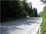
From the Ljubljana - Jesenice motorway, take the Lipce exit and turn left towards "Blejska Dobrava and Spodnje Gorje". Soon after entering the railway underpass, we are at the next crossroads, where we turn right - Bled, Kočna. The road, serpentine at first, climbs straight westwards and soon reaches the summit or settlement of Kočna in a left turn. Our starting point is 100 m before the local signboard, but because of the unbroken line we pass the first houses, where we see a bus stop on the right. Here we turn around and go all the way back to the turn or town - a few metres before we would have descended back down into the valley. Park on the gravel road.
Path description:
From where you parked, first cross the road carefully and walk 20 m back towards the valley on the opposite side. Here you will see a green sign with the inscription "hiking trail 6", where you continue into the forest in the route indicated by this sign. Turn right here, where you will soon come across the first sign pointing left uphill to an undistinguished ridge. Here the path climbs more steeply, and after a few minutes it turns even more to the left and south, and then lies down. For a short time the path gradually descends, then turns right up the bank and then left over the rocks. From here on it leads first briefly out of the forest, then back into the predominantly deciduous forest, where it climbs moderately to steeply.
After a good 20-minute walk from the starting point, you will come across a small signpost along the way, which reads 'Baba 5 min', where you can turn right and see the famous 'Poljanska Baba'.
The path to mountain pasture continues straight ahead or left up the bank. Soon you will come across a large number of fallen trees, which obstruct the path, then it turns right and after the left turn you will reach a ridge where there is a "Grandfather"-(rocky balcony), which you can climb. The path continues to the right, in a westerly direction, steeper and steeper uphill. A few small bends follow, after which the path starts to lead us again more and more to the left towards the south. When the steepness starts to ease, we are somehow at the top of the plateau. Here the winding path drops a little at times and climbs back up, and sometimes seemingly disappears, all the time more or less following the eastern edge of the plateau. As we approach our destination, but still in the forest, we descend a little, coming across a wooden barrier with a gate. When you emerge from the forest, you are at mountain pasture Obranica. To the left is a monument, and to the SE beyond it is the summit of mountain pasture with a cross on the trunk of a tree (you can't see it from here), where you go for a view. From here, descend back - west, slightly uphill, across the meadow to the back of mountain pasture with the shepherd's hut. This is reached in a further 5 minutes' walk.

Pictures:
 1
1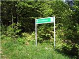 2
2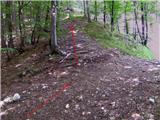 3
3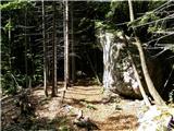 4
4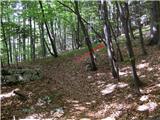 5
5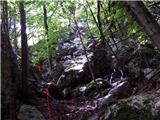 6
6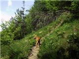 7
7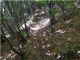 8
8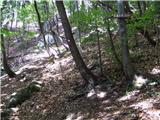 9
9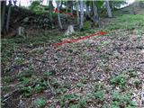 10
10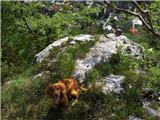 11
11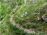 12
12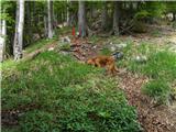 13
13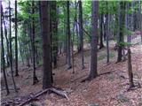 14
14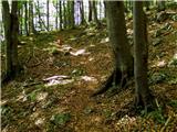 15
15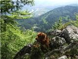 16
16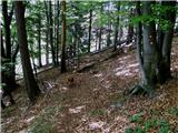 17
17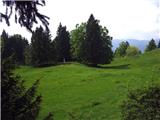 18
18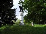 19
19 20
20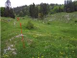 21
21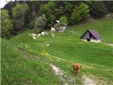 22
22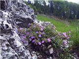 23
23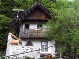 24
24 25
25 26
26 27
27 28
28
Discussion about the trail Kočna - Planina Obranica (via Baba)
|
| Jusk12. 11. 2019 |
Tudi dobra pot za ohranjanje kondicije,je občasno strma,ampak se da gor pa nazaj priti v 1uri in nekaj minut,sploh če greš pozno popoldne ko te lovi mrak. Sicer previdno,že v soboto ko sem šel gor je bilo zelo spolzko,pot polna mokrega listja,pod tem pa veje in korenine dreves.
|
|
|
|
| heinz4. 12. 2019 |
.. zaradi česar se ne splača tako hitet, razen če treniraš gorski tek
|
|
|
|
| Jusk4. 12. 2019 |
Ne ravno gorski tek,sem pa navajen hitro hodit  lp
|
|
|
|
| Jusk10. 02. 2020 |
Od Obrance dol proti Kočni pot brez posebnosti,razen mokra in spolzka,je pa kar nekaj na novo podrtega drevja od zadnjega vetroloma,ampak ne predstavlja ovire ker je ob poti
|
|
|
|
| anica.zu19. 07. 2020 |
Ali mi lahko kdo pove, zakaj ne morem odpret zemljevida poti (zgoraj), niti za to pot in niti za nobeno drugo. Včasih se je to dalo.
|
|
|
|
| Jusk19. 07. 2020 |
Tudi meni noče zemljevida odpret,ampak če se že odpravljaš na to pot,je dobro markirana. Na odcepu proti Babi je tabla ki te usmeri tja,na Obranco greš pa naprej po markirani poti. Lp
|
|
|
|
| anica.zu27. 07. 2020 |
Saj se nisem zgubila, na začetku so prav simpatični možici, naprej pa markacije. Ker pa imam že starejše specialke, me moti, ker novejše markirane poti tam še niso bile vrisane. Zato bi mi zelo prav prišlo, če bi lahko odpirala zemljevide poti. Ne vem, kam naj se obrnem za nasvet oz. pomoč.
|
|
|
|
| biba29. 07. 2020 |
Tudi meni redkokdaj odpre te zemljevide. Ne na računalniku ne na telefonu. Mogoče kdo ve zakaj?
|
|
|
|
| Majdag29. 07. 2020 |
Hvala Tadej, tudi meni se niso odpirali..
|
|
|
|
| anica.zu1. 08. 2020 |
Tadej, stokrat hvala. Na tem naslovu zdaj lahko vidim vse planinske poti. Vesela sem, da ste pomagali ne le meni, ampak, verjamem, tudi mnogim drugim.
|
|
|
|
| Majdag27. 07. 2022 19:42:48 |
Po dolgem času zopet na planini. Delala sem krožno, je bolj pestro. Potka je dobro označena z velikimi možici. Tudi nova pot z glavne ceste je označena s smerokazi, v gmajni pa z možici. Baba še vedno čaka svojega princa, je pa klopca in info tabla zraven. Vedno bolj je strmo in rožic ni več. Koča ima novo streho, se ujema z zeleno okolico. Oskrbnika sta prijazna in uživata na planini. Lepa je Obranca. https://jelenkamenmajdag.blogspot.com/2022/07/planina-obranca.html
|
|
|
|
| diana.jug25. 05. 2025 08:27:55 |
Po dolgem času na planini, tokrat po tej poti le sestop, vzpon pa po tisti od spomenika gor (fletno strmi).  Planina vsakič znova očara, tokrat z intenzivno zeleno barvo pomladi, drevesa so kar žarela, prav tako travniki, mnogo cvetlic... Energija gor posebna, umirjena, človek si res spočije glavo, dušo in srce. 🩷🫶💫🌼🍀
|
|
|