Stara Fužina - Planina Krstenica
Starting point: Stara Fužina (600 m)
| Lat/Lon: | 46,2903°N 13,8868°E |
| |
Time of walking: 3 h 15 min
Difficulty: easy marked way
Altitude difference: 1070 m
Altitude difference po putu: 1100 m
Map: Triglav 1:25.000
Recommended equipment (summer):
Recommended equipment (winter): ice axe, crampons
Views: 22.384
 | 2 people like this post |
Access to the starting point:
From the Ljubljana - Jesenice motorway, take the Lesce exit and follow the road towards Bled and on to Bohinjska Bistrica. Continue towards Bohinjsko jezero (Ribčev laz), at which you will come to a crossroads where you will turn right towards Stara Fužina. At Stara Fužina, at the crossroads by the chapel, turn sharp left onto the ascending road towards mountain pasture Blato, mountain pasture Vogar and the Voja valley. Follow this road to the parking lot where tolls and parking fees are collected.
Path description:
From the parking lot, continue right towards the Mostnice riverbeds along a wide path, which will take you to the Devil's Bridge in a few minutes, from which you can get your first view of the riverbeds. At the bridge, turn left onto a minor road, which you follow for a short distance, as the signs for the troughs then direct you to the right onto a well-maintained tourist trail. The path ahead soon leads us to the central trough, along which we then climb steeply. During the ascent along the troughs, we come across the "Elephant" markers (a rock hollowed out by water in the shape of an elephant - worth a look). The way forward continues to climb for some time along Mostnica, then turns slightly to the left, where after a few minutes of further walking it leads us to a forest road leading towards the valley of the Voja valley. Follow the road to the right and it will quickly lead you to the NOB monument (you can also drive here, this will shorten the journey by about 45 minutes).
At the monument, leave the road and continue to the left following the gently sloping cart track, which quickly leads to a small crossroads where you continue along the left marked path. The ascent continues on a moderately steep path which, after a short climb, leads to a woded ridge. Here the path turns to the right and transitively lays down. A little further along the way you will notice a small cross, and the path from here on becomes steeper and steeper.
For some time, the path climbs steeply through the dense forest. At an altitude of approximately 1300 m, the path is laid, and a few metres higher up it leads us to a place where we cross the unmarked path mountain pasture Blato - mountain pasture Zgornja Grintovica. The crossing of this path is almost imperceptible, as there are a lot of fallen trees covering both paths.
Continue in the same direction and soon you will rejoin the well-traced, but less well-marked path. The way ahead climbs for some time through the dense forest and then slowly approaches the nearby mountain pasture. Higher up, the forest becomes thinner and the path less steep. A little further on, we just exit the forest, where the unspoilt world of mountain pasture Krstenica opens up in front of us. Again a less visible path, it turns slightly to the left and leads us first in a moderate ascent and then in a slight descent to the shepherds' tents at mountain pasture Krstenica.

We can extend the trip to the following destinations: Planina Jezerce ( 30 min),
Krsteniški Stog ( 45 min),
Jezerski Stog,
Prevalski Stog (1 h 50 min),
Ogradi (1 h 45 min),
Škednjovec,
Vrh Hribaric,
Vršaki (Vrh za Koritami),
Vršaki (Srednji vrh),
Vršaki (Južni vrh),
Vršaki (Vzhodni vrh),
Teme (Hribarice),
Poprovec,
Kanjavec,
Kanjavec (Zahodni vrh)
Pictures:
 1
1 2
2 3
3 4
4 5
5 6
6 7
7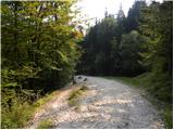 8
8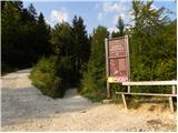 9
9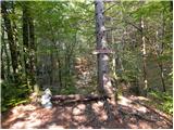 10
10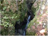 11
11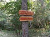 12
12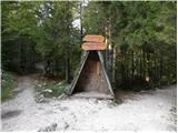 13
13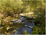 14
14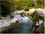 15
15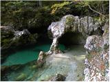 16
16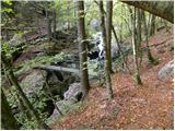 17
17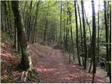 18
18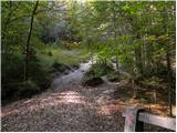 19
19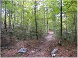 20
20 21
21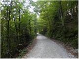 22
22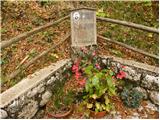 23
23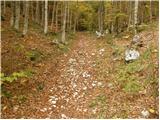 24
24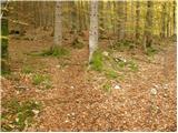 25
25 26
26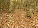 27
27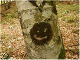 28
28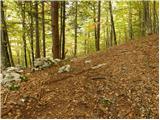 29
29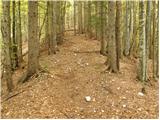 30
30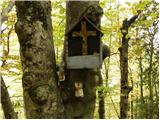 31
31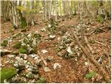 32
32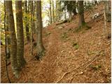 33
33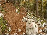 34
34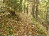 35
35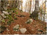 36
36 37
37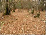 38
38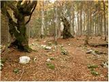 39
39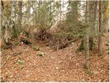 40
40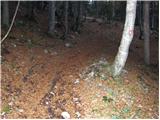 41
41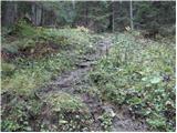 42
42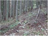 43
43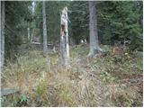 44
44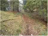 45
45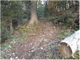 46
46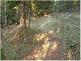 47
47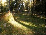 48
48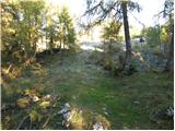 49
49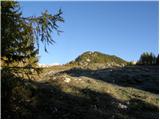 50
50 51
51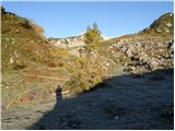 52
52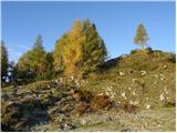 53
53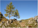 54
54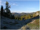 55
55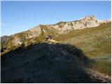 56
56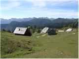 57
57
Discussion about the trail Stara Fužina - Planina Krstenica
|
| Iguana21. 11. 2010 |
Včeraj iz S. Fužine na planino Krstenica. Dolga in precej naporna pot, s prečudovito Mostnico. Med potjo sem in tja kak sončni žarek, na vrhu precej oblačno. Snega na nekaterih mestih do kolen. Graja za markacije, komaj jih opaziš, sploh ker je toliko podrtega drevja, je orientacija še težja. To pot najbrž niso merkirali že kar nekaj let.
|
|
|
|
| macek123. 10. 2012 |
Sledi kolesarskih 'užitkov'. 
|
|
|
|
| lojz18. 10. 2021 10:38:34 |
V kakšnem stanju je ta pot? Baje je vetrolom pred parimi leti naredil kar nekaj škode.
|
|
|
|
| exwannabe18. 10. 2021 19:34:10 |
Po dolini ni problema, tja do Pl. doma v Vojah. Naprej pa.... nazadnje, ko sem hodil je bil prvi del poti OK (tisti najstrmejši del), potem višje, ko se pot nekoliko poravna pa je bilo veliko posekanega (problem ker ni markacij), en predel pa tako rekoč golosek. Na tistem delu je bilo veliko vlak in nobene markacije nikjer tako, da je potrebno iti malo po občutku oziroma če si že kdaj prej tam hodil potem vsaj veš v katero smer iti. Potem čisto zadnji del poti pa je bil spet OK. Drugače zna biti kar problematično. Opcija, gps. Ampak to so info stare kakšno leto...tako da mogoče so letos kaj porihtali.
|
|
|
|
| lojz18. 10. 2021 20:18:16 |
|
|
|
|
| Luka2829. 04. 2022 18:27:55 |
Stanje 29.4.22
Golosek še vedno v katastrofalnem stanju, markacij ni. Bila sva prvič gor in se seveda izgubila. S pomočjo google maps sva nekako prišla na gozdarsko pot iz pl. Blato, tako da cilja sploh nisva videla. Za konec pa še pešačenje iz Blata do Stare Fužine, ker neke brihte ne odprejo ceste do 1.5. zaradi "zimskih razmer". Parkirnina za 7h je bila 21€. Skratka, obupen izlet je bil tole na koncu.
|
|
|
|
| padez29. 04. 2022 20:40:59 |
Planinsko pot upravlja PD Zeleznicar Ljubljana.
Pot je v katastrofalnem stanju ze leta in nic ne kaze, da bi jo kaj uredili. Ista situacija je tudi Krstenica - Grintovca in tudi Crno jezero - zavetisce Draga Bregarja. Na tej poti lezijo podrti macesni ze vec kot trideset!!! let! Vse nastete podi upravlja in vzdrzuje isto planinsko drustvo - Zeleznicar Ljubljana! Sramota!!!
|
|
|
|
| Luka2830. 04. 2022 04:45:57 |
Žalostno... Sam vzpon je pa tudi živ dolgčas, narejen, da pohodniku pobere voljo do vsega 
|
|
|
|
| pegasus12. 09. 2023 20:22:13 |
Danes prehodil to pot. Podrto drevje v strmem delu je pretežno očiščeno in ne ovira bistveno hoje, gor na poseki je pot speljana rahlo drugače kot v zemljevidih, le slediti je treba redkim novim markacijam. Če kljub temu zalutaš, te rešijo možici na vlakah. Je pa strm del mehko posut z listjem in humusom, idealna podlaga za ljubitelje bosonoge hoje 
|
|
|