Zell-Schaida / Šajda - Obirska planina
Starting point: Zell-Schaida / Šajda (1069 m)
| Lat/Lon: | 46,4791°N 14,4675°E |
| |
Time of walking: 1 h 30 min
Difficulty: easy marked way
Altitude difference: 203 m
Altitude difference po putu: 225 m
Map: Karavanke - osrednji del 1:50.000
Recommended equipment (summer):
Recommended equipment (winter): ice axe, crampons
Views: 4.006
 | 1 person likes this post |
Access to the starting point:
a) Cross the Jezerski vrh or Pavličev vrh border crossing and drive to Železna Kapla / Bad Eisenkappel, from where you turn left towards Šajda / Zell-Schaida. When you arrive in the village of Šajda / Zell-Schaida, you will see a parking lot near the church and mountain signs for Hochobir, where you park.
b) Cross the Border crossing Ljubelj into Austria and follow the main road to Klagenfurt to the village Podljubelj / Unterloibl, where you turn right towards Borovlje / Ferlach. From Borovlje we continue driving through the villages of Medborovnica / Unterferlach, Ostrovca / Ostrouza, Trata / Tratten, Glinje / Glainach, Vesca / Dörfl, Ždovlje / Seidolach, Dobrova / Dobrowa, Kočuha / Gotschuchen, Šmarjeta / St. Margarethen, Dolnja vas / Niederderdörfl, and then we pass the village of Zgornja Vesca / Oberdörfl before descending down to the Borovnica stream / Freibach. Cross the stream, then climb quickly to a crossroads, where you continue right towards the Borovnica Barrier Lake / Freibach - Stausee, Schaida / Zell - Schaida. A little above the barrier lake, leave the main road leading to Sele - Pri cerkvi / Zell - Pfarre, Sele - Borovnica / Zell - Freibach and continue left towards Sele - Šajda / Zell - Schaida and the Šajda Pass. Follow the road, which climbs slightly steeper, to the Šajda Pass, where you can park in a suitable place near the church or the pass.
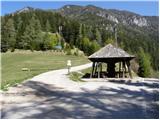
Path description:
From the parking lot, take the asphalted road towards Železna Kapla / Bad Eisenkappel. After walking a few dozen metres, a footpath branches off to the left, which we also follow. The path, which ascends only slightly, crosses a large number of ravines, mostly through the forest. However, as the trail has a few forks, you have to follow the markings carefully. A few minutes before Obirska planina we come across an exposed passage, which is well protected and in dry conditions does not pose a major danger. In snow and ice, however, great care is needed. After this, take the mountain pasture, which leads to a shepherd's tent.
Pictures:
 1
1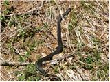 2
2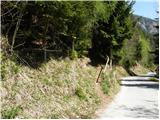 3
3 4
4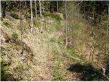 5
5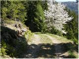 6
6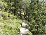 7
7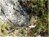 8
8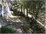 9
9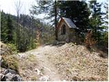 10
10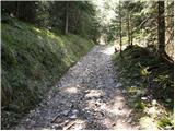 11
11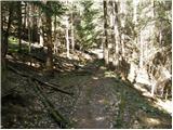 12
12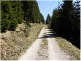 13
13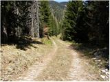 14
14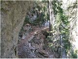 15
15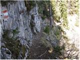 16
16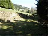 17
17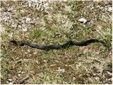 18
18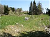 19
19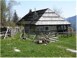 20
20
Discussion about the trail Zell-Schaida / Šajda - Obirska planina
|
| Gustl10. 08. 2012 |
Ali je na poti res toliko kač kot kaže tale album....3 slike od 14-ih, pa še prva je na asfaltirani cesti.
|
|
|
|
| Gustl13. 08. 2012 |
Sem pot opravil včeraj - nisem srečal nobene... 
|
|
|