Starting point: Železniki (450 m)
| Lat/Lon: | 46,2249°N 14,1644°E |
| |
Time of walking: 40 min
Difficulty: easy unmarked way
Altitude difference: 256 m
Altitude difference po putu: 256 m
Map: Škofjeloško in cerkljansko hribovje 1:50.00
Recommended equipment (summer):
Recommended equipment (winter): crampons
Views: 2.430
 | 2 people like this post |
Access to the starting point:
a) First drive to Škofja Loka, then continue driving towards Železniki. When you arrive in Železniki, first at the crossroads where the road to Kropa, Dražgoše and Rudne branches off to the right, continue straight ahead, then a little beyond the Mercator shop, or opposite the Niko d. o. o. company, continue right in the direction of Podlonk and Prtovča. Immediately after leaving the main road, turn right in the direction of the forest trail Kres and the sports hall Železniki, next to which you will park.
b) From Cerkno, Podbrdo or Sorice, drive to the Log Hall and then continue towards Škofja Loka. When you arrive in Železniki, leave the main road and drive left in the direction of Podlonk and Prtovča. Immediately after leaving the main road, turn right towards the forest nature trail Kres and the sports hall Železniki, where you can park.
Path description:
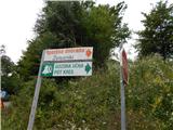
From the starting point at the Železniki sports hall, continue in the direction of the Kres forest trail, first crossing the Dašnjica stream over a small bridge, and then, when you reach another asphalt road about 100 m further on, continue left, and walk along it for a minute or two, or until you reach the place where you see a larger information board on the Kres forest trail on your right.
At the part where you leave the road before the information board of the forest nature trail Kres, continue slightly right (sharp right Hujska over Kresa and the correct direction of walking on the forest nature trail), walking parallel to the road and in the reverse direction of the circular trail Kres. Hujska over Kresa and the correct direction of walking on the forest nature trail. We soon move away from the road, and the path mainly climbs the slopes of Kresa in a transverse direction the whole time. When you reach a small pass and a meadow higher up, continue slightly left (right Kres and the path back to the tarmac road), onto the path that returns to the forest. On the other side of the meadow, we start climbing along and along an indistinct ridge Hujska, and the path leads us through dense forest. Higher up the path becomes steeper (the steep part can be left to the right at cart track) and then, as the above-mentioned cart track joins from the right, it becomes slightly flatter. When the two paths join, the cart track ends, and we continue straight ahead, along a moderately steep path, reaching the top of Hujska in a few minutes of further walking.
Description and pictures refer to the situation in 2016 (July).

Pictures:
 1
1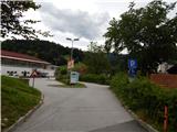 2
2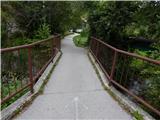 3
3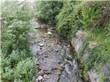 4
4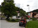 5
5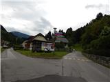 6
6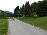 7
7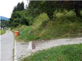 8
8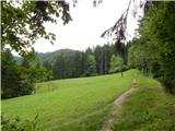 9
9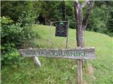 10
10 11
11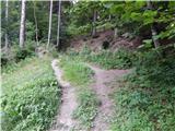 12
12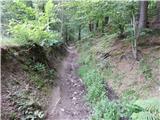 13
13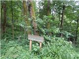 14
14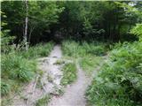 15
15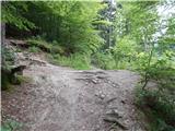 16
16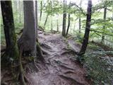 17
17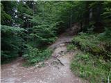 18
18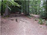 19
19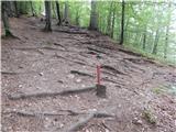 20
20 21
21
Discussion about the trail Železniki - Hujska
|
| MateZ28. 09. 2023 20:23:25 |
<Na drugi strani travnika se pričnemo vzpenjati po in ob neizrazitem grebenu Hujske, pot pa nas vodi skozi strnjen gozd. Višje pot postane bolj strma (strmemu delu se lahko umaknemo desno na kolovoz), nato pa, ko se nam z desne priključi omenjeni kolovoz, se le ta nekoliko položi.>
Če malo dopolnim ta del. Na višini ca. 600 m, kakšnih 5-10 minut po tem, ko zapustimo učno pot, pridemo do točke, kjer se v vse smeri sreča 5 ali 6 različno širokih in strmih poti. (Mislim, da je to mesto na fotografiji #18). Tam je treba, kot piše na fotki, iti naravnost gor v ne prestrm klanec. Res se mu lahko umaknemo desno na kolovoz, a v tem primeru ne smemo zgolj lagodno naravnost, pač pa je ca. 5 min kasneje treba zaviti ostro levo, da se spet srečamo z gozdno potjo. (Če po omenjenem kolovozu nadaljujemo naravnost, pridemo do mesta, kjer se skozi gozd desno dobro vidijo Dražgoše -> vsekakor predaleč!)
|
|
|