Starting point: Zazid (390 m)
| Lat/Lon: | 45,4994°N 13,9315°E |
| |
Time of walking: 1 h 20 min
Difficulty: easy marked way
Altitude difference: 412 m
Altitude difference po putu: 440 m
Map: Slovenska Istra - Čičarija, Brkini in Kras 1:50.000
Recommended equipment (summer):
Recommended equipment (winter):
Views: 9.955
 | 2 people like this post |
Access to the starting point:
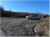
From the motorway Ljubljana - Koper take the exit Črni Kal. From Črni Kal, continue along the old road towards the sea, and we take it only as far as the next slightly larger crossroads, where we turn left towards Border crossing Sočerga. We drive along the road for a short time, and then the signs for Predloka, Loka, Bezovica, Podpeč, Zanigrad, Zazid and Rakitovec direct us to the left onto a slightly narrower local road. Continue to Bezovica, where at a small crossroads in the middle of the village, turn left towards Podpeči. Continue through Podpeč (the road through the village is very narrow) to the village of Zazid, where you park in the parking lot next to the sports ground.
Path description:
From the sports ground, walk to the village, where you will come to an unmarked crossroads with a bench and a water tap. Here, turn right and follow the gently ascending road to the upper part of the village, where you will see the first signs for Golič and Lipnik . Turn right again and continue climbing along the asphalted road leading to the nearby water reservoir. A few 10 m before the water reservoir, you will come to the next unmarked crossroads, where you will continue along the dirt road on the right. The dirt road then leads to a small crossroads, at which the next water trough is located. This time, continue along the wider road on the left, where you will quickly see a sign. Continue along the minor road for a short distance and then a marked shortcut forks off to the right. The path quickly returns to the road and after a few steps splits into two parts again. Wherever you continue, the path will quickly lead you to the railway line and the dilapidated Zazid railway station. Carefully cross the railway line leading to Pula, and we will arrive at a marked crossroads on the other side (it takes about 20 minutes to get here).
Continue left in the direction of the Kraško Edge (right Lipnik) and follow the wide cart track, which climbs crosswise over the railway line. The cart track soon lays down and then starts to descend slightly. After a few minutes of descending, we will see the markings for the Karst Edge, which point us right into the forest. The way ahead climbs through the forest, first moderately and then steeply. Higher up, we climb over the rocky level of the Kraško Edge, from the top of which we get a beautiful view.
Above the steep step is a marked crossroads, and we continue to the right in the direction of Kojnik (left Jampršnik). The way forward continues for some time along the edge of Kraško, then turns left into the forest and after a few minutes of further walking leads us to the forest road, which we follow to the right. The road takes us a little higher to a small crossroads where we continue along the road on the left, which quickly leads us to the Kojnik hunting shelter. A little above the shelter, leave the worse road and continue your ascent to the left into the forest along the marked path. After a short climb, we leave the forest and the path leads us to a grassy slope over which we cross the ascent. Above the viewing slope, the path passes into a pleasant pine groove, through which you climb to the top of Kojnik.

Pictures:
 1
1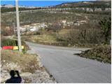 2
2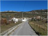 3
3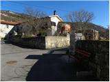 4
4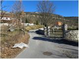 5
5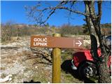 6
6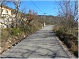 7
7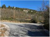 8
8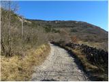 9
9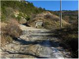 10
10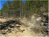 11
11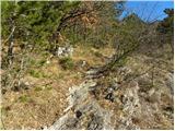 12
12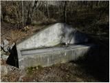 13
13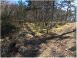 14
14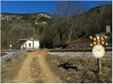 15
15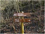 16
16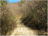 17
17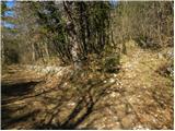 18
18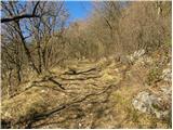 19
19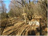 20
20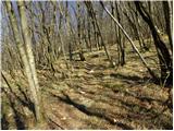 21
21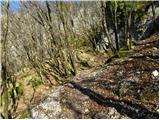 22
22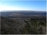 23
23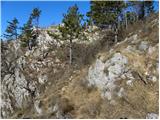 24
24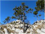 25
25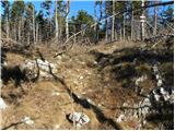 26
26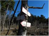 27
27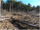 28
28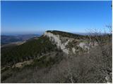 29
29 30
30 31
31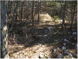 32
32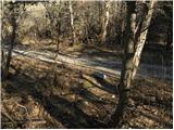 33
33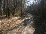 34
34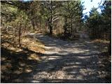 35
35 36
36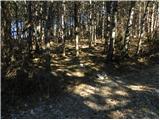 37
37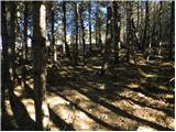 38
38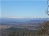 39
39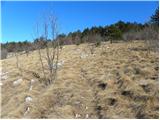 40
40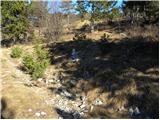 41
41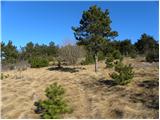 42
42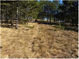 43
43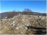 44
44 45
45
Discussion about the trail Zazid - Kojnik
|
| Kigeot21. 02. 2015 |
Jaz sem danes šla to pot, ki je zelo malo obiskana. Gozdarji so pridno čistili stezo v gozdu pod Kraškim robom. Markacije in oznake ponekod pa bi morali malo osvežiti, saj na par mestih se moraš prav igrati tabornike, da uganeš pravo smer...
Od parkirišča do železniške postaje rabiš kakih 15 minut po asfaltu in makadamu, nato še okrog 10 minut po gozdni cesti, šele nato pot zavije v gozd in se prične "prava" planinska pot... Ne maram teh poti po cestah, nekako mi ni "hribovsko". Drugače pa pot je lepa, nezahtevna, s Kraškega roba in vrha Kojnika so krasni razgledi.
|
|
|
|
| Borut12. 05. 2021 14:24:29 |
Zelo lepa in slikovita pot preko kraškega roba, skozi svetle gozdove in po travnikih. Markacije in kažipoti so zgledno obnovljeni, vendar samo do lovskega zavetišča. Mesto, kjer približno 300 m nad lovskim zavetiščem zavijemo s ceste levo v gozd (slika 37), je slabo označeno, zato si pomagamo z možicem ob cesti.
|
|
|