Zajasovnik - del (Strmce, chapel) - Jasovnik (Motnik tourist trail)
Starting point: Zajasovnik - del (Strmce, chapel) (580 m)
| Lat/Lon: | 46,20985°N 14,89273°E |
| |
Name of path: Motnik tourist trail
Time of walking: 45 min
Difficulty: easy marked way
Altitude difference: 184 m
Altitude difference po putu: 184 m
Map:
Recommended equipment (summer):
Recommended equipment (winter): ice axe, crampons
Views: 2.630
 | 3 people like this post |
Access to the starting point:
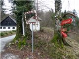
a) From the A1 motorway from the route of Celje, take exit Vransko. Turn right and follow the signs for Vransko and Kamnik. Drive to Ločica pri Vranskem. Soon you will reach the crossroads for Kamnik. Turn right. After a few kilometres, you will reach Motnik and turn into the centre of the town. At the crossroads in front of the bus station you will see red mountain signs. Turn left along the road and up the hill. After a little more than 1 km you reach the chapel (Zajasovnik - del, Strmec). Here we have a great place to park.
b) From the A1 motorway from the route of Ljubljana, take the Trojane exit. When you get to the junction from the exit, turn left onto the main road. The junction is well marked. Shortly before Ločica at Vransko turn left for Kamnik. After a few kilometres, you reach Motnik and turn into the centre of the town. At the crossroads in front of the bus station you will see red mountain signs. Turn left along the road and uphill. After a little more than 1 km you reach the chapel (Zajasovnik - del, Strmec). Here we have a great place to park.
Path description:
There is a chapel at our starting point and nearby there are mountain signs for Jasovnik, Ločica and Trojane. Turn left in the direction of Jasovnika. After a few dozen metres we pass a house. A little further on, you will see a sign for Jasovnik and Ločica on a tree. It directs us left up the meadow into the forest. The path is wider at first, markings are visible, but they are rare. After a short climb, we reach a crossroads where we follow the upper, right-hand path. There are no markings here. The path then descends a little, but only for a few metres. You reach a crossroads where you turn left upwards. Here again there are no markings, but there should be. The path leads upwards, where you finally see the markings. Let's keep our eyes on the trail, because after a few metres we have to head up to the left. There are a lot of felled trees here. There is no marking, but we can see it a little higher up. The path leads through the forest, it is visible, but care is never superfluous. We are briefly relieved when we reach the crossroads Little Jasovnik (left) - Jasovnik (right).
It takes us less than 5 minutes to get to Little Jasovnik. Through the treetops we have a beautiful view of Motnik.
From the crossroads to Jasovnik, we have a 10-minute climb up a steeper slope. From here the markings are clearly visible. The path is full of rocks and can be very slippery in rainy weather. Just below the summit, it gently slopes down. When you get to the registration box, you are at the top.
A word of caution is to be careful when walking, as you can quickly get lost below the summit due to the poor marking of the trail.

Pictures:
 1
1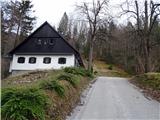 2
2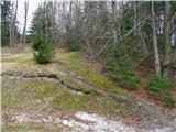 3
3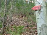 4
4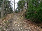 5
5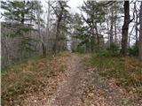 6
6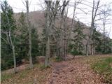 7
7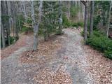 8
8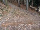 9
9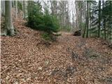 10
10 11
11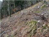 12
12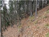 13
13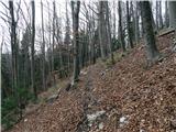 14
14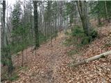 15
15 16
16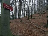 17
17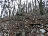 18
18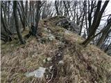 19
19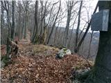 20
20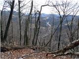 21
21 22
22
Discussion about the trail Zajasovnik - del (Strmce, chapel) - Jasovnik (Motnik tourist trail)
|
| grega_p22. 01. 2021 |
Za pristop do izhodišča iz osrednje Slovenije je najlažje, če gremo dol na izvozu Trojane, potem pa levo po glavni cesti še kakšen km in za avtobusno postajo in AC podvozom zavijemo levo (tabla občina Kamnik). Na dolgem ovinku nato zavijemo levo čez most potem pa na naslednjem odcepu ostro desno do izhodišča. Cesta je asfaltirana in skrajša ovinek čez Ločico za 10min.
Hvala za opis poti in idejo, zdi pa se mi da je pot orientacijsko precej enostavna. Je označeno, nekje so sicer obledele markacije, drugače pa popelje dokaj enostavno na vrh. Odcepi so pa smiselni, zmeraj navzgor.
Na sliki 10 je markacija (čeprav piše da niso vidne), slika 12 pa v naravi (vsaj trenutno) ni razpotje, saj je to edina pot.
Zgoraj mislim, da se ne da zaiti, kot je napisano, saj te pot smiselno pripelje na greben.
Te pripombe so mišljene zgolj kot popravek, da ne bi koga odvrnili od tega lepega izleta, saj orientacijsko ni zahteven, je lahko pristopen in ob moji zelo zmerni hoji dosegljiv v pol ure (opisanih 45min bi bilo z malim Jasovnikom vred).
Lep pozdrav, Grega
p.s. danes sta bila na poti dva lepa močerada, prelepo čudo naravo v posebnem počasnem gibanju in divjih barvah.
|
|
|