Starting point: Zagrad (780 m)
| Lat/Lon: | 45,5043°N 14,0599°E |
| |
Time of walking: 1 h 5 min
Difficulty: easy marked way
Altitude difference: 276 m
Altitude difference po putu: 276 m
Map: Slovenska Istra - Čičarija, Brkini in Kras 1:50.000
Recommended equipment (summer):
Recommended equipment (winter):
Views: 17.104
 | 1 person likes this post |
Access to the starting point:
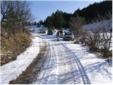
From the Ljubljana - Koper motorway, take the Kozina exit and follow the road towards Rijeka. In the village Obrov turn right in the direction of the village Golac from where you continue driving towards the hamlet Zagrad. In Zagrad, turn left and follow the road, which becomes macadam, until you see a sign for no further driving (use forest road at your own risk). Park here in a small parking lot on the side of the road.
Path description:
Just a few metres before the traffic sign, you will see cart track, which turns right off the road and starts to climb gently at first (the start is not marked). Soon we see the first marking, which tells us that we are on the right track. Continue moderately up the cart track, which at a higher altitude changes from forest to grassy slopes surrounded by individual trees (mostly pine). The path lays down here and slightly further on turns slightly to the right, where you also reach a marked crossroads.
Continue in the direction of Ostrič, Slavnik and Razsušica (pond on the left for 30 minutes) along the path which begins to climb towards an undistinguished saddle between Ostrič on the left and the lesser known Griža on the right. Follow this path to where you will see a larger sinkhole ahead. Here, cart track continues straight on, and the marked footpath turns left and starts to climb steeply up the uncultivated slope of Ostrič. Follow this briefly steeper path all the way to the top of Ostrič, from which a fine view opens up.

Pictures:
 1
1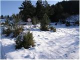 2
2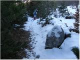 3
3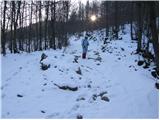 4
4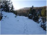 5
5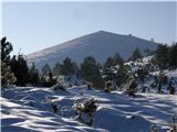 6
6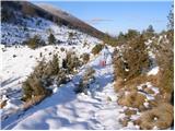 7
7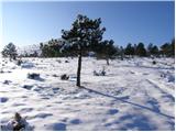 8
8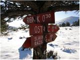 9
9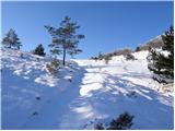 10
10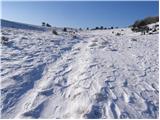 11
11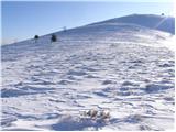 12
12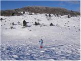 13
13 14
14
Discussion about the trail Zagrad - Ostrič
|
| klavdipo18. 04. 2012 |
Je na tem vrhu in tudi na Medvižici kakšen žig?
|
|
|
|
| B218. 04. 2012 |
Nikjer nobenih žigov! Pot pa čudovita - toda pozor! Tudi kakšen medved se rad najde...
|
|
|
|
| valerija11231. 12. 2018 |
Danes smo prehodili lepo krožno pot iz Zagrada čez Ostrič, Medvižico in Razsušico nazaj v Zagrad.Poti so zelo lepo markirane,na vseh treh vrhovih je žig.
SREČNO 2019
|
|
|
|
| bizgo9321. 02. 2021 |
Čudovita in razen zadnjega strmega vzpona precej nezahtevna pot skozi brinove grmičke, borovce ter mimo mnogih kraških vrtač. Iz vrha je ob lepem vremenu krasen pogled, ki seže po velikem delu zahodne Slovenije, če se obrnemo pa imamo kot na dlani še Učko in nekaj ostalih vrhov Čičarije. Pod vrhom planine vas bodo z zvonci okoli vratu pozdravili še konji. Če se spustite iz vrha v smeri Slavnika lahko obiščete še bližnja Medvižico in Razsušico (Glavičorko) in se v Zagrad vrnete po zgoraj omenjeni krožni poti. Krasen izlet!
|
|
|
|
| ločanka6. 02. 2024 06:20:50 |
Jaz pa močno priporočam še malo daljši krog, kot ga omenja bizgo93. In sicer podaljšek do Male Plešivice, spust na Velika vrata in ponoven vzpon na Veliko Plešivico. Nato se vrnete nazaj do vrat, kjer opazite napis Zagrad in od tam vas čaka še okoli 45 min povratka nazaj do parkirišča. Skupni krog okoli šest ur, a je vredno, če si že v teh koncih  .
|
|
|