Zadnjica - Zasavska koča na Prehodavcih
Starting point: Zadnjica (642 m)
| Lat/Lon: | 46,3824°N 13,7604°E |
| |
Time of walking: 4 h 15 min
Difficulty: easy marked way
Altitude difference: 1429 m
Altitude difference po putu: 1430 m
Map: Triglav 1:25.000
Recommended equipment (summer):
Recommended equipment (winter): ice axe, crampons
Views: 108.569
 | 7 people like this post |
Access to the starting point:
From Kranjska Gora, drive over the Vršič pass towards Bovec or vice versa, but only as far as the 50th serpentine of the Vršiška or Ruska road (near the village of Trenta). Here you turn onto a side road, and then park for a few 100 metres in a roadside parking lot.
Path description:
From the parking lot, continue along the road, which takes you past a few houses (mainly at weekends) in about 15 minutes to a place where the road splits into two parts (there used to be a parking lot at the crossroads, but now parking is prohibited).
Continue along the lower right road (the upper road leads to the cargo cableway leading to Pogačnikov dom) in the direction of Doliča, Luknja and Prehodavci. Initially, follow the gently sloping road, which leads us across the meadows and higher up through the forest, almost to its end, or more precisely to a marked crossroads, where a marked footpath branches off to the right towards Prehodavci (it takes about 1 hour to get here).
From the crossroads in the area called Utro, continue to the right (straight ahead to Luknja, Triglav and Dolič), where you first cross partly vegetated gravel and a few torrents. After a few minutes of crossing, with some short ascents and descents, we reach the beginning of the Last Dol. Here the path starts to climb moderately on the right side of the valley. Higher up, the path curves slightly more to the right, where it takes us into the wods and then returns to a rockier world. The way forward leads us to a small well, next to which there is a small bench on which we can rest. The path continues to climb moderately to steeply for some time and gradually passes onto the scree below Zadnjiškim Ozebnikom. With a view of the nearby walls of the surrounding peaks, we then climb to the saddle Čez Dol, where the trail lays down and splits into two parts.
At this crossroads, continue left in the direction of Zasavska koča na Prehodavcih (straight ahead Trenta) and continue up the path, which continues over a rather steep and exposed slope. Follow this slightly narrower path to a nearby crossroads, where you join the mulatier from Trenta.
(If we find the short, slightly exposed part to dangerous, we can also take a slightly longer route to reach this crossroads. In this case, at the previous crossroads, continue straight on in the direction of Trenta and then a little further left in the direction of Prehodavci).
At this crossroads, continue straight ahead and continue climbing along a wide mulatier which crosses steep and precipitous slopes. As you climb over the precipitous slope, you will see a small "chapel" (statue of Mary and Jesus) on the left-hand side.
The slope becomes less steep and more scenic as the route continues. Higher up, a well-preserved mulatier leads us over the slightly less steep slope of Zelena Griva, and above it the slope becomes steeper again. There are a few short steep sections, and then the path and the slope fall away. A little above the unmarked break, you arrive at a marked crossroads, where you continue left (right Lepo or Veliko špičje - the path of Stank Kos, straight Koča pri Triglavskih jezerih) towards the nearby Zasavska hut on Prehodavci. The way forward leads us along a wide and scenic ridge, which leads us past the winter bivouac in a few minutes to the Zasavska hut. Zadnjica - Čez Dol 3:00, Čez Dol - Zasavska koča 1:15.

Pictures:
 1
1 2
2 3
3 4
4 5
5 6
6 7
7 8
8 9
9 10
10 11
11 12
12 13
13 14
14 15
15 16
16 17
17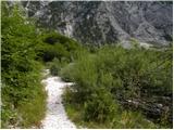 18
18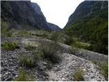 19
19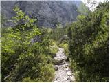 20
20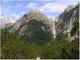 21
21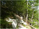 22
22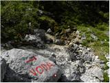 23
23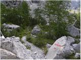 24
24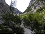 25
25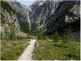 26
26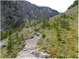 27
27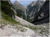 28
28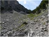 29
29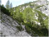 30
30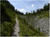 31
31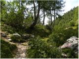 32
32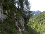 33
33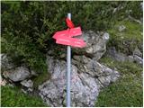 34
34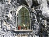 35
35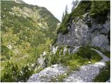 36
36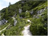 37
37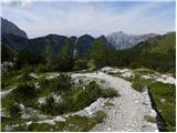 38
38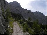 39
39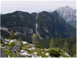 40
40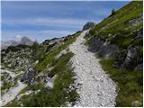 41
41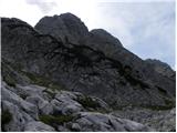 42
42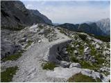 43
43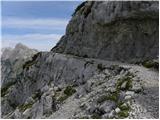 44
44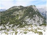 45
45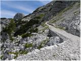 46
46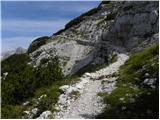 47
47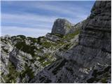 48
48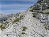 49
49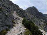 50
50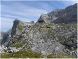 51
51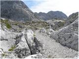 52
52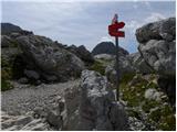 53
53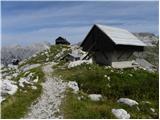 54
54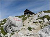 55
55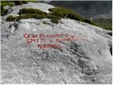 56
56 57
57
Discussion about the trail Zadnjica - Zasavska koča na Prehodavcih
Show older messages
|
| Guest17. 07. 2007 |
Kolikšen del te poti je v senčki?
|
|
|
|
| Joža17. 07. 2007 |
Včeraj sem šel dol z Prehodacev popldan in bi rekel dobra tretina. LP.
|
|
|
|
| Guest24. 07. 2007 |
Vrnila sem se Prehodavcev prijetno presenečna in vesela, da zna tudi mladi rod lepo skrbeti za planince, ki zaidejo v Zasavsko kočo na Prehodavcih. Koča je zgledno oskrbovana, osebje zelo, zelo prijazno... V razmerah kakršne so v visokogorju, kapo dol. Zaslužijo si čisto desetko. Zato še enkrat tudi prijazen pozdrav gori v kočo tem fantom in dekletom.
Srečno in varno v gorah!
|
|
|
|
| Guest24. 07. 2007 |
Zelo verjetno ima kočo na Prehodavcih tudi letos v oskrbi ista ekipa mladih, kot pred dvema letoma, ko sva bila midva z možem tam. Tako mladega osebja nisem pravzaprav srečala še nikjer drugje, tako prijetnega pa tudi malokje! Pridružujem se gornjemu mnenju! 
|
|
|
|
| Guest26. 07. 2007 |
SUPER OSEBJE, ŠE V KATERI KOČI BI MORALI PREVZETI MLADI (DOLIČ..)
|
|
|
|
| mkonci21. 07. 2009 |
Malo je že minilo od prejšnjega posta, vendar lahko povem da je ekipa v koči zelo mlada! Pot je ok, edino zgodaj zjutraj ko je še hladn je potrebna previdnost pri prehodu 3 plazišč (snega je kar veliko). Užitki za dol pa so fantastični, ni melišča je pa snežišče in se lahko "smučate" kar nekja metrov... 
|
|
|
|
| grahlck3. 08. 2009 |
Ali je kdo hodil po Kanjevčevih policah? Kakšna je pot? Je veliko snežišč?
|
|
|
|
| pipe5. 09. 2009 |
Zdravo
Me prav zanima kdo je določil 3 1/2 ure za
tole pot. Nismo vsi mladi kozli. osebje v koči je super
|
|
|
|
| MiR5. 09. 2009 |
Se dostikarat tudi jaz to vprašam. Čas na tablah in v vodnikih pa je skozi življenjska obdobja nekako takole:
- ko si mlad ga krajšaš
- prido obdboje, ko je glih ta prav
- ko pa EMŠO postane nesramno resen, pa k temu času dodaš kako urco ali pa tudi več. Sicer pa čas ni važen, glavno je, da imamo svojo pot, potem pride tudi cilj. In kaj je kašna ura več v hribih proti večnosti.
Srečno vsem!
|
|
|
|
| petruša12. 03. 2010 |
Mene pa zanima, kakšna pot iz Zasavske koče proti Koče pri Triglavskih jezerih. Koliko je pot dolga, in če je označena. če je že kdo prehodil tole pot naj mi prosim malo opiše, ker bi poleti radi to pot opravili. Hvala že v naprej. lp
|
|
|
|
| spotonbody24. 06. 2010 |
petruša: na vrhu pri Zasavki koči, kjer sem bila prejšnji teden so oznake in piše, da je do koče pri Triglavskih jezerih še 2'15 uri hoda. pot je označena. lp
|
|
|
|
| spotonbody24. 06. 2010 |
Po tej poti iz Zadnjice čez Dol je bilo 13.06. še nekaj malega snežnih zaplat, vendar nič nevarnega, vse prehodno brez derez do vrha Zasavske koče.Tudi nekaj gamsov je delalo družbo
|
|
|
|
| mt22. 08. 2010 |
Iz 21.8. na 22.8.2010 sem bil gost v Zasavski koči. Moram pohvaliti fante (oskrbnike), ki so kljub masi ljudi dobr poštimal stvari. Jota in ričet sta bila dobra. Spanje zarad gužve in (hrgoljenja) nepopolno ampak ne zarad prijaznega osebja. Že zarad vremena smo bli (ekipa 15-ih) dobr raspoloženi. Vsekakor dobro.
|
|
|
|
| bambroz24. 08. 2010 |
Tudi jaz sem prespala v koči iz 21. na 22.
Vračali smo se s Triglava. Mislim, da bi osebje lahko spravilo vse ljudi v kočo,da ne bi vedrili zunaj, oz. bi lahko priprave na spanje začeli prej kot ob 22.00
|
|
|
|
| medicinka24. 08. 2010 |
Nas je pa dosti prespalo na Prehodavcih.Fantje so bili prijazni,hitri in ustrežljivi.Kljub dolgi vrsti si dobil stvari kot bi mignil. 
|
|
|
|
| Janiel7422. 09. 2011 |
Prosim za kak nasvet oz. časovno pomoč Ena izmed variant je, da grem jutri na Triglav. In sicer: Zadnjica - Zasavska koča na Prehodavcih - Dolič - Triglav in nazaj dol do Doliča in potem po Komarju do Zadnjice. Če startam ob 4h iz Zadnjice...Ali se mi bi izšlo pred temo nazaj? Koliko je časovno iz Doliča po Komarju do Zadnjice navzdol? Morda kdo ve? Hvala
|
|
|
|
| katty22. 09. 2011 |
Uf Jani,dober si. Super turo si izbral, mene podobna še čaka. Najverjetneje naslednje leto. Je pa baje pot iz Doliča na Triglav res prijetna, pa zdi se mi, da sploh ne tako oblegana. Tko da kratko in jedernato, ti samo uživaj in sporoči, kako je bilo. Lp
|
|
|
|
| Janiel7422. 09. 2011 |
Ni še izbrano Zato pa želim kak komentar in nasvet, če se mi to izide. Ali so markacije dobre na začetku poti iz Zadnjice, da me en v temi kam narobe odnese..ker grem sam in ne poznam poti
|
|
|
|
| petruša22. 09. 2011 |
Pozdravljen, mi smo avgusta šli iz Zadnjice proti Luknji. Sta pa šla za nami mož in žena na Prehodovce. Dobro da smo mi poznali pot kje se odcepi za Prehodovce, ker ni već table. ker smo glih počivali na tem odcepu in smo se z njima pogovarjali sta mislila iti samo ravno, zato smo jim mi povedali.Prej ko prideš do potoka se cesta odcepi na desno za Prehodovce.pa srečno
|
|
|
|
| petruša22. 09. 2011 |
Četrto sliko si zapomni tu ni več table.lp
|
|
|
|
| robi1422. 09. 2011 |
@petruša: Rdeča tabla za odcepom je pred mesecem dni še stala...
@Janiel74: Poti s čelno svetilko ne boš mogel zgrešiti, ker je dobro markirana..
Uživaj
|
|
|
|
| otiv22. 09. 2011 |
Enodnevni obisk Triglava je pač pogojen z kondicijo,če tu ni težav,jih tudi ne bi smelo biti na turi.
Pa srečno in lep razgled z našega Očaka.
|
|
|
|
| Janiel7422. 09. 2011 |
Hvala Saj še nevem Morda pa iz Savice - Komarča- Koča pri Trigl.j. - Prehodavci- Kanjavec-Dolič-pa nazaj.. )) odvisno kdaj krenem na pot
|
|
|
|
| maucec4022. 09. 2011 |
Janiel,samo v vednost, da je pot čez Komar navzdol kar zahtevna, pa če boš še lovl dan... Za gor je super, dol pa je ne priporočam. Časovno je čisto vseeno, če greš navzdol kar lepo po poti proti Luknji in Zadnjici. Srečno in veliko užitkov!
|
|
|
|
| katty22. 09. 2011 |
Ja, tud jz se strinjam z zgornjim komentarjem. Komarča za dol kar naporna  , na nekaterih delih moraš biti še posebno pazljiv. Mislim, da bi bila pot iz Zadnjice na Prehodavce, Kanjavec do Doliča boljša. Prehodil boš nekaj mulatijer, ki dajejo tem koncem sploh še poseben čar . Če bi hotel it preko Komarče do Sedmerih in Prehodavcev itd, potem bi res moral kreniti že ob 4ih. Ker se bojim, da bi te prej res ujela tema  . Sporoči svojo odločitev. lP
|
|
|
|
| ivona22. 09. 2011 |
Petruša ima prav. Table na kateri piše Prehodavci ni.
|
|
|
|
| IgorZlodej22. 09. 2011 |
Fant še ve, ne kam bi sploh šel, vi pa toliko nasvetov nudite, kot, da bi vsak teden hodili tam okoli.
|
|
|
|
| tisa22. 09. 2011 |
Igor pozdravljen!
Vprašanje je bilo bolj splošno in tako tudi naši odgovori.
Pa srečno!
|
|
|
|
| IgorZlodej22. 09. 2011 |
Pri tako zastavljenem cilju ni splošnih vprašanj, je treba kar dobro poznati odseke poti, sicer je bolje ne razmišljati o tem.
|
|
|
|
| maucec4022. 09. 2011 |
Zato je pa fino, da se tudi kdaj kaj odsvetuje. Npr. dol čez Komar (ni to mišljena Komarča Katty). Mogoče bo Janiel74 ob takih nasvetih bolj pretuhtal svojo odločitev. Lep večer vsem!
|
|
|
|
| kungočan22. 09. 2011 |
Mi smo šli 18.8. na Luknjo in je tabla za Prehodavce res bila.LP
|
|
|
|
| katty22. 09. 2011 |
maucec49 hvala za informacijo.Pa za drugič, da bom vedela, zakaj se gre. Sicer pa ja, namen forum je, da s svojimi izkušnjami svetujemo in pomagamo drugim, ki ne vedo, v kaj se "spuščajo".
|
|
|
|
| Janiel7424. 09. 2011 |
No na koncu sem šel tole: Koča pri Savici - Komarča - Koča pri 7J - Zasavska koča pri Prehodavcih - nazaj na 7J - Komna - Savica....prvič srečal kozoroge Enkratna a tudi zeeeelo dolga pot, še posebej se je vlekla GorDol pot 7J-Komna
|
|
|
|
| falcon27. 08. 2014 |
Ima kdo informacijo o trenutnem stanju poti?
|
|
|
|
| fantazija11. 07. 2019 |
Dan,
mi kdo prosim napiše ali je od Zasavske koče do koče pri Triglavskih kaj prepadnega terena ?
hvala in lp
|
|
|
|
| margu5011. 07. 2019 |
Jaz bi ti kot prvo, bolj priporočila pot iz Trente do Prehodavcev, veliko lepša kot iz Zadnjice, časovno pa enaki. Do koče pri Sedmerih ni nič prepadnega.
|
|
|
|
| bbugari111. 07. 2019 |
Več prepadnega terena je na vseh pristopnih poti do Prehodavcev.
|
|
|
|
| B211. 07. 2019 |
Pot iz Loga v Trenti je lepa in speljana po nekdanji mulateri, ki nas zložno pripelje na Prehodavce. Tudi pot iz Zadnjice je speljana po nekaj odsekih nekdanje (in sedaj uničene) mulatere, je pa bolj monotona in naporna. Vseskozi pred seboj vidimo sedlo nad planino Dol, kjer se združita poti iz Zadnjice in Trente, do njega pa je kar nekaj "mučenja". Poti, ki so speljane po zložnih, dokaj širokih in uhojenih nekdanjih (italijanskih) mulaterah ne bi rekel da lahko štejemo med prepadne... Dostopa na Prehodavce s strani koče pri 7J in Doliča pa tudi nista prepadna. Le veselo na pot v te prelepe kotičke Julijskih Alp!
|
|
|
|
| bbugari111. 07. 2019 |
Občutek prepadnosti je dokaj subjektiven. Nekateremu je prepadna tudi pot nad Ledvico. Pa še več mulatjera na Dolič, ali Hribarice. Pristop na Prehodavce z 7 jezer ne štejem, ker fantazija očitno ima v načrtu sestop z Prehodavcev na 7 jezer.
|
|
|
|
| fantazija11. 07. 2019 |
Ja, sestop s Prehodavcev do 7J.
Res hvala za slikovit prikaz poti. S sabo bi imeli prijateljico, ki je malenkost bolj občutljiva na prepadne terene-ni pa panike.
Hvala marqu50 za namig.
|
|
|
|
| miratan31. 03. 2021 |
V nedeljo bi šli iz Zadnjice do Zasavske koče na Prehodavcih. Ali je kdo šel zadnne dni v tej smeri? Kdo ve, kakšne so razmere?
|
|
|
|
| Jernej96823. 04. 2021 22:11:53 |
Miratan, ste mogoče opravili to turo? Kakšne so bile razmere?
|
|
|
|
| Rajskioskar21. 06. 2022 11:41:15 |
Pozdravljeni,
glede na visoke temperature predvidevam, da trenutno snežnih ovir na poti ni. Drži? Hvala za info.
|
|
|
|
| pikica929. 07. 2023 08:29:37 |
Parkirišče plačljivo 5/dan. Pot pa je v redu ampak sem hodila dlje kot piše, sem počasna...
|
|
|
|
| Tomaž0015. 07. 2024 16:07:19 |
A je ta pot normalno prehodna, al je še kaj snega
|
|
|
|
| anazala28. 06. 2025 11:34:18 |
Je možno s psom iti gor. Je nevarno.
|
|
|
|
| miri28. 06. 2025 11:55:10 |
A za sebe te pa ne skrbi? 
|
|
|
|
| ppegan28. 06. 2025 12:20:14 |
Če je pes vajen takih, torej visokogorskih poti, bo to zanj mala malca Edino zna bit vroče, sploh pri sestopu, tako da na pot zgodaj zjutraj in s sabo dovolj vode
|
|
|