Weissensee - Eckwand (via Almspitz)
Starting point: Weissensee (940 m)
| Lat/Lon: | 46,6989°N 13,4148°E |
| |
Name of path: via Almspitz
Time of walking: 4 h 45 min
Difficulty: partly demanding marked way
Altitude difference: 1281 m
Altitude difference po putu: 1290 m
Map:
Recommended equipment (summer):
Recommended equipment (winter): ice axe, crampons
Views: 4.056
 | 1 person likes this post |
Access to the starting point:
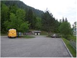
Shortly before Spittal, from the route of Villach (along the old road), the road to Ziebel branches off to the left. At the village, continue driving towards the Weissensee lake, which is about 15km from Ziebel. Park in the large parking lot near the lake.
Path description:
From the large parking lot, walk down a few metres to the main road, where you will see signs on the left. Take the wide path that leads along the lake behind the "Techendorf" sign. The path first leads over a small bridge and leads to the bivouac on the eastern side of Lake Weissensee. Here, turn right onto the tarmac road that runs alongside the bivouac and leads to a crossroads where you turn left and, after a few metres' walk, you come to a set of signs. Bear left after the "Techendorfer Alm steil" signs. After a few metres, regain the signs and bear right on the steep path towards mountain pasture Techendorfer Alm. The left-hand path follows a more gradual path, which is mostly on the road.
The path climbs quite steeply through the forest and leads to a clearing where you cross cart track and start climbing along the edge of the forest. Here the first views of the nearby peaks of the Latschur group open up. The path climbs through the forest again and then crosses the mountain road several times. At all the junctions, which are very well marked, continue in the direction of Techendorfer Alm steil (steep path). Finally, when the path to the left forks towards the Stosia saddle, continue along the road which, after about 15 minutes' walk, leads to the mountain pasture Techendorfer Alm, where there is also a small mountain hut.
From mountain pasture continue northwards following the signs Stosia, Latschur. The trail first crosses a sparse forest and then ascends grassy slopes towards the Stosia saddle. This part of the trail is marked with white and blue markers.
At the saddle, turn right and follow the grassy ridge. When you reach a crossroads, continue straight on along the ridge, and a direct path to Eckwand branches off to the right. When you reach the crossroads again, take the path to the right, which continues along the ridge and leads to Almspitz (2180m). The path to the left leads to Latschur. The trail then continues to climb along the grassy ridge and soon leads to the Almspitz peak, which offers a beautiful view of the surrounding peaks.
From the summit, descend a few metres westwards to the saddle between Almspitz and Latschur. At the saddle, turn right to cross the slightly steeper northern slopes of Almspitz. Once on the ridge again, a direct and slightly shorter path from the Stosia saddle soon joins from the right, followed by a shorter climb along a grassy ridge towards the summit.

Pictures:
 1
1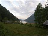 2
2 3
3 4
4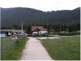 5
5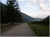 6
6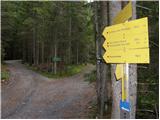 7
7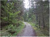 8
8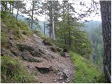 9
9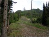 10
10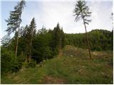 11
11 12
12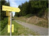 13
13 14
14 15
15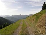 16
16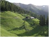 17
17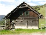 18
18 19
19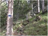 20
20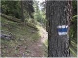 21
21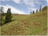 22
22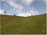 23
23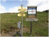 24
24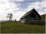 25
25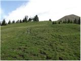 26
26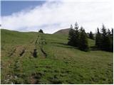 27
27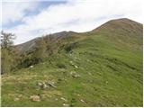 28
28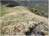 29
29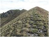 30
30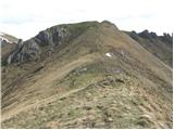 31
31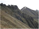 32
32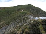 33
33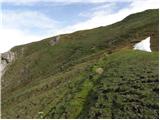 34
34 35
35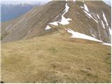 36
36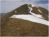 37
37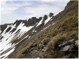 38
38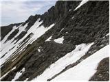 39
39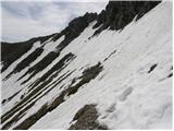 40
40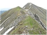 41
41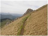 42
42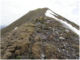 43
43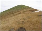 44
44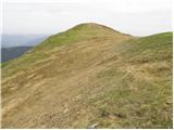 45
45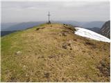 46
46
Discussion about the trail Weissensee - Eckwand (via Almspitz)
|
| VanSims26. 07. 2010 |
Dostop do Eckwanda ima samo iz izhodišča Weissensee veliko alternativnih pristopov. Glavni smeri sta sicer ti opisani na tem portalu(morda še kaka) imata pa kar nekaj variant in alternativnih pristopov. Že do Techendorfer Alma imamo alternativo opisano zgoraj: steil varianta in varianta po gozdni cesti. Steil varianta je kar strma in za ljudi z manj kondicije kar naporna. Je pa tehnično popolnoma nezahtevna. Se pa da že na približno pol poti izstopiti in nadaljevati po gozdni cesti(če bi koga zmanjkalo  ). Po drugem takem križanju s cesto tudi ni več tako strma, tako da se da kombinirati tudi cesta v spodnjem delu in steil varianta v zgornjem, če nismo ravno kondicijsko na vrhuncu Na Techendorfer Almu imajo dva odvezana psa(očitno last oskrbnika kočice). Kogar to moti ima alternativni odcep za Stosio že 10 min pred Techendorfer Almom(pa še profitira 10 min.) Potem od sedla Stosia vodi tudi direktna pot na Eckwand za tiste, ki bi jim pečenje pobočij Almspitza delalo težave. Samo to prečenje je dejansko malo zahtevnejše(za izkušene gornike sploh pa feratarje seveda mala malica  ). Jaz sem imel sicer kopno ampak v razmerah kot je bila posneta zgornja slika zna biti pa po moje nekoliko nevarno. Sestopil sem čez Karalm(obratna pot kot je opisana v opisu poti čez to planino). Tudi tu imamo, ko se po gozdni cesti spuščamo do Weissenseeja alternativo čez gozd. Alternativa je dobro markirana vse do tik pred koncem ko smo že čisto pri potoku. Tam jaz nisem videl markacij naprej zato sem jo ucvrl po desni potki do potoka. Samo prečenje potoka ni nič posebnega(razen po kakem deževju mogoče) potem pa se nikakor ne zagnati direkt v gruščevje, ki vodi na cesto(kot sem se jaz ) ampak pojdite še malo ob potočku gor nekaj deset metrov in se boste na cesto povzpeli skoraj brez težav(opazil seveda šele ko sem bil na cesti  ) Ta alternativa je tehnično morda nekoliko zahtevnejša(nekje med lahka in delno zahtevna), zelo strma in v mokrem (vsaj za navzdol) odsvetovana.
|
|
|