Vršič - Zadnja Mojstrovka (via Šitna glava)
Starting point: Vršič (1611 m)
| Lat/Lon: | 46,4336°N 13,7435°E |
| |
Name of path: via Šitna glava
Time of walking: 3 h 25 min
Difficulty: difficult pathless terrain
Altitude difference: 743 m
Altitude difference po putu: 800 m
Map: TNP 1:50.000
Recommended equipment (summer): helmet
Recommended equipment (winter): helmet, ice axe, crampons
Views: 18.787
 | 1 person likes this post |
Access to the starting point:
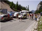
From Kranjska Gora drive towards Bovec or vice versa, but only as far as the Vršič pass, where you park.
Path description:
From the parking lot on Vršič, follow the initially poorly marked path leading to Mojstrovka and Sleme. After a short climb, the path leads us to a larger rock on which we see the inscription Mojstrovka on the left. Continue in the direction of Mojstrovka (to the right Mojstrovka on the Hanzo trail and Slemenova špica) along the trail, which climbs crosswise through a rare larch forest. After about half an hour's ascent, the path leads to a large scree field below Mojstrovka. At the point where the marked path to Mojstrovka approaches the wall, we come to an unmarked crossroads where we continue to the sharp right. Continue the ascent along the unmarked path, which leads us in a slight cross-climb towards the slopes of Šitna glava. A relatively visible path soon leads us into an unmarked valley between Mala Mojstrovka and Šitno glavo. Here the trail turns slightly left and climbs slightly more up the increasingly rocky slope. When the trail is quite close to the summit, it turns right, crosses a partly overgrown scree field and then climbs to a grassy summit.
From Šitna glava continue along the ridge, first gently down and then up towards Mojstrovka (unmarked). After a 20 minute walk from Šitna glava, a poorly visible path leads us to the place where we join the Hanzo trail to Mojstrovka. From here on, the orientation is easier, but the path becomes steeper and steeper. After a few more minutes, the steepness eases and the path leads us to a flatter world, which we go around on the right hand side. Next, the path approaches the ridge and we see Mangart and Jalovec in front of us. Here the path turns slightly left and leads us to a steep part of the path. With the help of a few pegs, but mainly without the fixed safety gear, we climb up the steep summit slope of Mala Mojstrovka to its scenic summit.
From Mala Mojstrovka continue in the direction of Veliki Mojstrovka. At first, descend a little and take the path that leads slightly to the right towards the saddle between the two Mojstrovkas. The path then crosses a scree slope and begins to ascend the steep southern slopes below Velika Mojstrovka. The slope soon becomes less steep and the path turns right upwards. From here it is only a short climb up the rocky slope to the top of Velika Mojstrovka.
From the summit, continue along the ridge in a westerly direction. The path then soon becomes a little more difficult and starts to climb up the slightly crumbly slope on the south side of the ridge. The path is marked with a number of cairns signs. The ascent towards the ridge is followed, soon reaching the head of the Velika Mojstrovka.
From the top, continue along a very scenic ridge. The ridge to the north is precipitous throughout, but it is wide enough that walking along it does not present any major problems. Later, the slope on the south side of the ridge becomes slightly steeper and there is a slightly steeper climb along the rocky ridge to the top of Zadnja Mojstrovka.

Pictures:
 1
1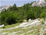 2
2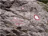 3
3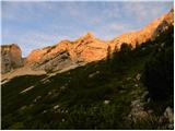 4
4 5
5 6
6 7
7 8
8 9
9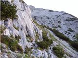 10
10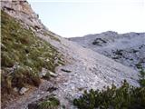 11
11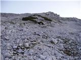 12
12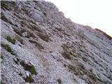 13
13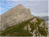 14
14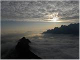 15
15 16
16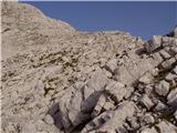 17
17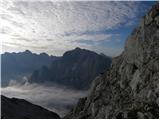 18
18 19
19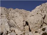 20
20 21
21 22
22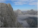 23
23 24
24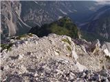 25
25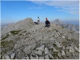 26
26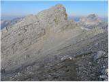 27
27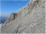 28
28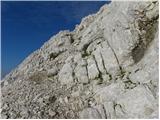 29
29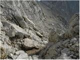 30
30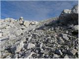 31
31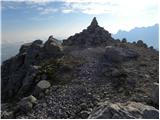 32
32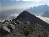 33
33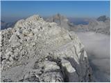 34
34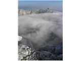 35
35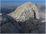 36
36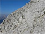 37
37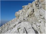 38
38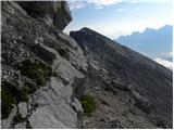 39
39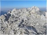 40
40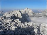 41
41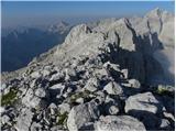 42
42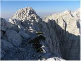 43
43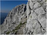 44
44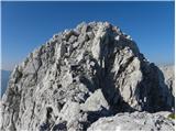 45
45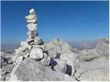 46
46
Discussion about the trail Vršič - Zadnja Mojstrovka (via Šitna glava)
|
| ljubitelj gora28. 09. 2014 |
Mene pa zanima zakaj topo karta prikazuje vrh Velike Mojstrovke šele na sliki 40. Tud višinski profil lepo prikazuje, da je Velika Mojstrovka še najprej po grebenu, kot prikazuje slika 32
|
|
|
|
| Perosu115. 08. 2019 |
Se strinjam, tudi na zemljevidu PZS je čudno in velika mojstrovka narisana bistveno bolj zahodno, kar ni res.
|
|
|