Vršič - Veliki Ozebnik (via zavetišče pod Špičkom)
Starting point: Vršič (1611 m)
| Lat/Lon: | 46,4336°N 13,7435°E |
| |
Name of path: via zavetišče pod Špičkom
Time of walking: 6 h
Difficulty: difficult pathless terrain
Altitude difference: 869 m
Altitude difference po putu: 1250 m
Map: TNP 1:50.000
Recommended equipment (summer): helmet, self belay set
Recommended equipment (winter): helmet, self belay set, ice axe, crampons
Views: 7.918
 | 2 people like this post |
Access to the starting point:
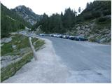
From Kranjska Gora drive towards Bovec or vice versa, but only as far as the Vršič pass, where you park.
Path description:
From the parking lot at the Vršič pass, walk to a small wooden hut selling various souvenirs. Here you will notice a path which turns right in front of the hut and after a few steps leads to a crossroads, where you continue on the left path, which starts to descend (the right path leads to Mojstrovka). At the beginning of the descent, you will notice the inscription Jalovec on a slightly larger rock, which tells you that you are on the right path.
The way ahead descends crosswise over a small scree slope, crosses a short lane of scrub or sparse forest and leads us under steep cliffs. A slight ascent follows, and then the path leads to two successive protected crossings (easy). The path then gradually passes into the forest and, with the exception of a few short ascents, begins to descend. After about two hours of walking from the Vršič pass, we will arrive at a marked crossroads, where we continue in the direction of the shelter under Špičko (right Jalovec).
There are a few successive forks, and we continue to follow the path in the direction of the shelter under Špičko. Only after a good 2 hours of walking, the path starts to climb more steeply. After a short climb, we emerge from the forest and the path, which passes under steep slopes for some time, soon opens up a close view of Špiček (the peak below which the shelter is located). The increasingly scenic path then slowly turns to the left, where the path from Zadnja Trenta joins us higher up.
Continue straight ahead towards the shelter under Špiček, following the path that turns into the area of high-lying plateau. The path from which we have beautiful views of the peaks above Zgornje Posočjem, but higher up leads us to a small crossroads where the path to Jalovec branches off to the right. Continue straight ahead and follow the path along which you will notice some interesting inscriptions (verses) and within a few minutes you will reach the shelter under Špičko.
From here, continue to the right slightly down towards Jalovec, past the rock with an interesting inscription to the entrance to the more difficult part of the trail (you can also reach here by a trail that does not climb up to the shelter and is about 15 minutes shorter). The way forward climbs up the initially relatively well protected rock ridge, and then climbs steeply along the wall of the lesser-known Velikého Ozebnik (Big Ozebnik). The steepness then gradually eases and the route turns slightly to the right, where it crosses the steep and slip-prone slopes below Veliki Ozebnik. The path on this part is less well protected and very exposed to falling rocks (helmet is compulsory). The path onwards crosses an even shorter exposed ravine and leads us into a softer world of grasses. Just a few steps after the ravine, leave the marked path and continue left along the pathless world. Continue climbing on the right side of the ravine on very steep ground (high risk of rockfall). After 20 minutes of easy climbing, which does not exceed level 1, you reach the top of Veliki Ozebnik.
Orientation in the last part is difficult and there is a high risk of falling rocks.
Vršič - shelter under Špičko 4:00, shelter under Špičko - Veliki Ozebnik 2:00.

Pictures:
 1
1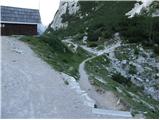 2
2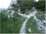 3
3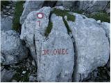 4
4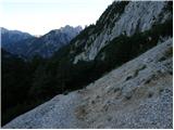 5
5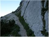 6
6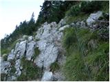 7
7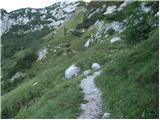 8
8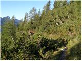 9
9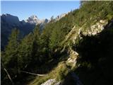 10
10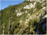 11
11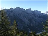 12
12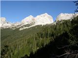 13
13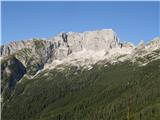 14
14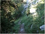 15
15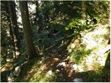 16
16 17
17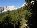 18
18 19
19 20
20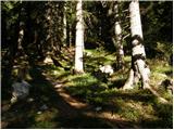 21
21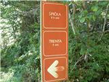 22
22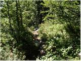 23
23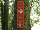 24
24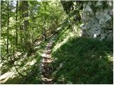 25
25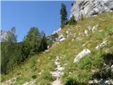 26
26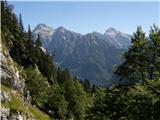 27
27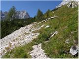 28
28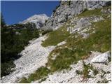 29
29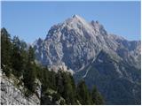 30
30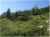 31
31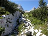 32
32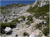 33
33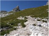 34
34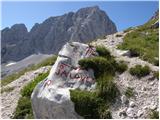 35
35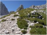 36
36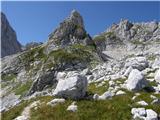 37
37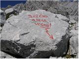 38
38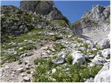 39
39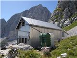 40
40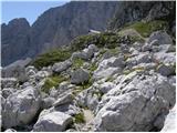 41
41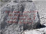 42
42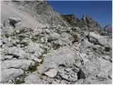 43
43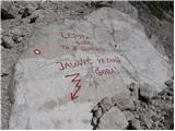 44
44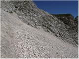 45
45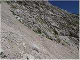 46
46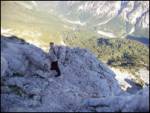 47
47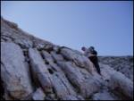 48
48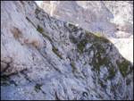 49
49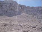 50
50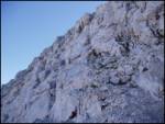 51
51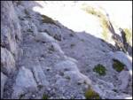 52
52 53
53
Discussion about the trail Vršič - Veliki Ozebnik (via zavetišče pod Špičkom)