Vrhnika - Koča na Planini nad Vrhniko (via bukev)
Starting point: Vrhnika (300 m)
| Lat/Lon: | 45,9636°N 14,2752°E |
| |
Name of path: via bukev
Time of walking: 1 h 5 min
Difficulty: easy marked way
Altitude difference: 433 m
Altitude difference po putu: 433 m
Map:
Recommended equipment (summer):
Recommended equipment (winter):
Views: 21.508
 | 2 people like this post |
Access to the starting point:
From the Ljubljana - Koper motorway, take the Vrhnika exit and then continue along the old road towards Logatec. At the last traffic light on Vrhnika, which you can recognise by the bank and pharmacy nearby, turn right in the route Mountain pasture. At all subsequent junctions, continue straight on, and we follow the road to the parking lot near the signs for the Shelter at Mountain pasture above Vrhnika.
Path description:
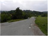
At the starting point, you will notice the mountain markings for Mountain pasture, which direct you to the ascending footpath. After a short climb, first through the scrub and then over the edge of the meadow, we emerge on a macadam road, which we follow to the left as we walk to Petkovec Storž (a log cabin with self-service drinks). Only a few metres further on, the signs for mountain pasture and Zaplana direct us left onto a wide footpath, which curves right from the road into a clump of lane of bushes. Continue up a relatively winding path, which continues through dense shade. Higher up, we come to a wide cart track, which gradually narrows and leads us higher up to a marked crossroads, at which stands the Mayor's Bench.
The ascent continues along the left path in the direction of "Planina - bukev" (right Planina čez Špico). The way forward climbs relatively gently through the dense forest, then past the cross leads us to a slightly steeper slope, where we are helped by a wooden fence and a rope (the crossing is completely easy, some caution is only needed in the ice). The way forward is laid out transitively and leads us to the place where the path from Blatnega dol joins us from the left.
Continue to the right and follow the slightly steeper path all the way to the Shelter at Mountain pasture above Vrhnika, which is reached after a good 10 minutes of further walking.
Description and pictures refer to August 2010.

Pictures:
 1
1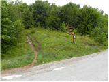 2
2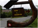 3
3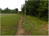 4
4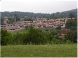 5
5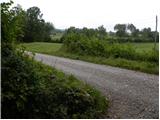 6
6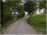 7
7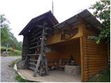 8
8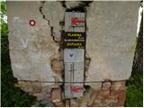 9
9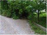 10
10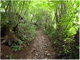 11
11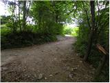 12
12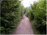 13
13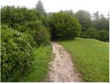 14
14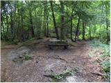 15
15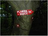 16
16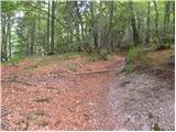 17
17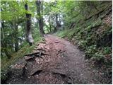 18
18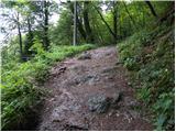 19
19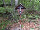 20
20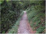 21
21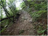 22
22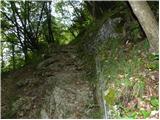 23
23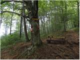 24
24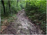 25
25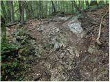 26
26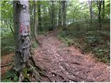 27
27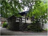 28
28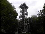 29
29 30
30 31
31
Discussion about the trail Vrhnika - Koča na Planini nad Vrhniko (via bukev)
|
| alesh746. 08. 2010 |
Lep izlet za družino z otroki...
|
|
|
|
| nisa10. 08. 2010 |
Res je prava pot za družinski izlet. Turo lahko tudi zaokrožimo. Od zavetišča na Planini se spustimo do Starga malna, in naprej po cesti do izhodišča.
|
|
|
|
| zaplancek9. 03. 2020 |
A se še komu zdi, da je odkar imajo novo bajto in greznico tako neznosno zaudarja okoli bajte! Že pot pod samo greznico malo pred ciljem tisti blatni del je začela grozno smrdeti! Kr razočaran 
|
|
|