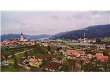
Višnja gora - Kucelj (pot dveh slapov)
Starting point: Višnja gora (386 m)
| Lat/Lon: | 45,9584°N 14,7446°E |
| |
Name of path: pot dveh slapov
Time of walking: 4 h 30 min
Difficulty: partly demanding marked way
Altitude difference: 362 m
Altitude difference po putu: 1014 m
Map: Ljubljana 1:50.000
Recommended equipment (summer):
Recommended equipment (winter): crampons
Views: 26.220
 | 1 person likes this post |
Access to the starting point:
Ljubljana-Novo Mesto motorway, exit Višnja gora, left under the motorway and continue to the lower church by the motorway. Park at the church.
Path description:
At the church, follow the motorway towards Ljubljana. After 500 metres turn right into the village of Dedni dol, at the end of the village continue along the macadam for 1. 5 km and soon you will arrive in the forest. After the chapel, turn left across the stream and go straight ahead until you reach the waterfall. At the waterfall, go up the ladder for the experienced, and just before the waterfall, go up the dug-out steps and follow the stream up to the spring. When you reach the village Blečji vrh, turn left along the macadam road to the top of the main path (a few bends and branches but on the main path).
At the top of Kuclja, from the lookout tower continue for 300 m, then right into the forest down to the village Gorenje Brezovo, at the chapel turn sharp left on the upper path, and after about 300 m on the asphalt turn right on cart track and straight on to Gradišče 706 m.
At the cross at Gradišče, follow the most descending path to the village of Vrh nad Višnjo gora to the Habjan agritourism centre, where you can have a refreshment, and then head downhill to the village, where the second left fork leads you to another waterfall. At the second waterfall, you go downhill along the stream. After about 2 km you come out of the forest, then follow the macadam to the asphalt, turn right at the motorway and you will see the turn from the church where you parked.

Pictures:
 1
1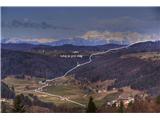 2
2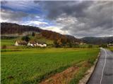 3
3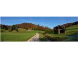 4
4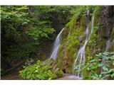 5
5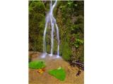 6
6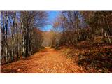 7
7 8
8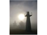 9
9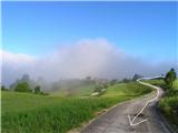 10
10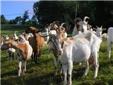 11
11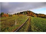 12
12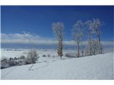 13
13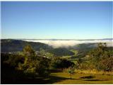 14
14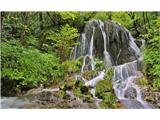 15
15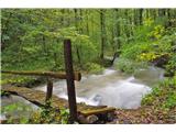 16
16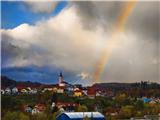 17
17
Discussion about the trail Višnja gora - Kucelj (pot dveh slapov)
|
| Lj15. 05. 2011 |
Hvala za tale opis. Pot sva s prijateljico prehodili včeraj in imeli čudovito potepanje ob svežini potokov in po cvetočih travnikih med Kucljem in Gradiščem. Malo sva se tudi izgubljali, kar se spodobi, če spoznavaš nove kraje. Omenjene vasi Blečji vrh nisva videli, iz grape potoka Višnjica sva prišli na makadamsko cesto, ki naju je pripeljala na razgledni Kucelj. V vasi Vrh nad Višnjo goro tabla "Košca" kaže v levo pri hiši z oranžno fasado. V levo gresta 2 makadamski cesti, prava je zgornja leva, ki se kmalu razcepi v 2 kolovoza - pravi je desni. Do izvira Košce nisva šli, saj je tam blizu pokalo kot na fronti in je celo pesek letel po zraku  Urno sva se umaknili po lepo zavarovani strmi stezi ob potoku navzdol. Slap je bil tokrat bolj skromen. Lp, Ljubica
|
|
|